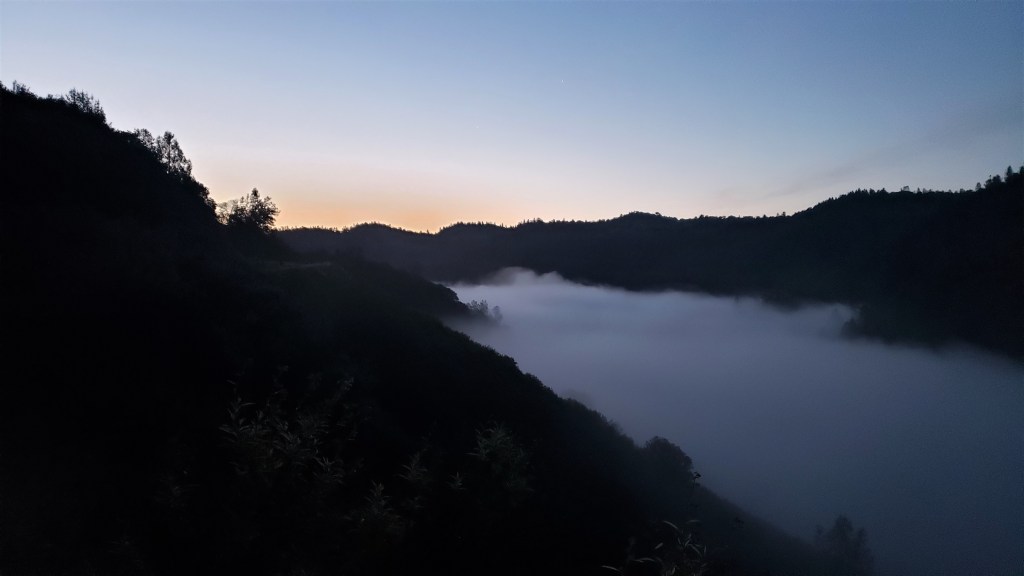
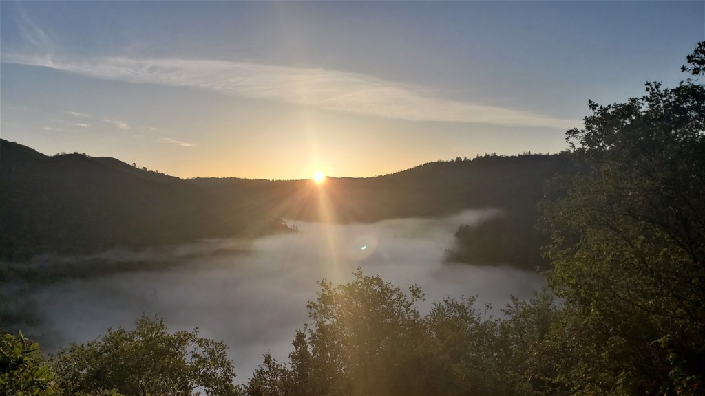
Last year I wrote a long report on Desolate Peaks, with lots of pictures, course descriptions, subjective impressions, etc. Here’s a link if you want all of that. This year I’m just going to focus on what was different and how that affected my race. Here’s what changed:
1. This year was way less windy. Last year we had howling winds all day and night, which made the day cooler but the night horrendous. This year was calm, which made the night WAY easier. Those last six peaks were a lot of work, but not stressful like last year.
2. Start to Mt Price: 8 minutes slower
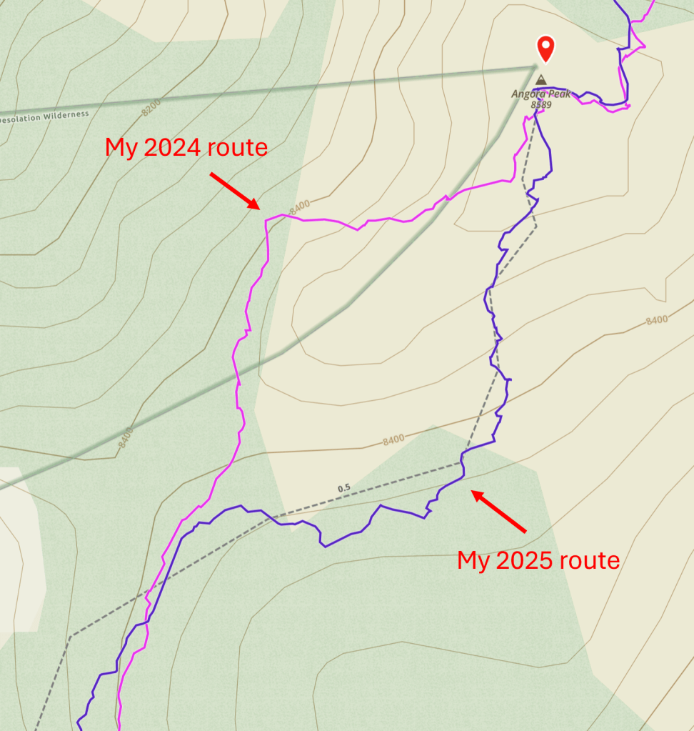
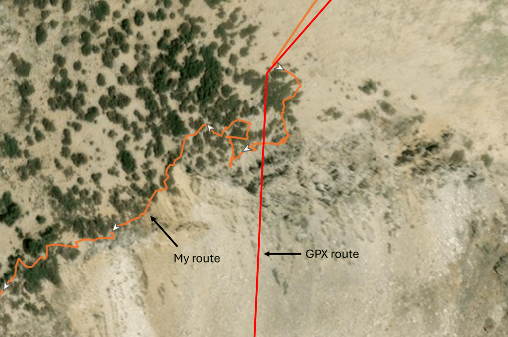
AJ Kaufmann was kind enough to share his 2024 track, which diverged from mine early on, in the approach to Mt Price:
My 2024 route wasn’t really my choice: it’s just where everyone ahead of me went, and I mindlessly followed. This year Shane and I went that way again, on the grounds that it worked last time. As we learned, however, it worked last time because we had others to follow: this year, without such guidance, we wasted a lot of time finding the route and picking through rocks. Once we’d ascended a bit, I could see that AJ’s route made more sense: it stayed on a trail for longer, then climbed some easily traversable slabs before hitting talus. Our route choice here slowed us by 8 minutes relative to last year, and probably by more relative to this year’s other runners–who wisely chose to follow AJ’s route. If I do this again, I’ll do the same.
3. Mt Price to Pyramid Peak: 12 minutes faster
I didn’t do anything special in this section except avoid the impassible ledge I got stuck on last year, just north of Pyramid Peak. This mostly explains the 12-minute improvement, getting me to Pyramid just ahead of last year’s time.
4. Pyramid Peak to Cracked Crag: 9 minutes slower
For some reason my descent from Pyramid was less efficient this year. It was less direct; it descended further, requiring me to climb again; and it stayed on talus longer rather than exploiting the more runnable slabs. I knew I’d gone wrong when I returned to the better route and saw some people who had been behind me now ahead. This poor route choice mostly offset my gains enroute to Pyramid, and I arrived at Cracked Crag five minutes slower than last year.
5. Cracked Crag to Keith’s Dome: 20 minutes faster
Last year I went off-trail from Cracked Crag to Margery Trail because this allowed me to stay up high. This year I chose to descend back down to the PCT because that off-trail route proved really slow. This was the right choice and shortened the trip by 20 minutes. Not all of that improvement reflects the route: last year I stopped for water at Lake Lucille, which probably took five minutes. But still, the PCT is the way to go. It involves more vert but gives you much more time on runnable trail rather than talus and sand.
6. Keith’s Dome to Echo Lake: 15 minutes faster
There’s no real route-finding on this section, so I mostly just moved a bit faster, both from Keith’s Dome to Ralston (4 minutes) and from Ralston to Echo (11 minutes). I think I had a better sense this year for when it’s easier to move along the top of the Ralston-to-Echo ridge and when it’s better to drop down to the side.
7. Start to Echo Lake: 30 minutes faster
I got to Echo Lake in 8:50 this year, a half-hour faster than last year’s 9:20. While I was happy about this, I think I could shave off more time by taking AJ’s route to Mt Price and crossing Desolation Valley more efficiently. So, that’s on the agenda if I do this again.
8. Echo Lake to Angora Peak: 16 minutes faster
My improvement on this stretch was almost entirely between Echo and Angora Peaks. Compared to last year, there were two main changes. First, I took less time crossing the sketchy gap in the ridge (I’ll assume everyone who’s done this knows what I mean). Last year I spent a while studying the gap and eventually decided to climb down and then back up the ridge’s west side: this approach is technically more difficult but also less risky, as the fall on the west side is less dangerous. This year I followed Zoe’s lead and climbed directly across. This is really not that hard, but you do want to be very careful, as a fall here would be really bad. It’s worth noting that one of my handholds–a large rock flake–moved in an unsettling way when I grabbed it, so make sure everything you’re grabbing or stepping on is solid before giving it any weight. In any case, this more direct route was faster, so thanks to Zoe for showing me the way.
Second, this year I correctly approached Angora by going east of the false summit rather than west:
Last year I tried the western approach because it involved less descending, but I quickly discovered that it’s a steep, slidey mess. The eastern route is comparatively straightforward and got us to Angora pretty quickly. Matisse was taking a break there, and led the way down to Fallen Leaf.
9. Start to Fallen Leaf: 52 minutes faster
I reached Fallen Leaf in 11:38, 52 minutes ahead of last year’s 12:30.
10. Fallen Leaf to Cathedral Peak: 38 minutes faster
This year I took the steep ravine to Cathedral Peak rather than the gradual Cathedral Trail. The journey was 38 minutes faster, but this can’t be attributed wholly to the new route. Last year I left the Fallen Leaf aid station three times, returning twice for things I’d forgotten. This year I somehow managed to leave just once, which probably saved me 10 minutes. Last year I also stopped at Cathedral Lake for water (maybe 5 minutes) and reached the Cathedral plateau in the dark, meandering wastefully enroute to the peak (see above track). All of these things probably added ~20 minutes to my 2024 time. Even so, I’d say the steeper and more direct route is a good 20 minutes faster than Cathedral Trail.
The reason it’s not even faster, despite being so much shorter, is that the ravine is really steep. It rises 1,972 feet in 0.52 horizontal miles, for an average grade of 72 percent. (The traveled distance is 0.64 miles, but that’s the right triangle’s hypotenuse, not its base.) And the actual grade is rarely the average grade because the ravine consists of many steps and ledges: you climb up a step, walk forward on a ledge, and repeat over and over again. It’s clearly been carved by water, so I’m guessing this is a series of waterfalls in the spring. In any case, it’s a really long and hard climb, and I was exhausted by the time I reached the top. That said, it’s not scary: the hand and footholds are consistently good, and the step structure means you’re never risking a really long fall. So if you’re looking to do this race quickly, this is the way to go.
11. Cathedral Peak to No Name 9579: 8 minutes faster
The net 8-minute improvement on this section reflects a couple of things that went well and one that didn’t. My ascent to Tallac was 5 minutes faster, mostly because I followed AJ’s lead and took a direct route to the summit rather than the more circuitous Floating Island Trail. My descent from the summit was slower, however, because I tried and failed to follow AJ’s off-trail shortcut down. This section is all talus, so I couldn’t look at my phone, and I got off course in the dark. Even after I left the talus, I blundered around for a bit, confused by what my phone was showing me. Fortunately Liz came down the trail just then and got me back on course. I probably wouldn’t attempt that shortcut again, even during the day, as it doesn’t save that much distance and the talus is slow.
Liz helped me make up for lost time by leading the way across the ridge to the next peak. I find this ridge impossible to navigate in the dark, and I get off course the moment I stop looking at my phone. Liz seemed to know her way around, so I had the luxury of just following her much of the time. By the time our paths diverged–she was doing 21 peaks–we were at the No Name just above Dick’s Pass.
12. No Name 9579 to Dick’s Peak: 4 minutes faster
I’m surprised that my improvement here was so small, given how much more smoothly it went than last year. Maybe it’s because I stopped at Dick’s Pass to put on a bunch of layers? Regardless, this section felt very different for a simple reason: I took the correct route to the summit. Last year Dick’s scared the crap out of me due to a steep technical climb in the cold, windy night. This year I approached the mountain with dread, waiting for that climb to appear. And waiting. And waiting. But it never came. I followed what appeared to be the obvious route, and it was consistently easy and safe. So, last year I somehow wandered off course into a needlessly technical climb. I’m not sure how this happened, but I’m guessing I was just less attentive in the wind, which had been eating my brain. I’m also not sure where it happened, but there is one point where my 2024 and 2025 tracks diverge, between 9,400 and 9,600 feet:
Anyway, there’s not much of a lesson here except that Dick’s is pretty easy if you stay on the proper route. Which apparently everyone but me can do.
13. Dick’s Peak to Jack’s Peak: 9 minutes slower
Not sure why I slowed down here, except that I stopped twice to remove stuff from my shoes. I did find the descent from Dick’s hard to navigate in the dark, but I assume that was also true last year? Last year I was desperate to get off the windy summits, so maybe that led to a faster descent? Who knows.
14. Jack’s Peak to No Name 9441: 20 minutes slower
This part, along with the climb to Cathedral, differed most from last year. Last year I took a direct route from Jack’s to the final peak, descending to the Rubicon Trail and climbing up the other side. I guess I should say I “tried to” take a direct route, since I got lost on the descent and blocked repeatedly by brush and rocks on the climb. This year I hoped to avoid those problems by following AJ’s route down to Mosquito Pass, then up to and along the ridge. While this route is longer, it potentially cuts the vert because you don’t have to descend all the way to the Rubicon. Based on my limited knowledge of that ridge, I thought it might also bypass the brush and other obstacles of the previous year.
I’ll say four things about this year’s route. First, it was 1.1 miles longer than last year’s–although, if I hadn’t gotten lost last year, the difference would probably be more like 1.4. Second, my Garmin data for that stretch doesn’t indicate much difference in elevation gain. That may seem surprising, given that the ridge avoids a significant descent, but the ridge itself has quite a bit of rolling enroute to the peak. Third, I suspect that the ridge is slower than a more direct route. Last year’s journey was not fast: I wasted a lot of time getting lost; I chose a poor route to the peak and was constantly stopping to figure things out; I was exhausted and moving at a snail’s pace. In contrast, I did not get lost or stuck this year and was feeling and moving well. But in spite of all that, the ridge took 20 minutes longer. This makes me think that a well-planned direct route from Jack’s to 9441 would save a lot of time.
Fourth, however, I kind of liked the ridge. It was what I expected: a ton of bare granite slabs free of talus or brush. There were difficult sections, but for much of the ridge you could move easily and quickly–and this was a welcome change. So while I’m not sure I’d take this route again, it had its charms.
That said, it was pretty hard. Like most other parts of the course–the endless talus of the Ralston-to-Echo ridge, the ravine to Cathedral, the descent from Jack’s–it just went on way too long. The moon was only a crescent, but at some point there was enough moonlight to make out the final peak–and the two climbs before it. Knowing you’d have to climb those rocks, descend down the other side, and climb again was demoralizing. I suppose the lesson is that there’s no easy route.
15. No Name 9441 to Finish: 4 minutes slower
I descended from 9441 differently this year, following AJ’s route to Island Lake rather than taking last year’s more gradual descent. I honestly have no thoughts on this change. I was four minutes slower this year, but I have no reason to think that’s due to the route as opposed to just moving more slowly, stopping to replace my light’s battery, etc. To be honest, both routes kind of sucked. But maybe everything sucks by this point in the race. The last couple miles of flat trail felt as hard as anything I’d done to that point. So we’re back to “there’s no easy route”.
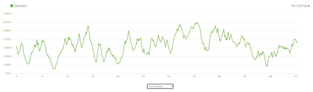
16. Start to Finish: 70 minutes faster
My watch clocked 24:19 last year and 23:09 this year, so I’ll say I was 70 minutes faster. I’m using equivocal language because my official 2024 time was 24:46, and I can’t explain this difference. But everything in this post has been based on my watch data, so I’ll stick with that. Either way, my time was over an hour faster, so I’m happy about that. But I also feel like I left a lot of room for improvement. If I had to do it again, this would be my list of do’s and don’ts:
Do: take AJ’s route to Mt Price, a more efficient route across Desolation valley, the PCT from Cracked Crag to Keith’s Dome, the eastern approach to Angora, the ravine to Cathedral Peak, the most direct trail to Tallac, and the correct route up Dick’s.
Don’t: take AJ’s shortcut down from Tallac, or the ridge to the last peak–find a more direct route.
That’s what I learned this year!
Since this has been a fairly “clinical” report, I’ll close by saying that this is a really special event. I’ve yet to do another race that is physically and technically challenging in so many different ways while also being absolutely gorgeous. Part of me wishes the race could “go public” so more people could experience it: I suspect it would draw adventure-seekers from far and wide. But Desolation is a wilderness, and there’s much to be said for quirky, low-key events that attract a small but dedicated community of freaks. So maybe it’s just as well this remains “NOT AN OFFICIAL EVENT”.
Last December my friend Garret asked if I’d pace him at Hardrock. I leaned toward “yes,” but Colorado’s San Juan mountains are not close, so I wondered if I could get more out of the trip than a pacing gig. I recalled another race in the same neighborhood–the Ouray 100–which turned out to be only one week later. Good enough: I’d pace at Hardrock and do Ouray the following week.
YouTuber Simon Guerard describes Ouray as Hardrock’s little brother–where “little” means younger, less established, and in need of validation. This is his explanation for Ouray’s absurd elevation gain. While Hardrock is legendary for its 33,197 feet of climbing, Ouray ups that ante by 26 percent, to 41,862 feet. That’s 410 feet of climbing per mile, for 102 miles. My hilliest prior ultras were the Tor des Geants (381 feet per mile), the Ben Nevis ultra (364 feet per mile), and the Swiss Peaks 100k (319 feet per mile). (Also the mostly off-trail Desolate Peaks–431 feet per mile–but that’s a different kind of beast.) Those are not easy races, but Ouray was something else. I hadn’t done any previous 100Ms with remotely this much vert, so I had no idea how long it would take. I set myself an A goal of 36 hours, a B goal of 38, a C goal of 40, and a D goal of “in time to make my flight.”
The course begins and ends at Ouray’s Fellin Park. It consists of multiple out-and-backs that climb to the surrounding peaks, as well as a large (Ironton) loop that runners do in both directions. While some might find this a contrived way to rack up distance, I thought it worked well. The “outs” and the “backs” felt completely different, as one is uphill and the other downhill, and they go in different directions. Moreover, this structure allows you to see other runners again and again, making this an unusually social and supportive race. That support would prove helpful as the miles added up.
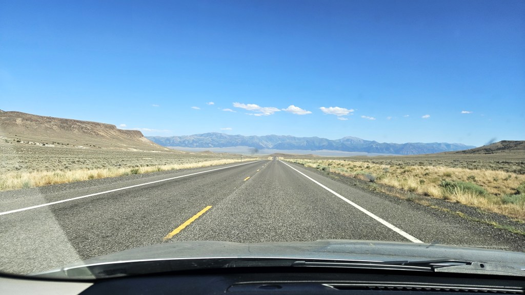
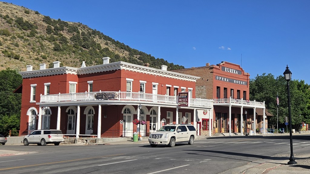
I left San Rafael on Saturday July 5, taking Highway 50–the “loneliest road in America”–through Nevada. I hadn’t been that way in years, but if you’re going to drive across Nevada, it’s the way to go. The highway is lonely but beautiful, passing through high desert and small towns like Austin, Eureka and Ely. I camped that night at Cave Lake State Park and did a short run there the following morning before moving on.
The loneliest roadEureka opera houseCave Lake State Park
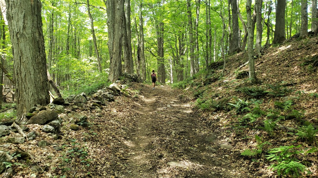
I arrived in Silverton Sunday evening and went straight to the Molas Lake campground, where I’d spend the next eleven days. I planned to spend my first few days running as much as possible to get used to the altitude. Molas Lake served this purpose well, as it’s above 10,000 feet, has showers, and is on the Colorado Trail. That trail isn’t particularly hilly, but I wasn’t looking for conditioning at this point–just getting acclimated to the thin air. I logged 75 miles over the next three days.
Sunrise at Molas LakeThe Colorado TrailThe Colorado Trail
On Friday-Saturday I paced Garret from Animas Forks to Telluride, logging another 30 miles. With Garret’s race out of the way, I could now think about my own. I’d logged a questionable 105 miles in the last week, so this mostly meant rest. I’d done all the training I could, and it was time for a hard taper.
On the Hardrock course, near Animas Forks
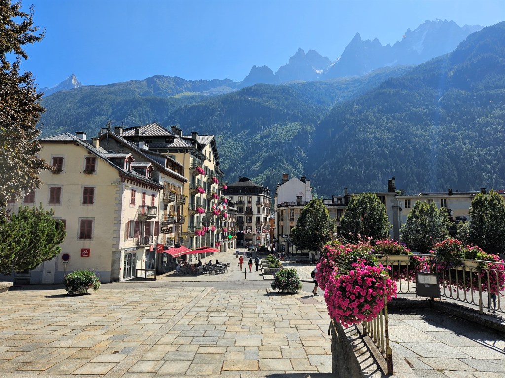
Megan flew into Montrose on Wednesday, where I picked her up and returned to Molas. On Thursday we headed back down to Ouray, where we’d spend the night at the Amphitheater campground. We strolled around Ouray, checked in for the race at Fellin Park, and grabbed a quick pizza dinner. Ouray, I should say, is a charming little town. It sits in a valley at 7,800′ but is surrounded on all sides by towering cliffs and peaks. It boasts a lot of pretty old buildings as well as natural hot springs, which we hoped to soak in after the race.
Never made it to the Ouray Brewery…maybe next time
In the days leading up to the race, I worried about two things. One was the weather: the forecast predicted days of thunderstorms and rain. I didn’t love the idea of traversing exposed peaks with lightning coming down, or of navigating the technical parts on muddy, slippery ground. (I was worried enough about the footing to make myself a pair of screw shoes before the race.) In the end, however, the RD’s admonition to never trust the forecast proved correct. Thursday was warmer and drier than predicted, and this unexpectedly good weather continued for the next few days.
My other worry concerned my D goal (finish in time for my flight). Due to some unwise planning, the D goal was effectively also the C goal (under 40 hours). For reasons that don’t matter here, I’d decided to fly from Salt Lake City to Hartford at 7:45am Monday. This meant I had to be in SLC Sunday night, which meant I had to drive up there Sunday. This would be fine if I could sleep Saturday night, but this basically meant finishing under the 40 hours that would get me to the finish by midnight Saturday. This wasn’t a crazy goal, but in previous years, only about ten percent of starters had managed it. I didn’t expect to flirt with the race’s 52-hour cutoff, but if my race stretched to even 44 or 46 hours, I’d be screwed. I couldn’t drive the eight hours to SLC after two grueling nights without sleep. In retrospect, my flight plans were an act of hubris that caused me a lot of avoidable stress.
The race had a late (8:00am Friday) start, so I was able to sleep well the night before. We packed up camp, went to the start, got my GPS tracker, and then I was off. Megan planned to start pacing me at Weehawken 2 (mile 58), so I didn’t expect to see her until after midnight. My plan was to average 3.5 mph as long as I could, which would get me to Weehawken 2 at 12:50 AM. This was not a sustainable pace–it implied a finishing time of 29:10, a course record–but it seemed like a reasonable first-half target given that the second half is harder, and I expected to slow down.
Fellin Park before the startDogs welcomeTime to go
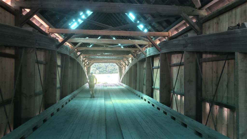
The first six miles were straightforward and familiar to me from Hardrock: a short single-track took you through a stone tunnel and over a gorge-spanning bridge, then spit you out on Camp Bird Road, which climbed gradually toward the Lower Camp Bird aid station. From there we took a right fork that led to the first turnaround at Silver Basin. This out-and-back was forgettable–mostly jeep road through dense woods–but opened up into a nice meadow with an alpine lake at the top. I followed the trail to the hole punch at the turnaround, punched my bib, and headed back down.
Silver Basin turnaround
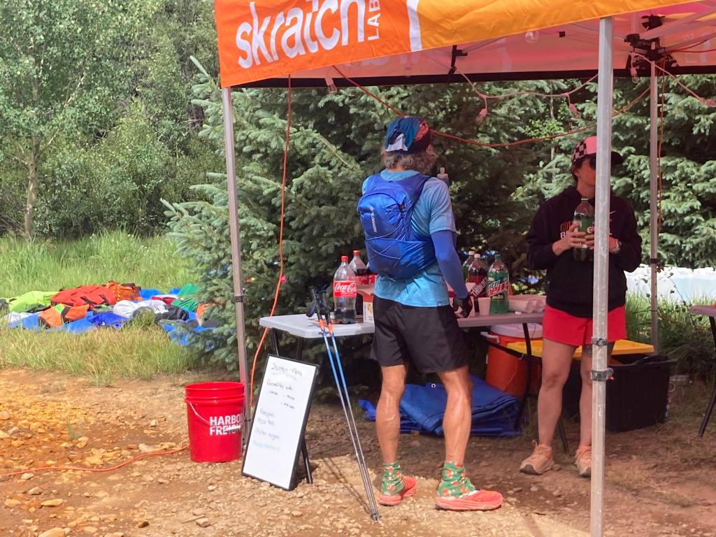
After returning to Lower Camp Bird, I headed south to the Richmond aid station. From there, a short stretch of jeep road led to the Upper Camp Bird junction, the nexus for the next two out-and-backs. The first was a single-track trail leading up to the Chicago Tunnel, an old mine entrance. This climb was steeper and more technical than the previous one, and also prettier. I was still close enough to the leaders to see them coming down, so I cheered them as they passed. I felt pretty good and passed a few people myself, reached the top, punched my bib, and headed back down.
Chicago Tunnel turnaround
The next out-and-back led to Fort Peabody, the race’s highest point (13,365′). I loved this section. Although it was mostly jeep road, the road was rocky, technical and steep enough to feel like a trail. It was also completely exposed, providing stellar views all the way up and down. My only gripe about this jeep road–and others to come–was that it had an awful lot of jeeps. Like, big convoys going up and down the mountain. Sometimes a convoy would stop for minutes while letting another pass, giving passing runners good whiffs of exhaust. This wasn’t anyone’s fault–we were all just out there enjoying the trails–but this much traffic in otherwise pristine outdoors was an unpleasant surprise.
Traffic aside, I felt good on the climb to Fort Peabody, passing quite a few people along the way. The last quarter-mile was a single-track through a scree field. The views from the top were stupendous.
Fort PeabodyView from Fort PeabodyView from Fort Peabody
The descent was fun, as descents on fresh legs tend to be. I was, however, having issues with my pack. I’d decided I needed a larger pack for this year’s Tor des Geants, so I was trying out a Salomon Cross Season 15 instead of my usual Advanced Skin 12. I’ve mostly been happy with it, but I’ve noticed that some problems arise when it’s fully loaded (as it was now) and when I’m running as opposed to hiking. The right shoulder binds in ways that cause discomfort and chafing, and no amount of fiddling seems to fix this. I think the problem is that my body is asymmetric (right shoulder larger than left), and this pack’s water-resistant material doesn’t stretch to accommodate my asymmetries. The threat of chafing worried me, but there wasn’t much I could do right now, so I tried to ignore it.
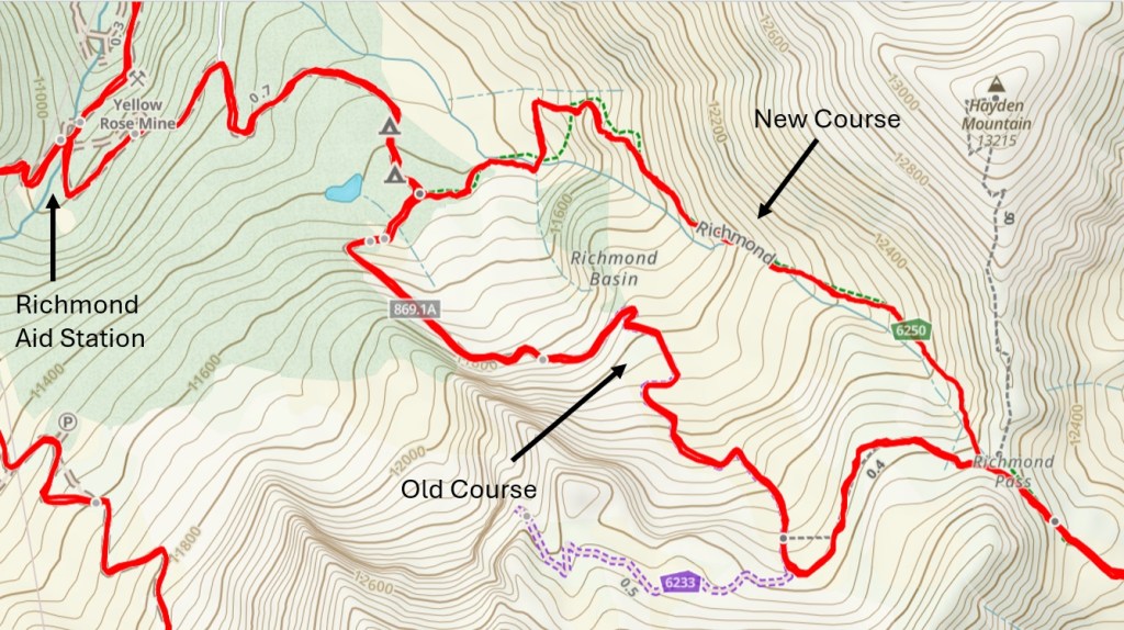
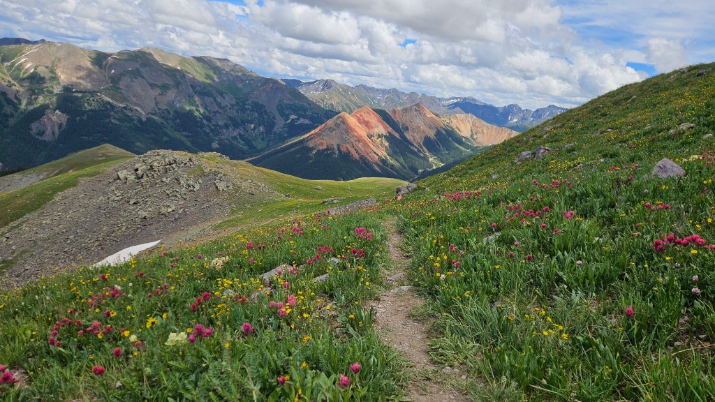
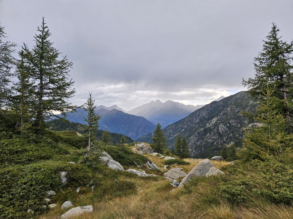
I returned to the Richmond aid station, then headed east toward Richmond Pass. We’d received an email the day before, with an attached GPX, saying that this year’s race would include the restored historic Richmond Trail. I’m glad it did, because this section was gorgeous. Both the climb to Richmond Pass and the descent down the other side had fantastic views and riotous wildflowers. (Note: the new course is slightly shorter but also steeper and more technical, so probably a wash in terms of time.)
Richmond old versus newClimb to Richmond PassClimb to Richmond PassDescent from Richmond PassDescent from Richmond Pass
This was also the slowest part of the race so far. I’d maintained my 3.5 mph average to Fort Peabody and was comfortably above it by Richmond 2. But the climb to the pass was steep, technical and often overgrown, and I fell behind my target pace for the first time. The descent helped, but less than I’d hoped, as much of it was too steep to move fast. By the time I hit Highway 550 and ran the short flat stretch to Ironton, I was back on target pace, but barely.
Ironton is a major milestone: runners pass through it three times (at miles 27, 35 and 43), so it’s a well-supported aid station with lots of crews. I heard someone call my name as I arrived and was pleasantly surprised to see Megan. She hadn’t planned on coming here, but it was easy to reach and she’d spent enough time in Ouray, so here she was. We passed through a sea of cars to reach the aid station.
Reaching Ironton 1Ironton 1
I didn’t stay long, just grabbing some Gatorade packets and a bag of potato chips before starting the counter-clockwise loop. The first few miles were bland: a steadily rising red-dirt jeep road through the woods. That was fine with me: after the eye-popping but challenging Richmond Pass, I welcomed the steady, mindless climb.
As the road cleared the treeline, the views of nearby Red Mountain got better and better. I’d been intrigued by these iron-ore hills throughout the race, so I was glad to get a close-up now. As I crested the loop’s high point, I saw the race leader coming toward me. He was moving fast and was now about eight miles ahead. We exchanged some supportive words and went on our way.
Red MountainOver the humpRace photographer
The jeep road rolled for a while, then ended at a single-track that descended sharply. Good: that meant the clockwise loop would probably be faster, as it would involve a steep climb and a more gradual, runnable descent.
Iron creek
Megan was still at Ironton when I got there. She filled my flasks as I drank some ginger ale and looked for food. I took a potato-and-cheese quesadilla, said goodbye to Megan, and ate the quesadilla as I walked back to the loop. Megan said she probably wouldn’t be there when I returned, so we agreed to meet at Weehawken 2 on a 3.5 mph schedule. That now seemed optimistic, but not impossible.
One loop down
The clockwise loop was fine, and different enough to not feel repetitive. While the first loop allowed me to see all the leaders, I now greeted everyone behind me. The race was pretty spread out now, and as I finished my second loop there were still a few runners starting their first–meaning they were 16 miles behind me and 24 behind the leader.
I’d been pondering whether to change my shoes at Ironton 3. I’d been running in Altra Mont Blancs, and those still felt fine, but I nonetheless put on a new pair of socks and the Altra Olympuses in my drop bag. I didn’t have any reason to switch beyond “maybe it’ll feel better,” but it gave me a chance to ditch the moleskin I’d placed over my toenails, which had been coming loose for hours.
Between the shoe change, a visit to the porta potties (which, annoyingly, had no toilet paper), and fishing batteries and such from my drop bag, I spent more time at Ironton than I’d hoped. I grabbed another two potato-and-cheese quesadillas for the road and got underway, eating the first enroute to Highway 550 and sticking the other in my pack.
The climb back up to Richmond Pass nearly broke me. It was steep, long and hard, rising 3,000′ in 2.7 miles. I compared it mentally with the Tor’s most grueling cols and thought “the Tor has nothing on this.” At some point a blond guy with a ponytail passed me, looking strong. I didn’t care about my place, but the contrast between us was dispiriting. I trudged up, watching him recede into the distance.
I told myself not to worry about the pace: just keep moving forward. This, at least, I did. It got colder and windier as I climbed, but I held off on my jacket, not wanting to overheat. I saw lightning in the distance, but overhead there was nothing but stars. I turned off my light to admire the beautiful, moonless sky. I saw a shooting star and wished for a successful race, whatever that might mean.
At last I reached the snow that marked the top of the pass. I crossed over and began the descent, which seemed steeper than it had on the way up. Between the grade and the growth along the trail, it was slow going. I felt wasted by the time I reached Richmond for the third time.
The aid station volunteers asked how I was doing, and I replied that Richmond Pass was hard. They said that seemed to be the consensus. I topped off my flasks, drank a little veggie broth, and tightened my shoes to stop my feet from slipping forward. I was starting to think the Olympuses were a mistake, as I’d been jamming my toes all the way down.
I headed down the fire road toward Weehawken. I was glad to be heading that way, both for the gradual downhill and the prospect of seeing Megan. The downhill helped less than I’d hoped, as it was very rocky, but I was doing better than a runner I passed who’d apparently lost his downhill legs. Eventually the road smoothed out, and I made good time from Lower Camp Bird on.
I hit the porta pottie again at Weehawken: my guts hadn’t been doing well for some time. I still had the second quesadilla I’d brought from Ironton but couldn’t stomach it now, so I looked for other fare. I’d been impressed by the aid stations at Hardrock–particularly the ubiquitous selection of vegan soups–but these aid stations were not Hardrock’s. Nothing really appealed to me, so I forced down a couple of pierogies and moved on.
The Weehawken out-and-back is short, rising 2,300 feet in 2.5 miles to the Alpine Mine Overlook, then coming back down. I climbed steadily but listlessly. I’d left Weehawken around 12:30 AM, which was faster than 3.0 mph pace but slower than the 3.5 I’d hoped for. This isn’t going to get better, I thought. I knew that, for all the vert I’d done, the worst was still to come. The runner I’d passed earlier, who couldn’t run downhill, passed me now. Great.
I was conscious of how poorly I’d been fueling since that last quesadilla at Ironton. My early fueling had gone well: I’d eaten some pizza and bananas before the race, then six Lenny and Larry’s cookies (1300 calories), six Gatorade packets (1100 calories), two ziploc bags of potato chips (~500 calories), the first quesadilla (~500 calories), and a few hundred calories of ginger ale before Ironton 3. Since then, however, I’d had only the one quesadilla and a couple of small pierogies. I wasn’t nauseous, but my guts felt off and I had no desire to eat anything (or drink any more sports drink, the thought of which made me sick). This had to change. I pulled out a cookie and forced it down with a lot of water to make it easier to chew.
The blond ponytail guy who’d passed me on Richmond descended and said there was a beautiful crescent moon at the overlook. I reached it a few minutes later, and there was indeed a nice view of Ouray 3,000 feet below. I exchanged a few words with the runner who’d passed me going up, punched my bib, and headed down. He still couldn’t run downhill, so I quickly left him behind.
Megan was waiting for me at Weehawken. She’d been waiting a while, as I was over an hour behind 3.5 mph pace. I wanted to leave quickly, as I had all race, so I wolfed down a banana and took another for the road. We headed out toward Hayden Pass. I told her I’d been having a rough time. I was feeling my 21,000 feet of climbing, but the heavier burden was the knowledge that I was only half done. It pained me to think of doing it all again in the remaining 40 miles. And my mental clock was constantly ticking: 40 hours, 40 hours, 40 hours. I was still on roughly a 32-hour pace (~3.2 mph), but I knew I’d slow.
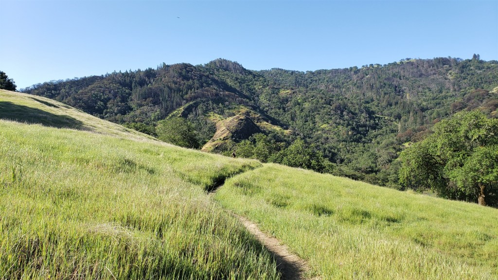
The climb up Hayden Pass wasn’t too bad, although I had to stop and sit down once. I wasn’t dying; just feeling weak. The single-track snaked through innumerable switchbacks, and it was a relief to finally break through the treeline and emerge onto an open ridge. It was light now, but I wasn’t paying much attention to my surroundings: just keep moving forward. The trail rolled along the ridge for a while, then began to descend–steeply. My immediate thought was “we’ll have to climb this again.” Every step of this super-steep descent filled me with dread.
When we reached the Crystal Lake aid station, Megan insisted that I sit down for a while and eat. I plunked myself into a chair for the first time all race. The volunteers were cooking bacon and eggs but didn’t have great veggie/vegan options. They did, however, give me some ramen noodles in veggie broth (which took a while to soften) and mixed up some instant mashed potatoes. Neither was amazing, but I got the half-softened noodles down and mixed the broth with the mashed potatoes. Best nutrition I’d had in some time.
Crystal Lake
Blond ponytail guy was there, looking tired, as was a younger blond guy, Sam, we’d been see-sawing with for some time. No one seemed in a hurry to leave. I noticed through the mesh pocket of my pack that my phone screen was lit up, and Gaia appeared to be recording a track. Sometimes the constant jostling of the pack will turn various apps on, which is annoying and drains the battery. I didn’t think about it much, but turned off the screen.
The break was nice, but we couldn’t stay here forever. I hoisted my pack, which weighed a ton. I had a lot of stuff in there: rain jacket, rain pants, base layer, gloves, emergency bivvy, two lights and extra batteries, phone, battery pack to charge the phone, GPS tracker, a bag of stuff that the race had provided and required us to carry at all times, and of course food and water. Aside from one light, food and water, I hadn’t used any of this stuff all race. It seemed like a wasteful burden, but I was stuck with it for now.
We began the climb back up to Hayden Pass. It was hard, but not as bad as I’d expected. My extended rest and the meal at Crystal Lake seemed to have done me good, and I was glad Megan had insisted on the break. While it’s good to get in and out of aid stations quickly, this go-go-go approach had stressed my system to the point where I couldn’t really eat. Taking 20 extra minutes at the aid station was worth it if it allowed me to get some real food down. We passed blond ponytail guy and Sam, as well as a lot of runners coming the other way.
The daylight also helped. I hadn’t really noticed the scenery on the way out, but this section was beautiful, lined with weird rock formations and wildflowers. I pulled out my phone to take some pictures but found the battery completely dead. Rats: the phone had been at 95 percent at Ironton 3, but apparently my pack had turned on a lot of apps. I took out my battery pack to start charging the phone, but this would take a while. Fortunately, Megan got some great pics along here.
We made good time on the descent from Hayden Pass. I was happy that my downhill legs were holding up, but I worried about the toll of all this braking. I’m pretty good at coasting down moderate grades without braking, but these descents were too steep for that, and my legs were starting to feel trashed. I was slaloming a lot on the last stretch of jeep road just to avoid too direct a descent.
We reached Camp Bird Road and took it back to Fellin Park. There were some spectators lining Oak Street, who looked me up and cheered me on by name. At some level I appreciated this, but I felt too tired to respond with more than a desultory “thanks.” I was worried about my pace, which had fallen below 3.0 mph, and it had gotten really hot. The previous day’s cloud cover was gone, and the direct sun at this altitude felt oppressive.
I wasn’t optimistic about breaking 40 and thought I might DNF. This was a depressing thought, as I knew I was capable of finishing the race. My real constraint wasn’t my endurance but the schedule I’d foolishly committed to. I wished I’d made different choices. But, I didn’t have to make any choices now. Whatever was in store, I could at least do the next out-and-back. And I had one thing going for me: I’d been able to ditch my excess gear at Fellin and now felt way lighter.
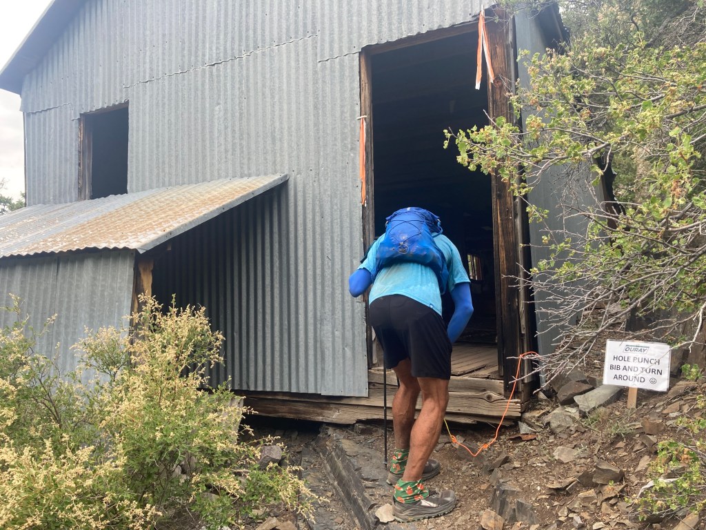
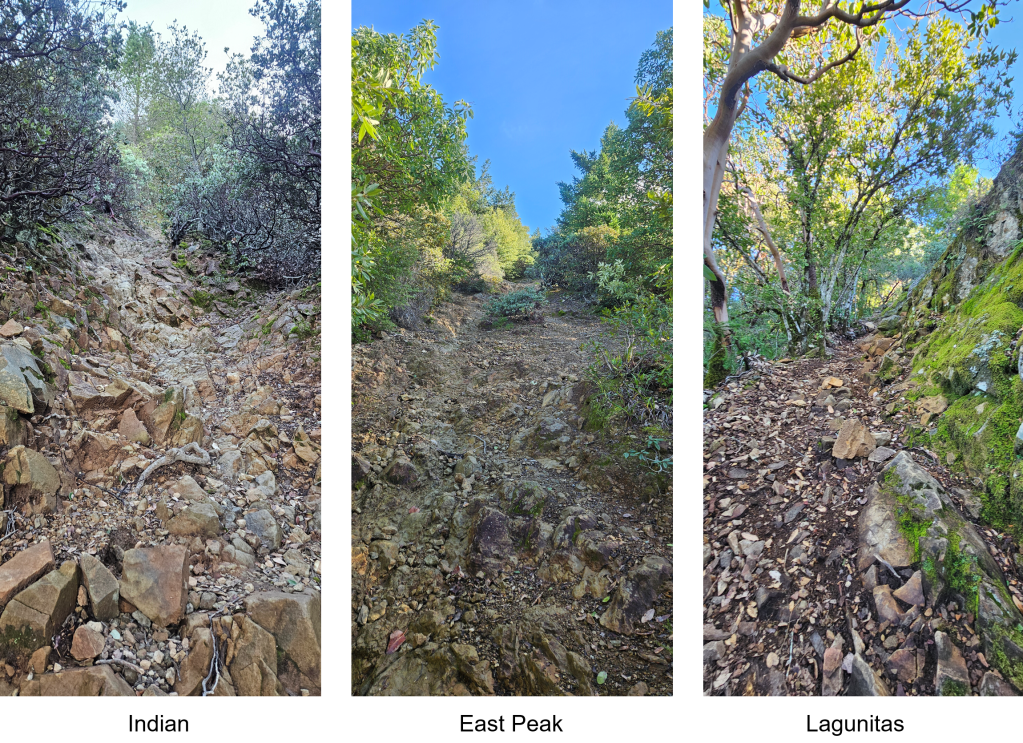
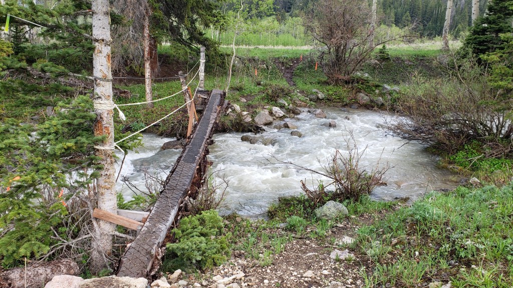
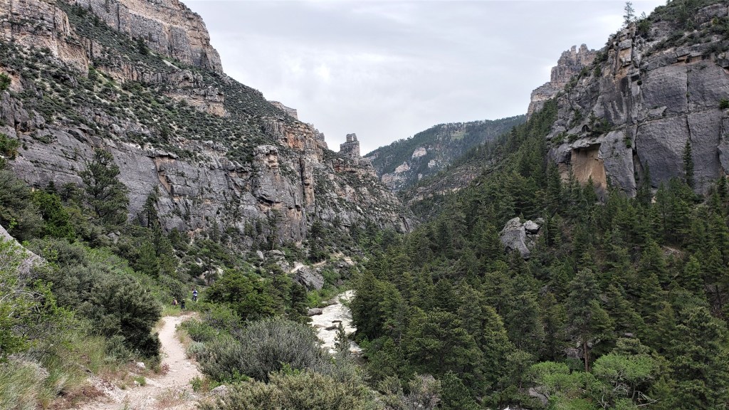
The next section took the Old Twin Peaks trail to Twin Peaks, a couple of rock spires high above Ouray. It then descended to the Silvershield aid station before climbing back up and descending again. The first part of Old Twin Peaks looked pretty sketchy, and Megan said “I didn’t sign up for Desolate Peaks!” Desolate Peaks is a highly technical event in the Desolation Wilderness, and while this wasn’t that, the trail did involve some exposed rock and dilapidated steps barely held in place by old iron stakes. The Ouray Trail Group website notes that “Around 300 steps were placed using rock, logs and 4x4s, and 607 feet of cribbing was placed to help hold the trail in this very steep gorge.”
The trail eventually improved, but toward the top it also got really steep. From bottom to top, Old Twin Peaks climbed 2,800′ in 2.2 miles, but even this steep average grade included long flat sections. So the steep parts were steep indeed. At least some cloud cover eventually came in, so it was relatively cool by the time we reached the top. We clambered up the rocks, punched my bib, and headed back down.
What. The. Fuck.
Our “local group” of racers had been stable for a while, and we saw the same faces again and again on the out-and-backs. First there would be a dark-haired guy, then a woman (the second female), then a bearded guy who was finishing strong and had been dropping his pacers. Blond ponytail guy was a little behind us, while Sam would sometimes pull ahead and sometimes fall behind. We’d see others further ahead and behind, but these were the faces we could count on within 5-10 minutes of the turnarounds.
We saw them all on our way to and from Silvershield, on Highway 550 at the foot of a long gradual descent. It was uncomfortably hot down here, making the climb out a chore despite the moderate grade. We reached the top and headed back down Old Twin Peaks. Megan had worried that I’d drop her on this technical stretch, but she kept up fine and soon we were back in Fellin Park.
Silvershield down below
The Fellin aid station was serving freshly made pizza, so we each grabbed two slices and ate them while walking to the Perimeter Trail. This is a well-maintained trail that starts across 550 from the hot springs, skirts the cliffs that overlook the town, then rises more steeply past the Amphitheater Campground where we’d stayed Thursday night. Along the way it passes Cascade Falls, a gorgeous waterfall that drops hundreds of feet before misting the spur trail below. We saw hikers cooling off at the base of the falls and were tempted to join them, but I didn’t want to spare the time.
Cascade Falls
Not far past the falls, we caught up with the bearded guy’s pacer. The two had passed us at the start of Perimeter, but the pacer had been unable to keep up, and now he was soldiering on alone. We also passed and left him behind.
As we climbed toward the turnaround at the Chief Ouray Mine, I began to feel something I hadn’t felt in hours: hope. This whole out-and-back had a much gentler grade than previous ones, which meant not only a quick ascent but also–more importantly–a runnable descent. For most of this race, I couldn’t make up on the downhills what I’d lost on the climbs because the downhills were too steep to run. It’s not like this section was flat: the main climb rose 2,000 feet in two miles. But the grade was more or less constant, so the average grade was also the actual grade–which was something I could run. I estimated that, if we kept our foot on the gas, we could get back to Fellin by around the 33-hour mark, leaving just the final 10.5-mile stretch. If we could average 2 mph on that, we’d finish in the neighborhood of 38 hours.
I shared my thoughts with Megan, who agreed that we were in good shape. We pressed on to the turnaround, seeing the usual faces as we neared the top (including bearded guy sans pacer). The Chief Ouray Mine wasn’t much to look at: just an old shack. I punched my bib and headed back. We must have moved quickly down the hill, as we passed Alexandra (the second-place female), who’d been ahead of us for hours, just before reaching Highway 550.
Chief Ouray MineDescending the Perimeter Trail
We also saw blond ponytail guy just before hitting the highway, but he was on his way up. He’d stopped to take a nap, saying he couldn’t keep his eyes open any more. I couldn’t fault him for that decision–you gotta do what you gotta do–but I was sorry to lose one of our local group.
We reached Fellin at 5:13, used the bathroom, filled our flasks, grabbed four more slices of pizza, and were enroute to the last out-and-back by 5:21. This meant we could break 38 hours by averaging 2.3 mph. That seemed doable to me, but of course it would depend on the terrain. I no longer worried about finishing before midnight–that seemed assured–but I did hope to reach the Bridge of Heaven turnaround before dark.
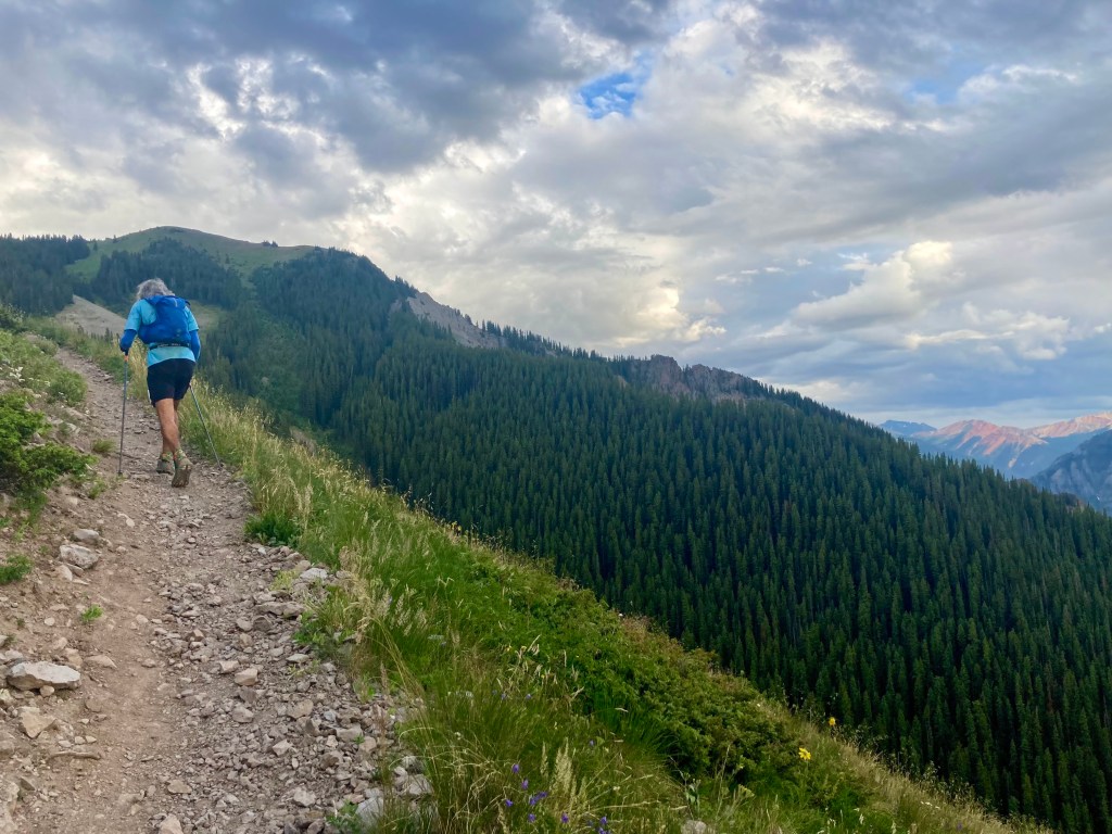
We left Fellin with Alexandra and chatted with her for a bit, but she wasn’t eating pizza and went on ahead. We spent a few minutes on 550, then headed up the Horsethief Trail. This rose gradually through a series of switchbacks, and we could see Alexandra up ahead. Not for long, though: she was a really strong climber and soon left us behind.
A friend had told me before the race that he really enjoyed Ouray’s final climb. He didn’t say why, however, so I was left to wonder. Was it particularly beautiful? Memorably technical? So far it was none of those things. What it was was gradual. Like the previous out-and-back, it had a steady grade–rising 5,000′ in five miles–that never got particularly steep. For hours I’d assumed this race would save the worst for last, but instead it was ending with the two most gradual out-and-backs of the day. It seemed the RD was not the sadist I’d thought.
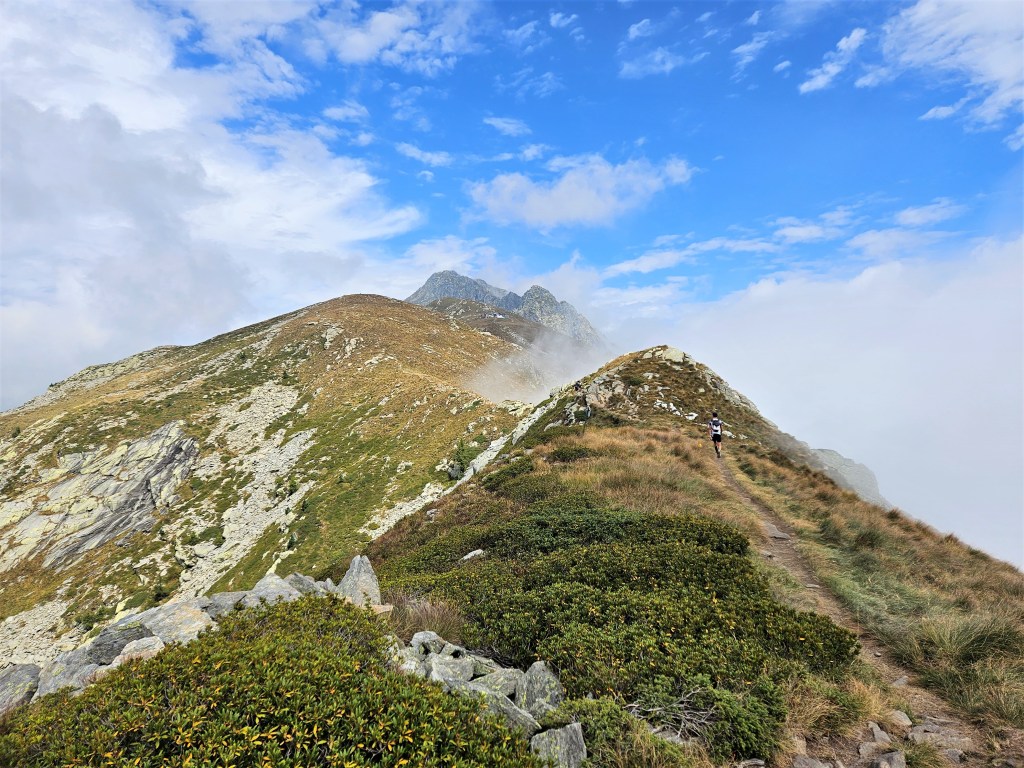
And actually, that last climb was beautiful. Once we’d cleared the treeline, we emerged onto an open ridge with spacious views. This is my favorite kind of terrain, and I welcomed it now. But I was also very, very tired. I’d pushed hard through the previous out-and-back to gain a cushion, and I was feeling the toll now. Although the terrain was easy, I struggled to keep up with Megan and kept looking at my watch, wondering how much farther we had to go. I figured less than a mile, but I saw no end in sight, and I started to wonder how much longer I’d last. I told Megan I finally understood what people meant by “leaving it all on the trail.” I’d pretty much left it all.
We passed a strangely fresh-looking runner: another of the bearded guy’s pacers. He too had been unable to keep up with his runner, who he said had started weak but was finishing strong. No kidding: I’d never seen a runner leave so many orphaned pacers in his wake.
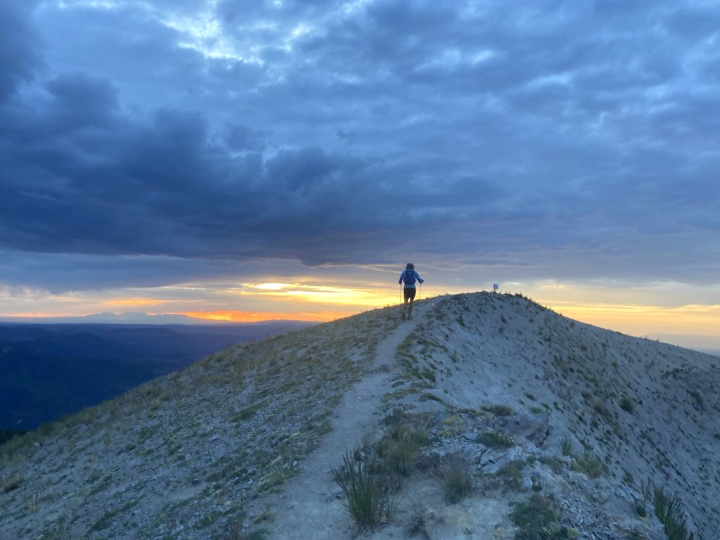
The last mile to the turnaround was beautiful and gentle, but things got harder and harder for me. I made a lot of pained noises. I occasionally stopped and leaned on my poles. I thought how insane it would be to come this far and not make it to the top, or to make it to the top without the energy to get back down. I felt lightheaded and wondered if I might pass out. Finally, I wondered: what was the Bridge of Heaven? Was it an actual bridge? A bridge-like rock formation? My ignorance was probably for the best: at least I had curiosity to pull me along.
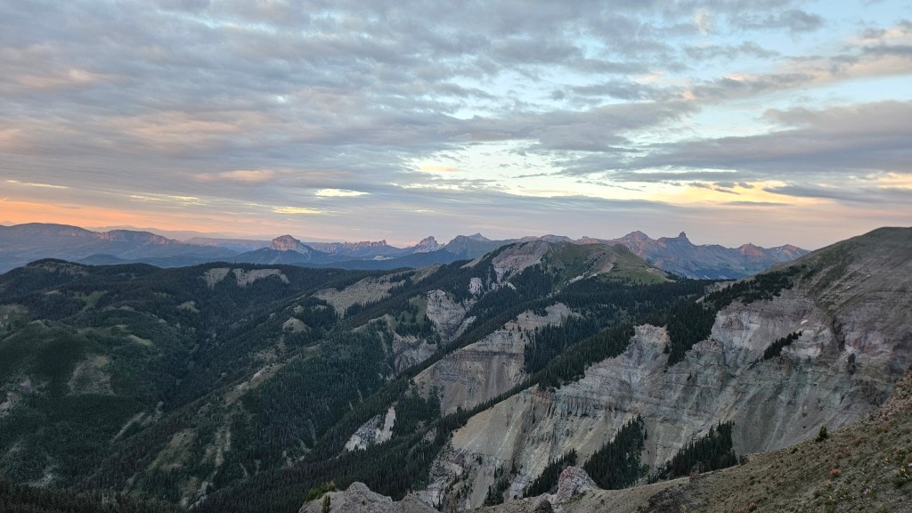
Finally we saw our harbingers: bearded guy and Alexandra. They said the views from the top were amazing. But where was the top? I still couldn’t see where this all ended. At last we saw dark-haired guy descending a trail from a grassy knoll above us. I said something like “Are you f***ing kidding me?? I have to go all the way up there??” It really wasn’t far, but I was ready to be done.
We congratulated dark-haired guy as he went by and continued on to the top. The views were unreal. We’d arrived just before sunset, and the light was ethereal. We reached the Bridge, which was a narrow ridge with views in all directions. We hiked out to the turnaround, punched my bib, and stood a moment to take it all in.
It’s hard now to convey what it felt like to be there. I’d been on a pilgrimage for 36 hours just to get to this place, and I was exhausted and in a heightened emotional state. I remember feeling awe in a way that’s rare. I remember telling Megan I’d never done a race with a finale like this. I remember that we both felt incredibly lucky to arrive there at that time, able to see everything in that magical light. I felt deeply moved, grateful for this place and the journey that brought me here.
But we weren’t done. We still had over five miles left. So we left the Bridge and headed down the trail.
Homeward bound
We passed Sam just below the summit, glad he’d make it while it was still light. I moved slowly at first, finding the downhill hard on my battered legs. But once we hit a runnable stretch, I was able to relax and let gravity do its thing. I clicked off a couple fast miles, leaving Megan behind, only slowing when the trail got steeper and more technical. The rest of the descent alternated between more and less runnable parts, with the former ok and the latter painful.
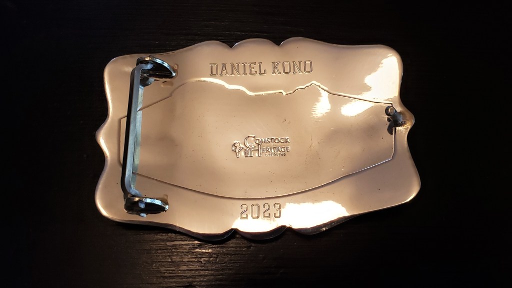
We hit 550 and jogged to the finish, reaching it in 37:52. Due to some finish-line confusion, my official time is 37:55. Unlike most races, Ouray doesn’t have a finishing chute: just a couple of small cones on the grass. I didn’t see them in the dark or realize I had to run through them, and since I didn’t run through them, no one knew I had finished. By the time I’d figured all of this out, I’d added a few minutes to my time. That’s fine: I was thrilled to finish under 38 hours and wasn’t going to sweat the change.
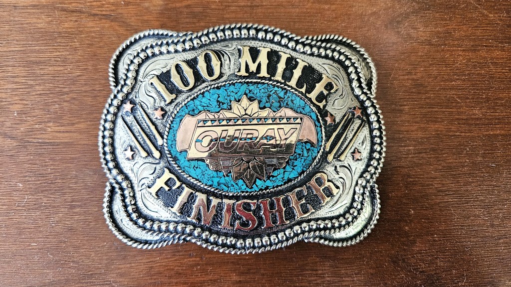
I was desperate for some real food, but everything in Ouray is closed by 10. Fortunately, the aid station had options I hadn’t been eating all day, like Impossible burgers. I ate two of these while checking out my new belt buckle.
I was happy with my race. I finished 14th overall (out of 137 starters), 12th male, and 1st in the 50-59 age group, despite it being a fast year for the race as a whole. Both the male and female winners (Ted Bross, 36 and Sarah Ostaszewski, 33) set new course records (29:19 and 32:42, respectively). A record 21 people broke 40 hours: over the race’s previous history, that number ranged from 2 to 12. And 60 percent of the starters finished the race, also a record high. This year’s strong performances probably owed something to the weather, which was mostly cool and rain-free. But they also continued an obvious trend: the race has gotten larger and faster with each passing year. I heard someone say that this year’s race sold out in early spring, which had never happened before. So it seems Hardrock’s little brother is growing up.
We got a good night’s sleep in a local B&B and visited the hot springs the next day while waiting for the last runners to come in. I won’t ascribe them any curative powers, but it was nice to soak my tired legs in the hot pools, occasionally alternating with a plunge in the cold swimming pool. All while taking in the views of the surrounding peaks, which, thankfully, I no longer had to climb. After an hour of this, we headed to the awards ceremony.
The ceremony was a comedy of errors. They first presented the top three females, noting that the winner had set a course record. Then, after some discussion, they “corrected” themselves, saying it wasn’t a CR after all. Except that, actually, it was. They then presented the third place male, Vernon Palm, who seemed pretty sure he wasn’t third. After some discussion, they realized Tim Shepard had actually finished third, so they took the trophy away from Palm, gave it to Shepard, and sent Palm to sit back down. But hey, it’s a low-key and quirky race, so I don’t think anyone minded. It was actually an admirable ceremony in at least two ways. It lasted all of five minutes–probably because the last runners didn’t finish till noon, and people had flights to catch. And they had a trophy for the DFL (Dead F***ing Last) finisher, Jacob Stevens in 51:48.
L to R: F1, F2, F3, DFL, M3, M2, M1
Would I recommend this race? Hell, yeah. It’s brutally hard and takes much longer than the typical 100-miler, but it is jaw-droppingly beautiful and the most social 100-miler I’ve done. The out-and-backs don’t seem redundant and offer a great opportunity to bond with other runners. The course is well marked, and for all my griping about the lack of vegan soups, the aid stations range from average (e.g., Richmond, Weehawken) to excellent (the much-trafficked Ironton and Fellin Park). The race is well-organized (when it counts), and every volunteer I met was friendly and helpful. There are hot springs to soak in afterwards. If you love mountains and aren’t afraid of a lot of vert, you should give it a try. Just give yourself some time to catch your post-race flight.
Will I do it again? Probably not. I’m happy with both my time and my experience, and I don’t think I can improve on either. I might feel differently if I were 32 or 45, but I’m not. I might also feel differently if it weren’t so hard, but it is. I feel lucky to have the buckle and some great memories, and maybe I don’t want to push my luck. But if you do Ouray and want a pacer, let me know. I’ll try to keep up.
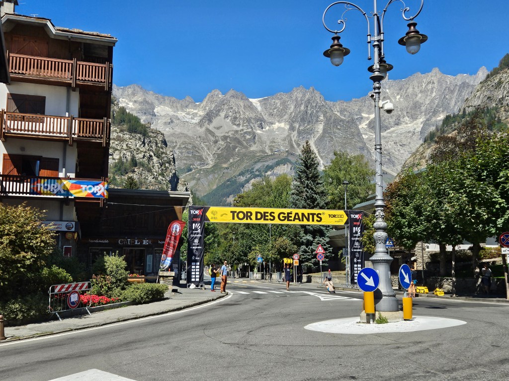
What is Desolate Peaks? One could be forgiven for thinking it’s a race: it has aid stations, drop bags, timers, a course guide, and even a page on Ultrasignup. But races (and organized events more generally) are not allowed in the Desolation Wilderness, so it can’t be that. As the participant guide states–no less than six times–“THIS IS NOT AN OFFICIAL EVENT – JUST A GROUP OF FRIENDS ENJOYING THE MOUNTAINS.”
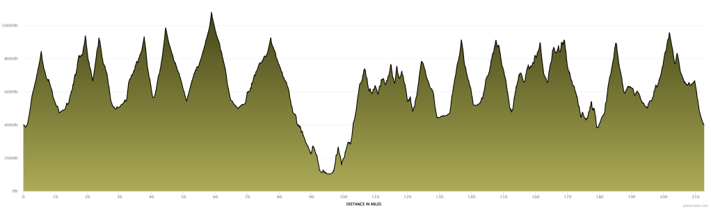
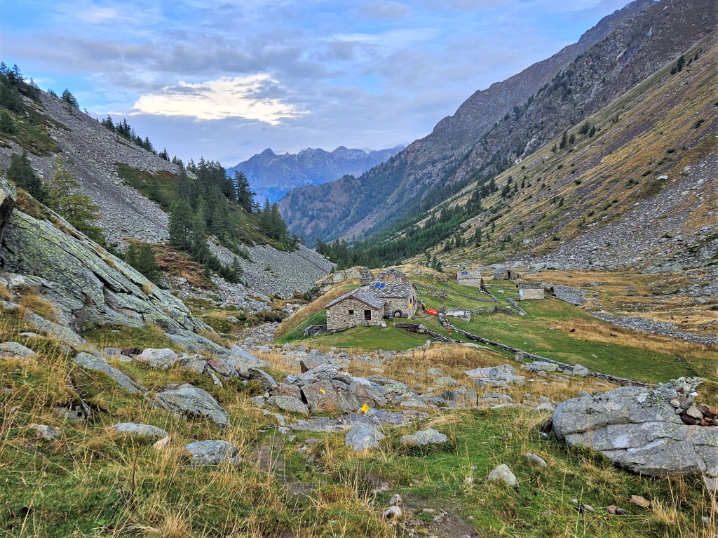
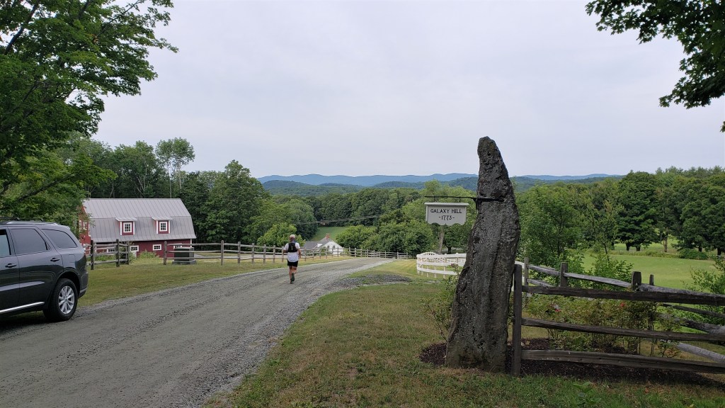
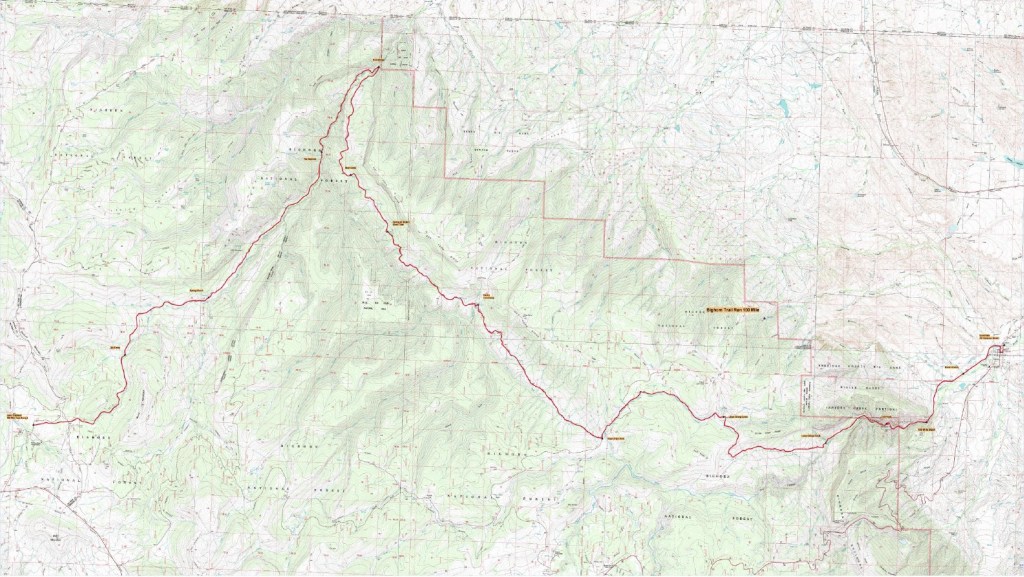
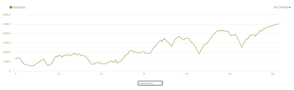
Whatever it’s not, Desolate Peaks is a remarkable opportunity to experience the Desolation Wilderness. The goal is to hit numerous Desolation peaks in one go–how many is up to you. The classic course (“The Beast”) consists of 17 peaks: Price, Agassiz, Pyramid, Cracked Crag, Keith’s Dome, Ralston, Talking Mountain, Becker, Flagpole, Echo, Angora, Cathedral, Tallac, no name 9579, Dick’s, Jack’s, and no name 9441. This will get you close to 20,000 feet of elevation gain in roughly 40 miles. For those who consider this a bit much–i.e., the sane–there’s an 11-peak “Fun Run” (the first 11 listed above). For those who think, like Lazarus Lake, that we could all use a bit more suffering, there’s a 21-peak “Beast + Lucifer’s Frolic” that adds four peaks in the northern end of the wilderness–South Maggie’s, North Maggie’s, Phipps, no name 9263–and which, prior to this year, no one had ever done. The map below shows the broad contours of the course: each waypoint is a peak, and the red line shows the approximate Beast route, beginning and ending near Wright’s Lake and followed in a counter-clockwise direction.
I say “approximate” because there is no set route: you just have to make it from one peak to the next. The participant guide says The Beast is 47 percent on trails, but I’d say this reflects a generous definition of “trail” as well as specific route-finding choices. One can often choose between a longer on-trail option and a shorter off-trail one, and different runners will make different choices. But all runners will spend the majority of their time off-trail, and much of that time figuring out where to go.
Desolate Peaks is (not) organized by Mats Jansson, who, along with some other spirited volunteers, provide the support runners need for such an attempt. There are two aid stations–at Echo Lake (mile 18) and Fallen Leaf Lake (mile 23)–where runners can leave drop bags. The non-organizers also provide shuttles from Echo and Fallen Leaf for runners who do the Fun Run or drop along the way. Two aid stations, five miles apart, in the middle of a 20-to-30 hour race isn’t much by normal mountain ultra standards. But it’s what makes an endeavor like this even thinkable to ordinary mortals like me.
I first learned of Desolate Peaks in 2021, and it seemed like my kind of non-event. I’ve loved Desolation for years, escaping there most summers to clear my head amidst its lakes and crags. I know the wilderness fairly well, even if I’d only summited four of the peaks, and I’m a moderately experienced rock climber–helpful on a course with more climbing than running. I signed up in 2021 but ultimately bailed due to that year’s fires. No such excuses this year: with good weather and smoke-free skies, it was time to get it done.
And yet. As the date approached, I felt a growing unease. Actually, let’s be honest: I was afraid. Not afraid I’d have a bad performance: I didn’t care about my time or place. Not afraid I’d DNF: if that happened, so be it. Not afraid it would be hard: I’ve done hard things. Afraid that something really bad could happen. Like, I could die. If that seems strange for someone who’s done a lot of backpacking and hard mountain ultras, I have to emphasize how different this was from anything I’d done. I’d traversed peaks like these, but always during the day. I’d spent many nights in Desolation and other wild places, but safely ensconced in my tent. I’d run or hiked through high mountain passes at night, but always on trails, and never too far from aid. The thought of navigating Desolation’s high, technical ridgelines in the dark, in the cold, perhaps with bad weather, possibly alone, scared me. Megan reminded me there’d be other runners in the race, including some I call friends. But we could get pretty spread out in a race this long, and I could easily end up on my own. That thought filled me with dread.
I was nervous enough to borrow Megan’s SPOT: a satellite tracking device that allowed me to send regular check-in messages to Megan and Mats, and an SOS to local rescue authorities if need be. It’s an old model that Megan bought for the PCT in 2016: it doesn’t allow two-way communication or typed messages, but it still works and allows pre-recorded messages with a link to your location. I set it up to say “Peak!” every time I sent a check-in, which I planned to do on every peak.
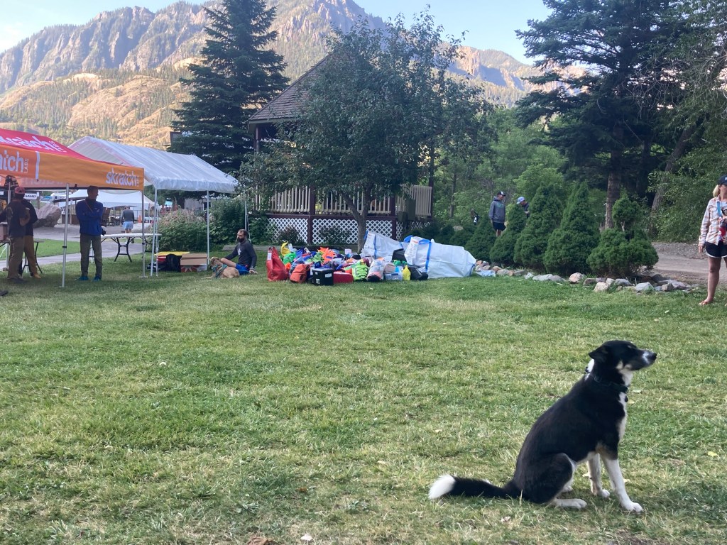
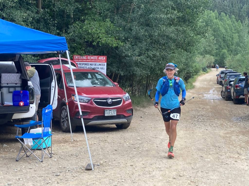
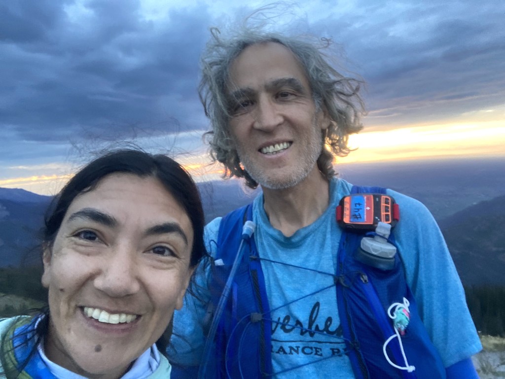
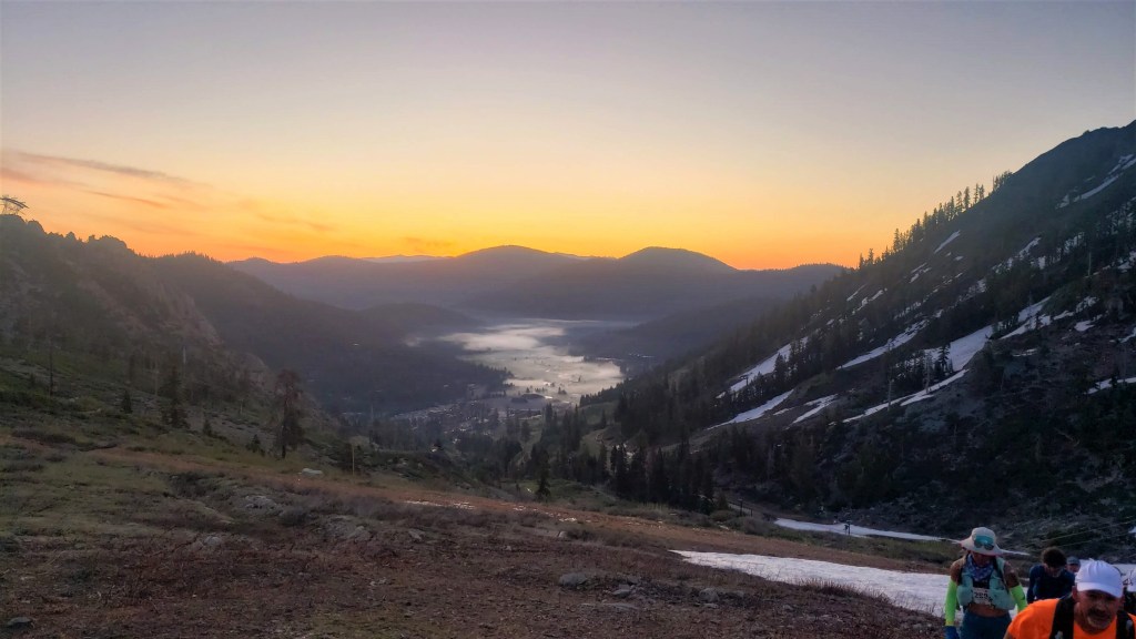
On race day, I arrived at the overflow parking lot at 5:25am. The main lot by the start was already full, so I parked here to wait for the shuttle. I saw a few familiar faces: Sam and his son Oliver, who were running together, and Shane, who helpfully got me a parking pass while I collected my gear. A few minutes later we caught the first shuttle to the start, where twenty runners milled around: four for the Fun Run, fourteen for The Beast, and two for The Beast + Lucifer’s Frolic. Someone greeted me, and it took me a second to recognize my friend Garret. “Dude, your beard is out of control!” I said–an inside joke, but also true. Mats called everyone to the start, offered some last-minute advice, took a group photo, and at 6:10am sent us on our way.
Desolate Freaks
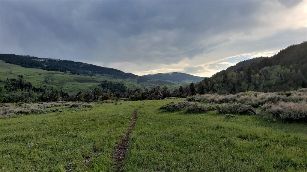
The group started surprisingly fast, running down the short paved road and along the flat trail leading to Twin Lakes. I settled into the back of the pack, thinking we had a long day and night ahead. After a short while we began to climb toward Mount Price, our first peak and the northernmost of the Crystal Range. I’d put together a tentative course GPX with information from the course guide, but with so many people ahead, I didn’t bother to look at my phone and instead mindlessly followed everyone else. It began to dawn on me, however, that we weren’t taking the route I’d planned: instead of continuing north past Twin Lakes and approaching Price from the northwest, we were heading east toward Smith Lake and approaching Price from the south. Oh well, that’s fine–I was happy to trust the wisdom of the crowds. (It should be noted that the lead runners missed a turn only a minute into the race, but most of the crowd didn’t follow them, which I’ll call a win for the crowd.)
Before long we left the trail and began climbing toward Price. This area was mostly slabs, large talus and scree, but not particularly technical. The sun cleared the ridgeline just as our route turned east, blinding me a bit. I hastily put on my sunglasses.
I soon caught up with Shane, and we traversed the first ridge together. It was an easy traverse, though maybe not comfortable for everyone, that provided a taste of things to come.
Ridgeline to Price (summit at top left)
Shane on the ridge
Shane mantling
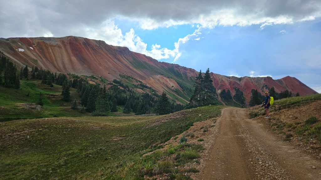
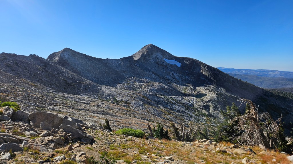
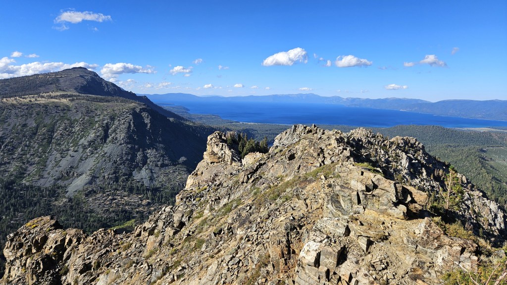
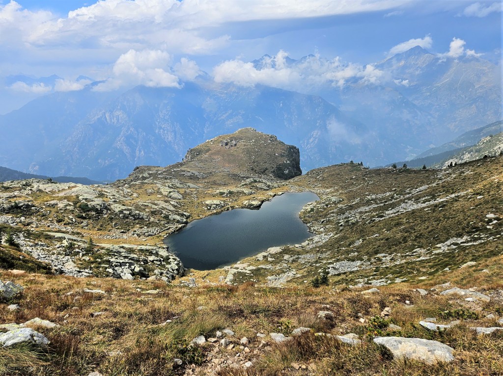
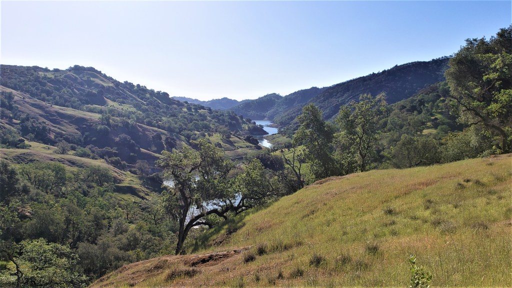
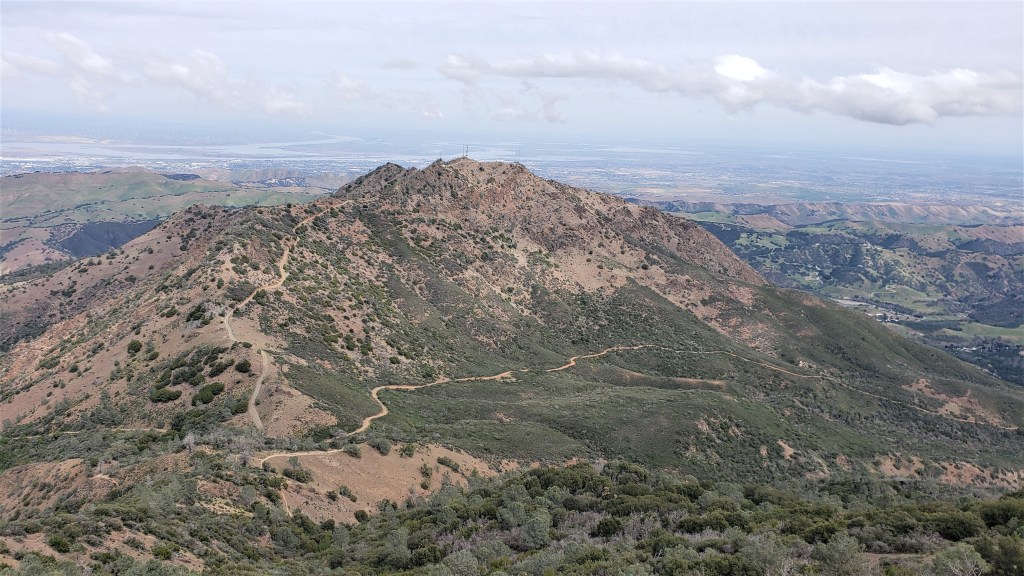
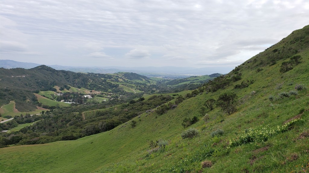
From there, it didn’t take long to reach Price. This was my first time on the north end of the Crystal Range, and it was worth the trip. To the south stretched the rest of the range: the sharp, hook-shaped Agassiz and behind it, at the south end, the aptly named Pyramid Peak. Far behind it and to the left, you could see the ridgeline stretching from Ralston to Talking Mountain to Becker Peak, and eventually to the eastern end of Lower Echo Lake, where we’d find our first drop bags.
R to L: Agassiz, Pyramid, Ralston, Talking Mountain, Becker
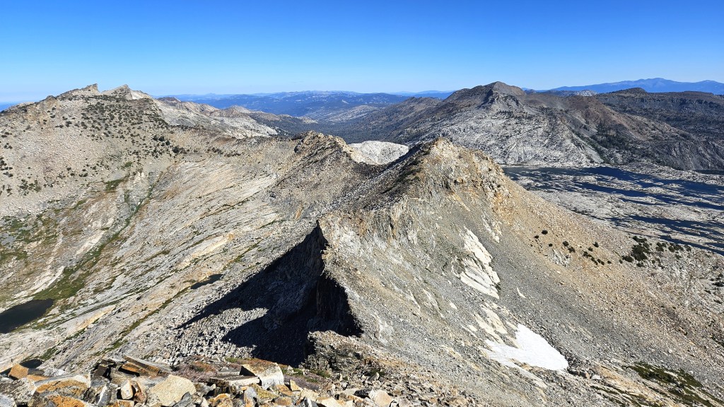
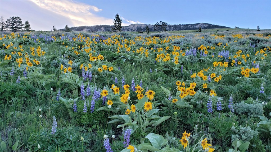
Below and to the east was Lake Aloha and Desolation Valley, surrounded by the remaining peaks we’d do that day (and night). The photo below shows the peaks through Tallac. The last four–9579, Dick’s, Jack’s, 9441–aren’t shown because they weren’t that photogenic, and I wasn’t taking out my camera to catalogue peaks. But you get the picture: from here we could see the entire course, which was both uplifting and daunting.
Our route would be more circuitous than the above picture might suggest, as we wouldn’t simply move from right to left. After hitting Agassiz and Price and leaving the Crystal Range, we’d descend to and cross Desolation Valley to Cracked Crag. We’d then go Keith’s Dome, then to Ralston, then down the ridgeline to Talking Mountain, Becker, and Lower Echo Lake. From there, we’d move left across the landscape, hitting Flagpole, Echo, Angora and Cathedral enroute to Tallac. Then on to the remaining four peaks.
Shane and I moved on to Agassiz, which was easy. I stopped for a minute to put in eye drops: something I was supposed to do every hour, since I got Lasik surgery two weeks before. By the time I finished, Shane had disappeared. I continued on toward Pyramid but didn’t see him anywhere. Oh well–I’m sure he’d turn up eventually. My GPX guided me close to the ridge, but I remembered the course guide saying we needed to descend to the slabs below. I’d tried to follow those instructions when constructing the file, but without seeing the landscape before me, it was hard to know exactly what they meant. Now that I saw it, it seemed clear that I needed to descend further than I’d planned, so I did, cutting more or less straight across to Pyramid.
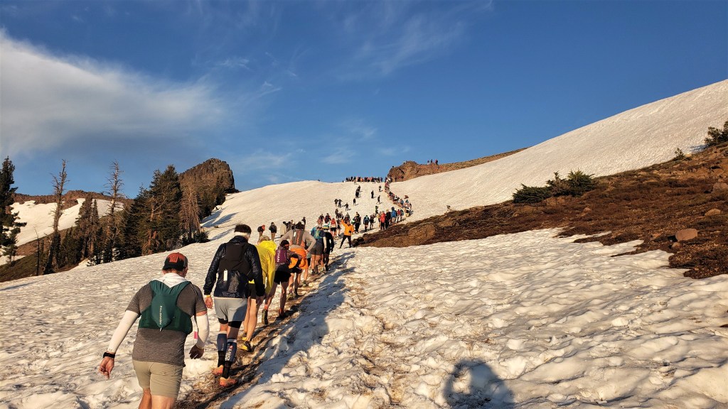
The route across the plateau was easy and even permitted some running. But at some point, I’d need to climb again. I wasn’t sure exactly where: the guide said to look for a steep and narrow gully, but that could mean a lot of things. I made my best guess and started climbing a promising-looking rock ledge. It was fine for a while, but got increasingly technical and eventually brought me to a steep cliff I couldn’t descend. I’d have to go back. I backtracked a bit, tried one descent, found that impossible, then backtracked some more and eventually got down to where some other runners were passing through. Having proved myself an inept route-finder, I decided to follow them. They soon located the aforementioned gully, and we took it up to the ridge. I remember this climb mostly for the wind, which was now howling. At the previous day’s check-in, someone had mentioned that we’d get sustained winds of 50mph on the ridges. That seemed about right: I climbed with one hand, using the other to hold my hat on my head.
It was a relief to emerge on the east face of Pyramid, which was shielded from the wind. The vibe suddenly changed: it was sunny and warm, and other runners were climbing to and descending from the summit. I’d been looking forward to this spot, as I wanted to check its reality against my memory. I’d been up here only once before, while hiking with a friend in 2012. We’d turned back before the summit, since the talus seemed dodgy, and that memory has stuck with me since. Now, however, it seemed fine. Sure, the talus would occasionally slide, but never far, and overall everything seemed solid. I hiked up to the top, took a few pics, and headed back down.
Looking back down the ridge toward Agassiz and Price
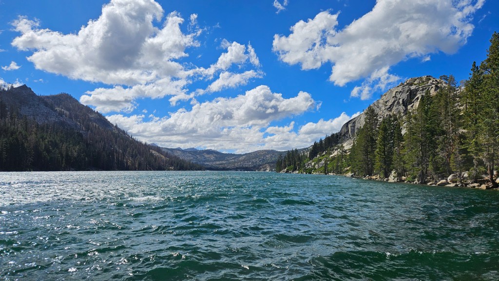
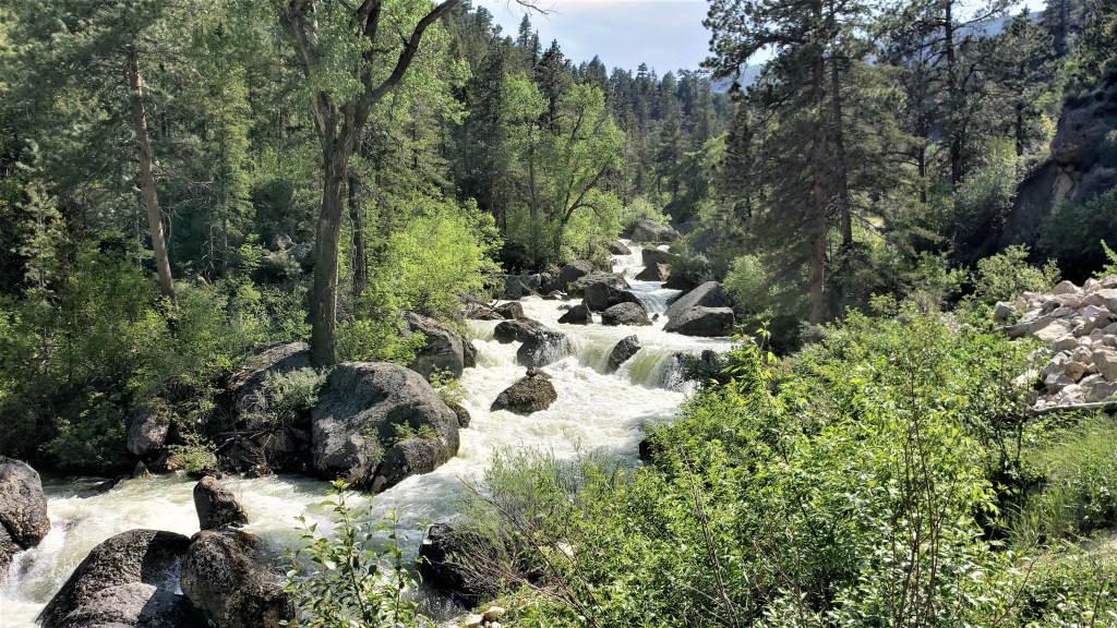
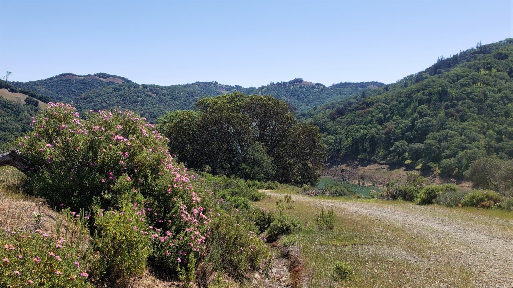
The descent to Desolation Valley was easy and quick, as was the trek across the valley. Lake Aloha was lower and drier than I’d ever seen, but maybe this is just how it is in late August–I’m usually here in June or July, when the snowmelt is still flowing. I crossed the Medley Lakes dam just north of American Lake, made my way to the Aloha Desolation trail, and followed that to the PCT.
View from the dam toward American Lake
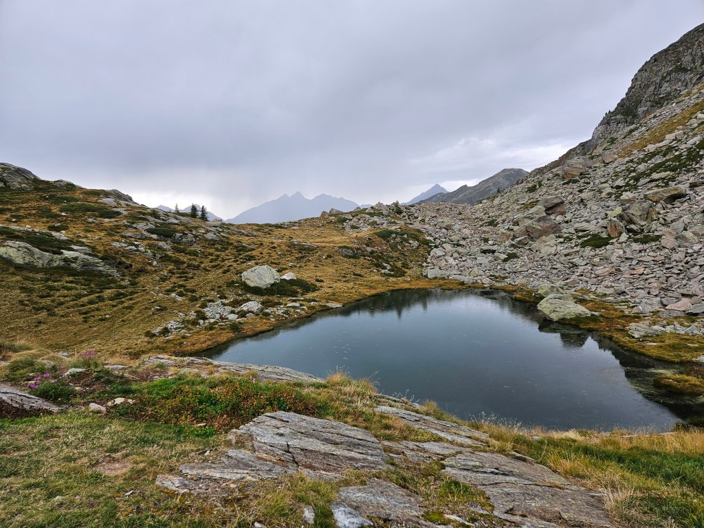
I didn’t follow the PCT, but crossed it and immediately began climbing the talus toward Cracked Crag. I’d passed below Cracked Crag many times but had never bothered to ascend it. Doing so was fairly easy, if slow: just talus and more talus. Another runner–one of the few women out here today–caught up to me, and we chatted about how low the lake was. After seeing it full so many times, as in the pic below, it now seemed dull and sad. But again, that’s probably just the season.
Aloha in late June 2020
Aloha now, from Cracked Crag
Cracked Crag didn’t take long, and after taking a moment to put in eye drops, I headed back down. I’d planned to descend to the PCT but decided instead to take a shorter off-trail route. I’d have to depart from my original route at some point, as I wanted to stop at Lake Lucille for water, and the terrain didn’t look bad. In the end, it was probably a wash, as I traveled less distance but at a slower pace.
Lake Lucille wasn’t ideal for refilling, as the shores were reedy and marshy, and I wasn’t able to fill my filter flask. I eventually filled both of my drinking flasks, however, and continued on to Keith’s Dome. Like Cracked Crag, Keith’s Dome was straightforward: just a slow slog up the talus. I took a few pics, put in eye drops, sent my SPOT message, and headed down toward the PCT. It was now a little past noon, so I’d been going about six hours.
View of Crystal Range from Keith’s Dome
I hit the PCT exactly where I’d planned, at the junction with a small connector that led to Ralston Peak trail. This gave me the luxury of forgetting about navigation for a while: I’d simply follow the trails to Ralston Peak. I put away my phone, took out my poles, and made good time to Ralston. I’d summited Ralston so many times that I wasn’t much interested in taking pics, but here’s the obligatory view back toward the Crystal Range. To make it more interesting, I’ve indicated the four peaks that weren’t in my earlier pics, and which I’d (hopefully) be hitting sometime that night: 9579, Dick’s Peak, Jack’s Peak, and 9441.
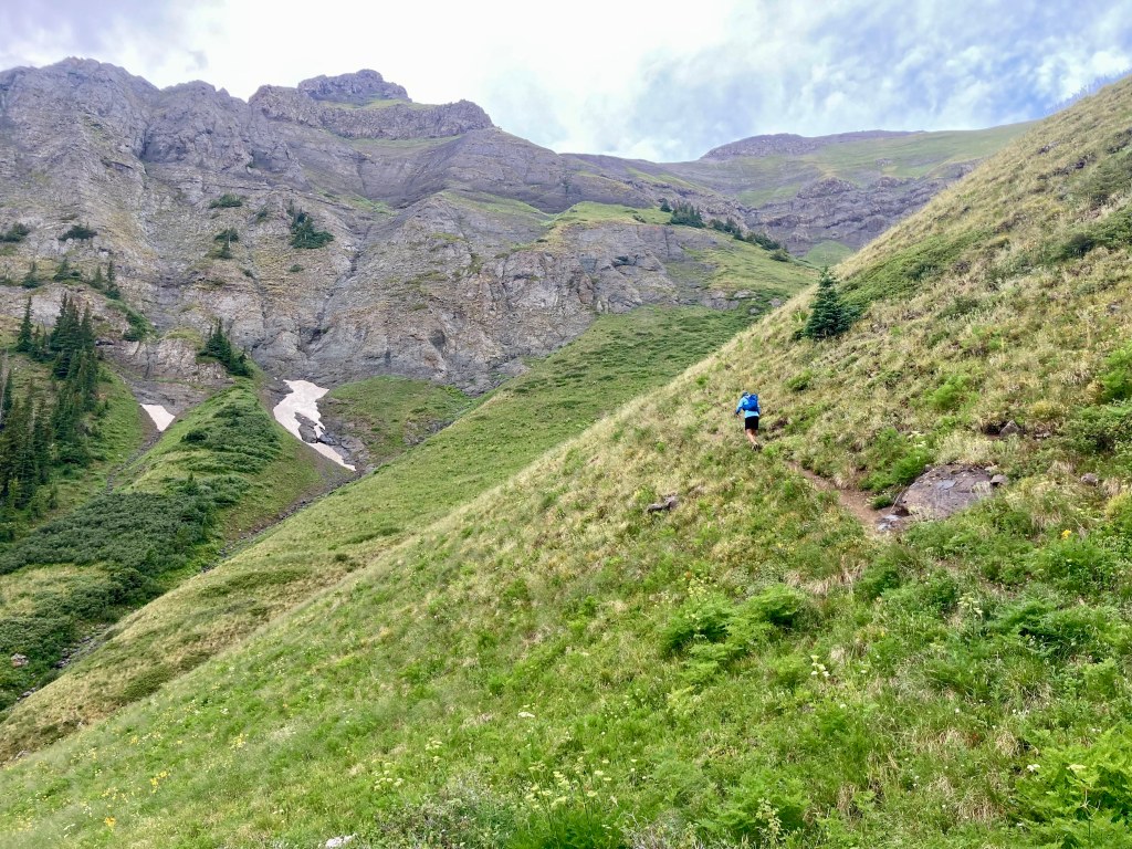
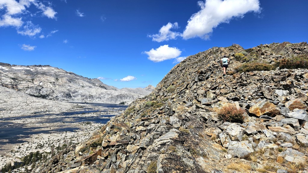
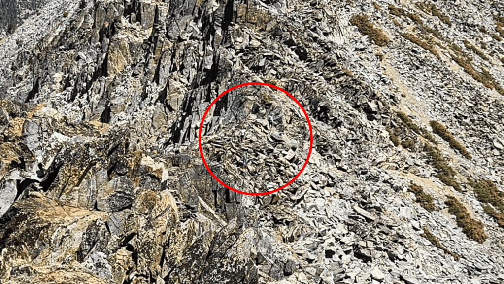
The ridge toward Talking Mountain surprised me a bit. I’d imagined it as an easy, gentle descent, since that’s how it had always looked from Ralston. But it was slow going from the start, as it was mostly talus, and eventually became very technical, requiring hands-on climbing. I was constantly trying to decide whether I should stay on the ridge or descend to the talus, which dropped down steeply toward Cup Lake. I mostly stayed on the ridge, but that was not always smart. At one point I had no choice but to downclimb a steep crevice where a fall could have led to serious injury or, if I landed badly, death. It didn’t seem bad initially, but the holds turned out to be worse than expected, and I cursed myself for not backtracking and taking the talus route. It turned out ok, but I was rattled. The wind didn’t help: it was howling constantly, and I again wasted a hand holding onto my hat so it wouldn’t fly away. I’d tightened the hat’s headband as much as possible, but that was little use against a wind like this.
The ridge toward Talking Mountain. Can you see the runners ahead?
Here they are
Cup Lake
Shortly after leaving the most technical part of the ridge, I caught up with the woman I’d met on Cracked Crag, and then with Sam and Oliver, who I hadn’t seen since Pyramid Peak. They seemed to be doing well, and it was a relief to have some company for a while. I enjoyed the journey with them, first to Talking Mountain and then to Becker Peak. They lingered a while on Becker, but I was determined to cover as much ground as possible while it was still light, so I went on ahead. The remaining mile to Echo Lake was the easy, gentle descent I’d been hoping for, and I was in good spirits by the time I reached the aid station there.
Mats was there with another volunteer, who filled my hydration pack as I looked through my drop bag. I was grateful to them for being there: they weren’t making any money from this, and it was nice to see people willing to devote so much time and energy just so a few crazy people could have a great day on the trails. Mats said five others had already passed through, which surprised me: I’d thought there were more people ahead. But the last time I could see many runners was on Pyramid Peak, and there were a lot of miles between here and there, and many possible routes.
Sam, Oliver and their two companions arrived a few minutes later. I took my applesauce-filled flasks, a bag of potato chips, a bag of pretzel nuggets and few cookies from my drop bag and headed on my way. It was now a little after 3:00, so I’d been going nine hours.
Good to go
Lower Echo Lake
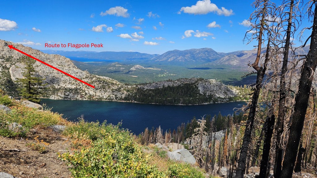
The first mile from the Echo Lake parking lot was easy, as it was on the PCT, and after eating my chips and pretzels, I ran for a bit. That didn’t last long, however, as I soon needed to climb to Flagpole Peak. I’d looked at those high rock slabs many times before but had never been up there. I didn’t think to take a pic, but this one from the ridge near Talking Mountain–across Echo Lake from Flagpole–shows the route to the peak, if not the peak itself.
As I climbed toward the peak, the wind got ferocious again. I took my hat off and stashed it in my pack’s chest straps, but then I realized that, while I’d re-applied sunscreen at Echo, I’d forgotten to put any on my forehead. I hadn’t bothered with that area because I figured the hat would protect me, but now I had to decide which was worse: dealing with the hat in the wind or getting sunburned. I put the hat back on, but I’d go back and forth for the next couple hours, depending on the wind.
The lower part of the ascent was steep hiking, but the higher parts involved hands-on climbing: not difficult, but slow. I enjoyed it, however, and felt like I was doing a better job route-finding now I was on my own. When you’re following others, as I was earlier in the day, you get lazy and stop paying attention–and that laziness can persist even after the others have gone, and get you into trouble. Now that I was conscious of being alone, I was taking more care: I’d try a route, decide I didn’t like it, and try another until I made my way through. I kept doing this until I saw the flagpole above me–yes, there’s a flagpole on Flagpole Peak. And there, wedged into a crack, was Shane.
I was surprised to see him. I’d last seen him on Pyramid Peak, where he was behind me. I didn’t know where he’d passed me, but he said he hadn’t stopped for water at Lake Lucille, so it was probably then. In any case, I was glad to see him. We left Flagpole and followed the ridge toward Echo Peak, moving as fast as we could. We both had the same idea: get as far as possible before the sun sets. We knew the night would be tough in various ways–cold temperatures spring to mind–but our biggest concern was route-finding. We had lights, of course, but those allowed you to see only a few dozen yards ahead, which was a big liability. You might follow a technical ridge that looks feasible only to find that it ends at an impassable chasm or cliff. And then you might find going back harder than going out. Other bad things could happen, but you get the point: it helps to be able to see. So we hurried on.
Right now everything seemed good. We were both feeling fine, and it was a beautiful day. The approach to Echo Peak was a wide, gentle plateau, and we even found a vestigial trail. I felt more relaxed than I’d been all day. The wind was still howling–I could barely hold my camera steady to take pictures–but that didn’t seem to matter in this safe, sunny place. We soon reached Echo Peak, which was unremarkable–which was fine with me.
Shane on Echo Peak, Crystal Range visible in background
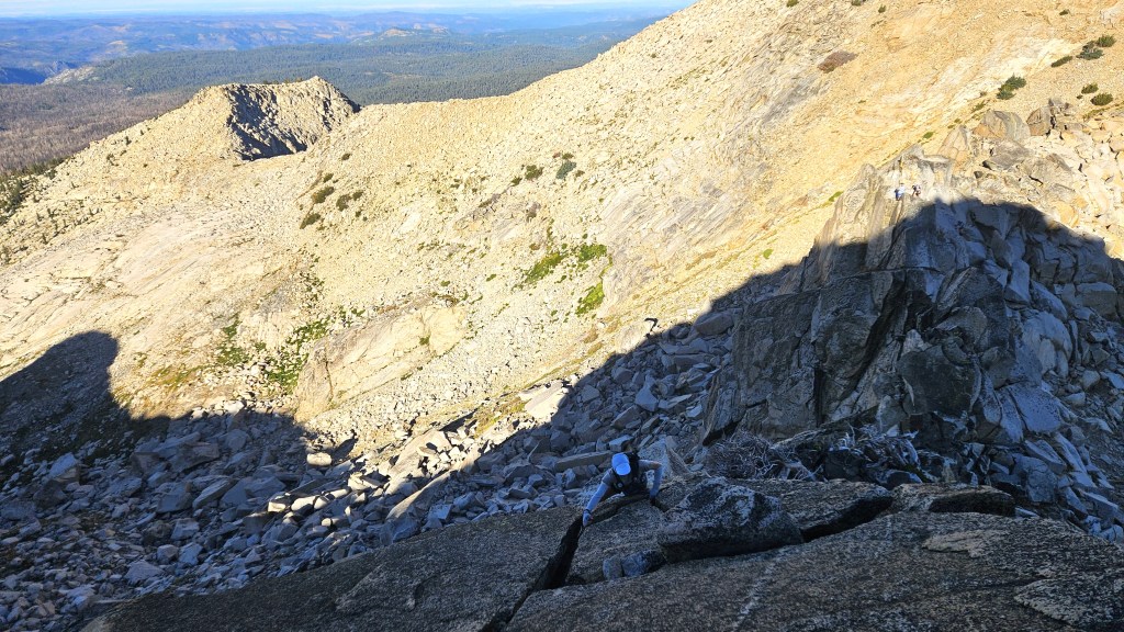
The idyll didn’t last. As we moved north, the ridge got more technical. The course guide had warned us of this, but I didn’t remember anything except “If it seems like there is no way forward, back-track and try another approach.” We reached a scary gap in the ridge and debated how to cross. My first instinct was to stay high on the ridge and to take a narrow ledge to a point where you could hop across. That could work if you maintained your balance, but you could pretty easily die. Shane was meanwhile surveying the lower route, so I gave that a look. I found a narrow crack that you could climb to the other side, so I hiked down and climbed up that. It was tricky but doable, and safer than the other way. After reaching the top and rounding a corner, I was relieved to see the way forward looked safe.
A challenging ridge
After waiting a minute, I started to wonder what had happened to Shane. “You ok?” I called. He said he didn’t like the crack and was going to look for another route, maybe dropping down to the talus on the east side. Bummer. I’d have liked to stick together, but I wasn’t going to cross that gap in reverse, so I told him I was going to continue on. He’d caught me before; maybe he would again.
Angora Peak looked close, but the course guide noted (and my GPX showed) that the summit in front of me was a false one. I needed to get around it, but on which side: east or west? If I’d bothered to look at my GPX more closely, the answer would have been obvious: east. Not only was the slope on that side much more gradual; the map also indicated a trail to the summit. Somehow I failed to notice this and, because the west side didn’t require me to drop down, I went west. Big mistake. The west side consisted of a steep, sandy slope that was hard to not slide down without grabbing onto rocks–some of which came loose and tumbled down the hill. It didn’t feel deadly, but it was precarious, and it took a long time to get by. Eventually I made it through to the summit, where I took a few pics and sent another SPOT message. I exited on the east side, noting with chagrin how much easier it was than the west.
Fallen Leaf Lake and Lake Tahoe from Angora Peak
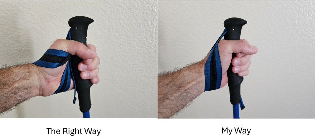
The descent from Angora was steep. Not scary–just a long, sandy slope–but steep enough that if you lost control and started sliding, you’d slide for a long time. I took out my poles to help stabilize myself. I hadn’t used them much today because I so often needed both hands, and they were at best a distraction on talus. But there were a few sections, like this, where they were helpful. I’d never been proficient at putting my poles in their quiver and taking them back out, but I got a lot of practice today and had already noticeably improved.
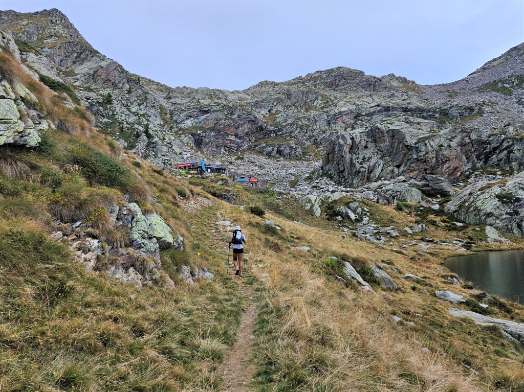
I soon reached the Angora Lake trail, which took me quickly to the Fallen Leaf aid station. It was pretty quiet there, with only one volunteer and a runner (Zoe Wood) who had just set the female course record for the Fun Run. The volunteer told me two other runners had continued on: so now we were down to two. Not that it mattered: I just wanted to finish. It was now around 6:30, so I’d been going around twelve and a half hours.
I filled a flask with water, drank it, filled it again and drank it again. I was planning to cut straight from Tallac to No Name 9579, bypassing Gilmore Lake and the PCT. This would shorten my route, but I’d have no chance to refill water until the Rubicon River, beyond Jack’s Peak. I probably wouldn’t need much water in the cold, but I didn’t want to take chances, so I hydrated well here and then filled both flasks with Gatorade. I then turned to my drop bag. I took out my Primaloft (synthetic down) jacket and put it in my pack, along with another Lenny’s and Larry’s cookie and spare batteries for both my light belt and headlamp. Then I grabbed what I’d really been looking forward to: two ziploc bags of ramen noodles. I’d cooked them beforehand and mixed them with the flavor packets, making them nice and salty and giving me 1100 calories. I knew there was a long, flat road to the Cathedral trail–my chosen route to Cathedral Peak–and I planned to walk that road leisurely, eating the noodles on the way. My reward for what I’d been through, and what was to come.
I said goodbye to the volunteer and Zoe and walked away eating my noodles. I got maybe a quarter-mile before I realized: I’d planned to leave my hat and sunglasses in my drop bag, as they were taking up space and were no longer needed. I turned around and walked back, greeting Zoe and the volunteer again, then headed back out. This time I got as far as the Stanford Sierra camp before I realized: shit, I forgot my warm gloves. I’d come closer to a half-mile this time, so I briefly contemplated continuing without them before concluding that was insane. Cursing myself for being so careless, I headed back to Fallen Leaf. I felt sheepish showing up there again, but whatever–I needed the gloves. I grabbed them and left for the third and final time.
The delay wasn’t all bad. Maybe it would give Shane time to catch up, and it gave me time to eat both bags of noodles. They were satisfying and would hold me quite a while. I chased them with my first 100mg of caffeine: the sun was setting and I wanted to stay alert.
I hadn’t seen the Stanford Sierra Camp since I was an undergrad back in 1991, and didn’t remember much besides canoeing on Fallen Leaf Lake and losing a lot of money at a South Lake Tahoe casino. It didn’t ring any bells now. I passed through the camp to a parking lot where the Cathedral trail began, and took the trail.
This was a long and circuitous way to reach Cathedral Peak. There was a much shorter route: a steeper trail right below the peak–which Megan and I had discovered last summer–followed by an off-trail scramble up the hillside. Sam had said he planned to take that route, but I chose the longer and more gradual one both so I could eat my noodles and because I could use a break from steep, technical stuff. As I hiked up the gentle slope, I didn’t regret my choice. It was nice to be on an actual trail, to stop looking at my phone, and to use my poles. And the trail provided great views of Fallen Leaf Lake and Tahoe in the setting sun.
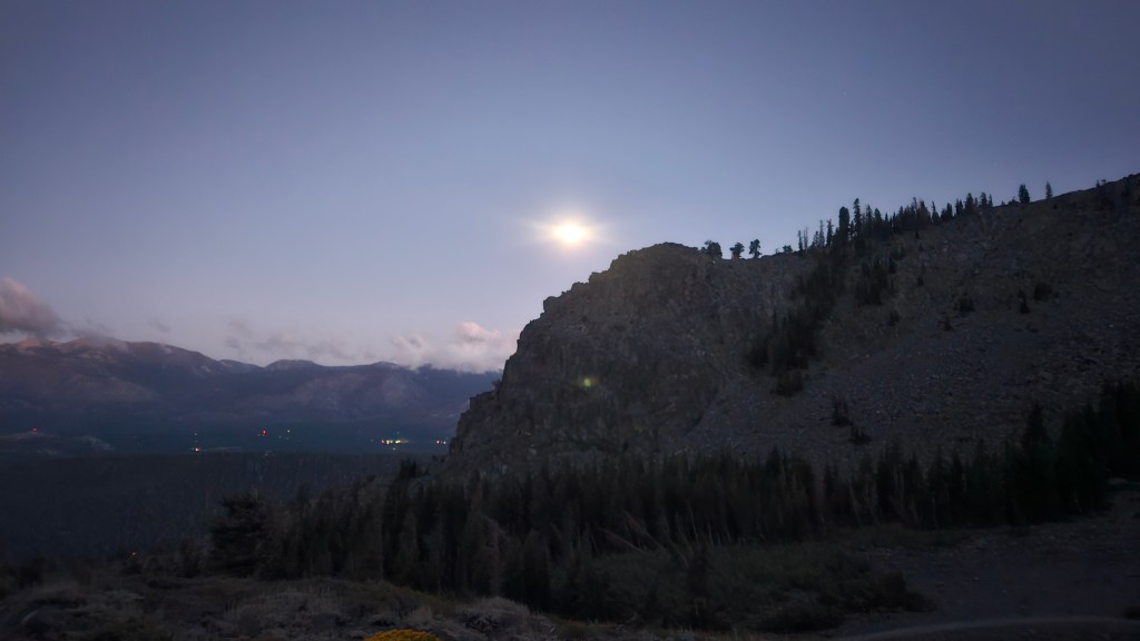
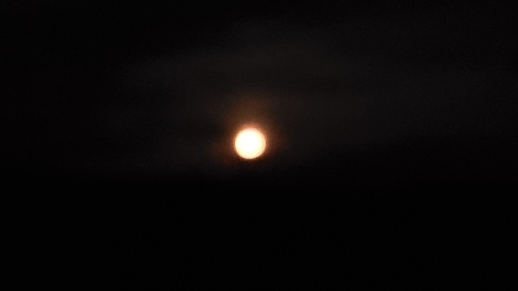
The trail wound slowly upward. The sun went down, and the moon came out. I reached Cathedral Lake and decided to drink a flask and refill it, just to be safe. It got colder and windier as I climbed, so I stopped to put on my rain jacket. I left the forest for more talus and got a nice view of the moon behind Cathedral Peak.
Moon over Cathedral Lake
Moon over Cathedral Peak
The wind was really howling now, and this caused problems for my hood. I’d put the jacket hood on to keep my head warm, but the wind kept whipping it around. I tightened the straps, but the fasteners couldn’t stand up to the wind. I tried tying the straps but gave up, figuring I might not be able to get them untied. It occurred to me that I’d prepared poorly and should have brought better gear.
Aside from the wind, the ascent was fine. It was still nice to be on a trail and I was in no hurry to leave. I liked the trail so much, in fact, that I lost track of distance and hiked past the point where I’d planned to cut across to the plateau leading to Cathedral Peak. No harm done, though: I could cut across here. I left the trail and navigated a long stretch of talus to the plateau.
Once I reached the plateau, getting to Cathedral Peak would be straightforward: I’d head out to its terminus, where the peak was located, and come back. In practice, however, this turned out to be harder than I’d thought. For one thing, the plateau was technical in places: mostly talus, but I also blundered into a few spots that required more care. I realized my light belt was useless for anything resembling a climb: when your body was twisting this way and that, you couldn’t point the light where it needed to go. I put on my headlamp: better. The headlamp also held my hood in place, solving that problem.
The larger problem was that I couldn’t maintain my direction in the dark. The route to Cathedral Peak should have been a straight out-and-back, but I found myself constantly wandering off course. I’d come up to the edge of the plateau, realize there was a big drop, then pull out my phone to reorient myself. Eventually I decided to just keep the phone out and watch it constantly as I walked along.
I reached the peak, sent my SPOT message, and turned back. The way back went a bit more smoothly, as I stayed glued to my phone. (I really should have loaded the GPX into my watch. I didn’t because I generally prefer my phone, but I usually don’t have to check it often. Lesson learned.) When I reached a sheltered spot in the woods, I stopped to put on my Primaloft jacket and gloves. Better here than in some windy spot above, even if it meant being hot on the hike up to Tallac.
I located the Floating Island trail, which led all the way up to Tallac. The sky was dark, but I could just make out Tallac’s silhouette looming above. I had a good stretch here: I was able to put away the phone and take out my poles, and the continuous hiking warmed me up. I ate some pretzel nuggets and took another caffeine pill, and was feeling good by the time I reached the short connector trail to the summit.
I couldn’t see much, but I knew Tallac well enough to be aware of the steep drops all around. Fortunately, the route is easy and safe, and I navigated the talus and rock formations to the top. It was now just past 10:00pm, so I’d been out here sixteen hours. I sent my SPOT message and headed down. As I did so, I saw lights in the distance below. “SHANE!” I shouted, hoping it was him. But then I noticed there were two lights, so maybe Sam and Oliver? I thought the lights might have moved when I shouted, but maybe not. In any case, they were a long way off, so I continued on.
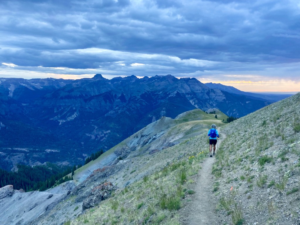
I soon reached the point where I had to choose between two routes: the trail down to Gilmore Lake and the PCT, or an off-trail shortcut straight across to No Name 9579. The trail offered water and, well, a trail, but the shortcut eliminated two miles and a thousand feet of elevation change. I’d planned on the shortcut and had put together a GPX for this purpose. I headed off trail into some tall grass.
I found the off-trail hiking pretty pleasant: mostly tall grass, with some occasional pushing through pine groves. I checked my phone frequently but not constantly. Suddenly, however, I found myself looking down into a chasm: I’d almost walked off a cliff. What had been a wide plateau had narrowed into a ridge with steep drops on both sides. Hiking the ridge was neither technical nor hard, but you did need to know where to go. I was glad I’d put together the GPX and kept my eyes on my phone from then on.
Speaking of eyes: this ridge was littered with the pine trees I’d seen all day, which sported some really sharp needles. As I pushed my way through a grove, a needle stabbed me in my left eye. This would have been painful under any circumstances, but my mind immediately went to my Lasik. It had only been two weeks since my surgery, and my eyes were still healing. I’d been so careful to take care of them, using my antibiotic, anti-inflammatory and lubricating drops on a set schedule, and following the doctor’s instructions not to rub them for a month. And now I stab myself in the eye? The eye felt irritated and watered a lot, and I worried I’d done some irreparable harm. But I could still see, and there was nothing I could do about it now, so I hoped for the best and pushed on.
I reached 9579 easily enough. I couldn’t see anything, but I knew where I was, having passed by many times on the PCT. This summit was a small rounded hill just above Dick’s pass, and would have been comfortable if not for the wind. I crouched down behind a rock and sent my SPOT message. I was sending those messages to let Megan know I was ok, and to give Mats a record of my peaks, but I’d also come to value the implied connection with the outside world. Even though the transmission was only one way, it somehow made me feel less alone.
I headed down the hill to the PCT, then took the trail leading to Dick’s Peak. I couldn’t see much in the dark, or take any pictures, but here’s one I took of Dick’s and Jack’s a while back, with Half Moon Lake down below.
And here’s a fragment of another picture I took, which caught Dick’s in the background. It’s grainy because I had to blow it up, but it clearly shows the spine that constitutes the main approach to the peak.
Needless to say, this isn’t what I saw in the dark. I could barely make out the peak’s silhouette, looking huge and menacing. I’d remembered the approach as a gentle ridge, and that was true for a while. But the ridge got steeper and steeper, and eventually the trail disappeared into rock faces you had to climb. Most of this was not bad: you had to use your hands, but you’d be fine if you kept your wits about you. But one section, maybe 15 feet high, gave me serious pause. It wasn’t vertical, but it was really steep, and the hand and footholds weren’t great. The slopes below it were so steep that if you slipped and fell, you’d probably keep on falling, probably until you died. I might have had a different take in the light of day, but there, in the dark, freezing in 50mph winds, climbing this face seemed insane.
I felt trapped and hopeless. I really didn’t want to climb this face, but I didn’t see any alternative. There was no nearby aid station where I could drop, and I felt like I’d reached a point of no return. What was I doing out here, anyway? Why did I think this was a good idea? I didn’t want to die. I closed my eyes for a second and took a deep breath. “The only way out is through,” I thought. (I know, it’s a cliché, but cut me some slack–I wasn’t at my best.) I was just going to have to make this work. I made a mental note to stay calm and focused, and began to climb.
A few seconds later, I’d cleared that part and was back on firmer ground. It was still hands-on climbing, but the hand and footholds were good. Crisis passed. I continued up.
(Note: At the base of that climb, I actually wasn’t at a point of no return. I could have walked back to the PCT and then taken trails all the way back to Fallen Leaf. It would have been a long journey but a safe one. However, once you’ve done that climb, you are basically committed. Downclimbing Dick’s in the dark would be a very bad idea, so once you’ve climbed it, you have little choice but to continue on to Jack’s. From there the return would be very long, as you’d have to descend to Mosquito Pass and make your way back from there.)
(2025 update: Having done this race again in 2025, I can now say that last year’s frightening experience on Dick’s was the result of bad route finding. This year I managed to stay on the standard route to the summit, which was comfortable and safe. So, in 2024 I somehow blundered off course into a needlessly technical ascent. I’m not sure why this happened, as the standard route seemed pretty obvious this year, but I’m guessing it had something to do with feeling rushed in the wind. In any case, Dick’s turns out to be an easy climb if you take the correct route.)
A few minutes later, my light belt began to flicker, letting me know the batteries would soon die. That didn’t matter much right here, since the belt didn’t shine in a useful direction (i.e., above) anyway. But my headlamp batteries were also almost dead, and its light was very dim. I jammed myself into a crevice where I had some shelter from the wind and changed both sets of batteries. Better.
Not long after that, I really started to worry about the cold. I’d been shivering for some time, and it was getting worse as I climbed higher and the wind got more intense. The temperatures were supposed to be in the high 30s or low 40s, but with the wind chill it felt much colder. I was wearing shorts but had no pants, and while I had my Primaloft jacket, the rain jacket over it was very light and not windproof. Worst of all, I was moving so slowly up this rock that I wasn’t generating much body heat–my usual defense against the cold. I had to do something.
I had an emergency blanket in my pack, and it occurred to me that I could wrap it around my torso and put my jacket on over it. I found another sheltered crevice where I could give this a try. I pulled out the foil blanket and began to unfold it. To my dismay, it came apart at the creases, and I was left with not a blanket but a bunch of foil ribbons. WTF?? I guess emergency blankets don’t last forever. This one had been in my closet for years–part of a value pack–and had clearly degraded over time. I bunched the ribbons together as best I could, took off my rain jacket, and tried to wrap the ribbons around my torso. It didn’t work that well–they were flying everywhere in the wind–but I at least managed to encircle my rib cage. Good enough: I put the rain jacket back on, then strapped on my pack to hold everything in place. It wasn’t the solution I’d hoped for, but it did make a difference. I could already feel the ribbons trapping a bit more heat. Maybe I wouldn’t die after all.
I looked back the way I’d come and noticed lights in the distance, maybe near the PCT. I guessed it was the same people I’d seen from Tallac, probably Sam and Oliver. They seemed farther behind now, but it was hard to tell. They’d certainly take a long time to get here, longer than I could wait.
A bit more climbing brought me to the summit. The wind was so ferocious that I couldn’t stand: when I tried, I got knocked off my feet and almost off the mountain. I got down on all fours and crawled to the highest point. Someone had built a stone circle up here, maybe 18 inches high, and I lay down inside the circle to escape the wind. I pulled out the SPOT and sent a notification. I thought about Megan on the other end and wondered how she imagined this to be. Did she suspect it was like this? Or did she imagine me strolling comfortably along a ridge? Was she even awake? It was now almost 1:00am, well past her bedtime, and I’d been out here almost 19 hours.
I headed down the ridge toward Jack’s Peak. I don’t remember this part very well, but the climb to Jack’s was definitely less stressful than the climb to Dick’s. It required hands, but the climbing was easy and safe, and I reached the top without any scares. It was still crazy windy and cold, however, so after sending my SPOT at 1:50am, I quickly headed down.
The descent from Jack’s sucked. It wasn’t really technical, just a super steep hill where your options were loose sand or talus. I initially went back and forth: the talus was less likely to slide, but occasionally a big rock would start to roll and keep on rolling. I heard one of them crashing down the hill long after it disappeared from sight. Thinking about Dave Mackey and Aron Ralston–both of whom had had limbs crushed by rocks–I decided the sand was the safer bet.
The main problem with this descent was that it was really, really long. It just kept going…and going…and going. I initially tried to stay on the course I’d plotted, but I concluded that holding my phone was a bad idea. It wasn’t that I needed my hands, but that I was constantly falling and using my hands to break my fall. If there was one thing I couldn’t allow, it was damage to my phone. Without it, I was effectively blind and couldn’t go on. So I decided to forget about the route and just get to the bottom.
All routes led to the same place, anyway: the Rubicon trail. Once I reached it, wherever that was, I could make my way to where I’d planned to cross it and go up the other side. So I just kept going down, not worrying about my direction. Eventually the grade moderated a bit, the vegetation grew thicker, and the wind died down. I sat down next to a tree and tried to eat a cookie. It was hard and frozen, but I managed to get half of it down. Then I continued toward the trail.
Things got a bit weird here. I reached a flattish area, checked my location relative to the route I’d plotted, and headed off in that direction. I was south of my route, so I headed north. But after walking a while, I checked my phone again and found I’d moved even farther from my route. Somehow I’d been heading south toward Mosquito Pass. I didn’t understand this: I thought I knew where Jack’s was behind me, and that told me the direction I needed to go. I began to distrust my phone, thinking it couldn’t be right. The truth, however, is that I was starting to lose it mentally: between fatigue and the dark, my sense of direction was shot. I had enough sense left to do the smart thing, i.e., I trusted my phone.
I soon hit the trail, took that back to my GPX route, then left the trail and headed to the Rubicon River. The river was low, and I quickly found some logs on which I could cross. Then I headed up the other side to the last peak. At first this seemed like a relatively easy ascent: the valley wall consisted of huge rock slabs that were easy to walk on. But after a while things got tougher. The way up was impassable in many places due to either rocks or vegetation. I mostly followed my GPX, but that route was just a best guess, and it often ran me into those impassable spots. I was gradually climbing, but at a snail’s pace, as I searched for the spots that would let me through.
My brain was doing weird things. I’ve long had an earworm problem during long ultras. Whatever song or songs I last heard keep playing in my head on an infinite loop. During Bighorn in 2022, I was plagued by the Encanto soundtrack because I’d just seen the film. This time the culprit was an Economist article on Pennsylvania politics. The article mentioned the Billy Joel song “Allentown”–which is, I think, a pretty good Rust Belt ballad–which led me to listen to that and some of his other songs. They’d now been cycling through my head for hours. I was sick of it, but maybe anything that passed the time was good. And “Pressure” did at least capture the vibe:
You’ve only had to run so far, so good But you will come to a place Where the only thing you feel Are loaded guns in your face And you’ll have to deal With pressure
I also found myself visualizing scenes from the BBC series All Creatures Great and Small. I’d recently listened to the books by James Herriot and thought I’d check out the show. I don’t love it–too saccharine for even my taste–but now my mind kept wandering to images of the Yorkshire Dales. I suppose it was an escape, those comforting green hills a refuge from my current plight. And maybe that too was good.
I finally broke through the rocks and vegetation to a steep and arid moonscape. I could hike unobstructedly here, although the hiking was slow because the sand kept sliding under my feet. I stopped to check my phone and was surprised to see that I was almost there. I could now see beyond the ridge; on the other side was an extraordinary red moon.
A few more strides brought me to the summit. I sent my SPOT message–my last, a little after 4:00am–and looked for the route down. I initially tried to follow my GPX but was dismayed to find that it led me over a cliff. I looked for another way and began to descend, but that too vanished over a cliff and into a black void. I scrambled back up. This picture shows my GPX route (red) and my attempts to find another way (orange).
What the picture doesn’t show is my rising sense of panic. I had no idea how to get down. In retrospect, it shouldn’t have been hard: I had Gaia, and that told me where the finish was. I just had to use the topo map to find a gradual descent, and I’d be fine. But that’s easy to say now. At the time, my mind was frayed. After getting lost near the Rubicon trail, I’d stopped trusting both myself and my phone’s directional arrow. I’m sure the latter was fine, but nothing made sense to me. Those lights on the horizon in the moonset picture above–what were they? South Lake Tahoe? Reno? The Central Valley? I had no idea. (For the record, it’s the Central Valley.) I was completely disoriented and, even when looking at my map, couldn’t make sense of it. To make matters worse, I could barely see the real world: my light belt was fine, but the headlamp was almost dead, and I had no more batteries. And the wind… For hours, my emotional state had followed the wind. Whenever it fell for even a minute, I felt a palpable sense of calm. Now it was howling in my ears, and I couldn’t think straight. I needed shelter.
I crouched down behind some shrubby trees and took a good long look at my phone. With my mind calming a bit, things didn’t look so bad. The topo map clearly indicated a gradual slope that would take me down to the Twin Lakes area. I headed off in that direction, always looking for the easiest route. That never ended up being the route I’d plotted, but once I’d gotten past those initial steep cliffs, I was able to stay fairly close to my GPX. The wind died down as I descended, and soon I felt safe.
As I approached Twin Lakes, it began to get light. I found this dismaying at the time: a sign of how long I’d been out there. It took me longer to grasp the bigger implication: the sun was always going to rise! I’d spent half the night fearing I’d get lost and freeze to death. But that was never likely: morning would eventually come; temperatures would rise, and I’d have light to navigate by. Somehow I’d forgotten this truth, believing the night and cold and wind to be eternal, the finish line the only escape. As I said, I wasn’t all there.
The rest is simple. I reached the Twin Lakes trail and made my way slowly to the finish, taking a couple of wrong turns along the way. I saw several guys standing at the finish: Mats, Shane and two I didn’t know. They clapped for me and I wearily said “Thanks.” And then I was done. I was confused, thinking for some reason that one of these guys was Oliver. Where was Sam? And how was Shane here? Had he passed me when I was meandering around Rubicon or up that last peak? Turns out he’d dropped after Cathedral Peak due to watch problems, and gotten a ride from Fallen Leaf back to his car. That was good news for me: my car was parked nearly a mile away, so I was happy Shane’s was here now. I was having trouble talking, much less walking.
Why?
We chatted with Mats for a bit and learned about the history of the race, which had grown organically from a few guys bagging peaks to what it is today. Mats gave me a finisher’s beer: a fine helles lager. Shane drove me back to my car and I drove home, stopping four times along the way to close my eyes. I was wrecked.
It was a good year for Desolate Peaks: as Mats said, a year of firsts. Josh Cleveland set a new course record for The Beast, finishing in 20:51. I was second in 24:46 and was, at 55, the oldest Beast finisher ever. Eighteen-year-old Oliver, who finished third with Sam in 27:07, became the youngest Beast finisher ever. Melody Hazi–who, it turns out, was the woman I’d met around Cracked Crag and Talking Mountain–became the first female ever to finish The Beast, in 28:11. Zoe Wood set a female record for the Fun Run of 12:01. Most impressively of all, AJ Kaufmann became the first person ever to finish The Beast + Lucifer’s Frolic, in 29:03. Of the fourteen people who’d set out to conquer The Beast, six had finished. Which, when you think about it, is pretty good.
Would I do it again? It partly depends on what “it” is. I would absolutely do the Fun Run again. Those first eleven peaks are spectacular, and I loved doing them under the sun. Anyone who wants to see Desolation in all its glory should give it a try. As for The Beast: I don’t know. I suspect my pre-race apprehension was trying to tell me something important. Maybe something like this:
Seriously, it was really hard. Not the physical strain–I’ve put my body through worse–but the cold, wind and technical route-finding at night really stressed me out. That said, these problems can be solved. Better clothing would deal with the cold and wind. Reconnoitering the night parts beforehand would make me more comfortable on Dick’s Peak and faster on 9441. And I could get to the night parts faster–and do more during the day–simply by having done the course. (I wouldn’t, for example, waste time getting stuck on that ridge beneath Pyramid Peak.) So I could imagine doing it again, if I made the time to prep. Whether I’ll do that, I don’t know. But I’m glad I did it once. And I’m glad someone is (not) organizing something like this, so others can give it a try. Because man, those are some peaks.
Note: I’m writing this in July 2024, ten months after the race, so some details are fuzzy. But be warned: there are still a lot of details.
If you’d told me ten years ago that I’d end up doing a multi-day 350k race through the Alps, I might have asked “Why?” I’d always been better at shorter, faster races, and back then even runnable 100-milers seemed like a stretch. But it turns out we don’t get faster with age–at least on my side of the curve–and when your PR days are behind you, you start looking for new challenges. Like fast-hiking for days through the mountains on almost no sleep.
Even so, I wouldn’t have entered the Tor had Megan not applied for the Tor de Lucas scholarship. Named after Lucas Horan, a Bay Area adventurer who loved the Tor–but who died tragically in 2020–the scholarship pays race, travel and coaching expenses for one athlete who most embodies the “spirit of Lucas.” In 2023, Megan was that athlete. And if she was doing this alpine adventure, I wanted to come along.
For those not familiar with the Tor des Geants (“Tour of Giants”), it’s a long race around Italy’s Aosta Valley. Exactly how long is somewhat unclear: it’s called the Tor 330, but most GPS watches put it closer to 350k (220 miles), and the race’s GPX file says 343k (213 miles). Whatever; it’s long. It’s also hilly–I mean, it’s the Alps–with over 80,000′ of elevation gain. Until recently it was considered one of the hardest ultras in the world, along with other such worthies as Badwater, Barkley, and Marathon des Sables. This may be less true today, thanks to never-ending race inflation: TorX now offers the 450k Tor des Glaciers; SwissPeaks has a 660k, etc. I’m not sure where this all ends, but 220 miles of crazy steep mountains still seems long to me.
Although both of us had done long races, the Tor would be qualitatively different and would present some unfamiliar challenges. One was sleep. Unlike a 100-miler, you can’t do the whole thing in one sleepless shot. But unlike some multi-day events, the Tor is not a stage race, i.e., the clock never stops. Sleep along the way adds to your time, so you have to strike the right balance between necessary rest and excessive delay. Since we’d never slept during a race before, we had no idea how much sleep we’d need, how often we’d need it, etc. Friends who’d done the race had slept very little: e.g., five hours in five days. That seemed extreme to us–we both leaned toward getting a bit more sleep and feeling a bit better–but we realized we’d have to play it by ear. We definitely planned to run through the first night without sleep; after that we’d have to see.
Another challenge was pacing. We both wanted to run the race together, for moral support and English-speaking company. Moreover, I’d signed up mostly to support Megan (and see some amazing stuff), so running with her was always my default plan. However, Megan’s coach advised against sticking together rigidly, and that also made sense. Megan and I are different runners, and even when we run the same average pace, we usually alternate leads and lags. Sticking together could lead to a lowest-common-denominator pace that would slow us both down. Our uncertainty about sleep complicated things further, as we might want to sleep at different times or for different durations. In the end, we decided on a middle course: we’d try to stay within catching-up distance of each other without being together the whole time. Hopefully this would give us some flexibility while still allowing us to see each other along the way.
A final challenge was deciding what to bring into the race. The Tor gives each runner a “follow bag” that runners can fill with whatever they want: food, clothing, gear, etc. These bags can be accessed at each “lifebase”: the major aid stations, located roughly every 50k, where runners can sleep, shower, and get more substantial meals. While it’s nice to have this resource, it raises a lot of questions about what to bring. Microspikes in case of snow? An extra set of poles? Plug-in chargers or just battery packs? It’s always tempting to overprepare, but the follow bags only hold so much–and as I would learn, you don’t necessarily want to bring everything they can hold.
As for training: I felt pretty good going in, having done Western States in June and the Beaverhead 100k in July. Both of those races are quite runnable, however, and not ideal prep for the steep hikes of the Tor. So we spent August hiking up and down the steepest hillsides we could find. That mostly meant three fire trails on Mt Tam: East Peak, Indian, and Lagunitas. All three trails go straight to the summit with no switchbacks, offering over 1,000 highly technical feet of elevation gain per mile. We got to know these trails really well.
We left for Europe on Sunday, September 3. Packing was a challenge, as I was committed to bringing only a carry-on but had a long gear list: two pairs of shoes/socks/shorts/shirts, two pairs of trekking poles (in case one broke), hydration pack, cold-weather gear (down jacket, thermal shirt, hat, gloves, tights), rain gear (rain jacket, rain pants), light belt and batteries, battery pack for charging on the go, etc. I somehow managed to fit it all in, but I had to abandon two types of fuel I really wanted to have: Gatorade Endurance Formula, which is the only sports drink I like, and protein bars, which I figured would be good for a vegetarian to have on a multi-day race. Oh well: I’d just have to buy something similar over there.
We arrived in Geneva on Monday, September 4 and spent a couple of nights there. This was my first time seeing Geneva, and I was impressed. It’s not an architectural gem like Prague or Venice, but it seems very livable. Our Airbnb’s neighborhood was a bit red-lighty but boasted an incredible diversity of restaurants: every cuisine imaginable within a few blocks. On Tuesday we went for a short run along the waterfront and through the old town, then went swimming and got dinner with Megan’s trail friend Noemie and her kids.
Jet d’EauMegan and Jonah
On Wednesday, September 6 we picked up our rental car and drove to Chamonix. We hadn’t originally planned on a car, but there was ongoing uncertainty surrounding the Mont Blanc tunnel, which connects Chamonix to the race start in Courmayeur. Shortly after we’d bought our tickets to Geneva, we learned that the tunnel would be closed for construction. This threw a monkey wrench into our plans, as all public transport to Courmayeur went through the tunnel–and was not rerouted. As we landed in Geneva, the tunnel’s status was still unclear: the closure had been postponed, but French and Italian authorities continued to debate how long. Renting a car–which would allow us, if needed, to make the long drive around Mont Blanc–seemed like the safe option, so we sucked up the cost and drove.
This was our first time in Chamonix, which–thanks to the prominence of Ultra Trail du Mont Blanc (UTMB)–has become something of an ultrarunning Mecca. It was amazing. The snow-covered Mont Blanc massif is a constant, looming presence. You can’t look up without seeing paragliders circling high above. The town itself is beautiful, and at one point Megan remarked that it’s basically Disneyland for trail runners (and other outdoor athletes). True enough: I don’t think I’ve ever seen another town so totally devoted to outdoor sports. When we boarded a local train for a short point-to-point run, we were, for a change, not the only passengers in running gear and hydration packs.
Centre-villeParaglidersView from our shakeout run
While in Chamonix, we did some shopping for things we couldn’t fit in our carry-ons. Those things proved surprisingly hard to find. Protein bars were easy enough, but I searched in vain for a sports drink that looked good. Most were too weak for my liking–I don’t see the point in filling a flask with 80 watered-down calories (Gatorade Endurance Formula has 180)–but I finally settled on an unfamiliar sports drink, in assorted flavors, that contained, among other things, milk solids. I also looked for a foam roller, which I thought might be good to have in my follow bag. I couldn’t find any foam ones–just unpleasantly hard, rubber-sheathed plastic cylinders–but that’s what they had, so I got one.
Also hard to find: sunscreen. Megan and I combed multiple stores, but all we could find was some very low-SPF stuff for kids. A weird dilemma in a highly commercialized outdoor-sports destination, but we figured shops had run down their summer inventories after UTMB. We decided we’d have better luck in Courmayeur.
On Friday, September 8 we headed to Courmayeur. The tunnel was open, but the traffic was horrendous, and the 14-mile trip took almost three hours. We checked into our Airbnb and headed into the town center to orient ourselves. We went first to the race headquarters at the Courmayeur Sports Center, then shopped for groceries–learning that kale is not a thing here–and finally parked near the center and walked around. Courmayeur is small but lovely, with one main pedestrian street, the Via Roma, running through town. The center was already bustling with race activity, as the Tor des Glaciers was about to start. Tor posters and banners were everywhere, adding to the pre-race electricity. We particularly liked the official poster and wondered if we could bring one home:
On Saturday, September 9 we headed back to the Sports Center for check-in. At the entrance we ran into an acquaintance, Shane, who seemed to keep popping up in unlikely places. We’d met on a post-race train after the 2022 SwissPeaks, and while I don’t know the odds of meeting another San Rafael resident on a train in rural Switzerland, they seem long. Then, over the summer, we ran into him on the Indian fire trail–itself not a place where one runs into people–and learned that he was also doing the Tor. He’d arrived here before us and explained the check-in process. We’d have to get a ticket, then wait until our number was called. This looked to take hours, but at least we could keep tabs on the ticket queue with a mobile app. We went inside and saw Maureen, the previous year’s Tor de Lucas recipient, at the massage tables. After saying hi to her, we grabbed our tickets and left.
On our way out we ran into Mat, Maureen’s husband and another Bay Area runner. I asked if he had any thoughts on where we could leave our car. This had been on my mind, as we’d need to leave it somewhere while on the trail, and I didn’t want to return to find it towed. After some discussion, we decided it would be best to leave it where it currently was, in the Sports Center parking lot. We’d have to do without it until after the race, but at least we’d know it was safely parked. We walked the mile or so back to our Airbnb, grabbed all the things we thought we’d want in our follow bags, and brought them back to the car so we could pack them later.
We whiled away the remaining hours by exploring the town center. It was a beautiful day, and relaxing to walk around. We checked out some shops–eventually finding some overpriced sunscreen–took in some live music on the main town square, located the race start, and generally basked in the sight of the surrounding peaks. At some point we ran into Mat again, along with Jan Horan (Lucas’s mom), who’d helped establish the Tor de Lucas scholarship. We knew she’d be around, as she had been the last few years, and were glad to finally meet her. After chatting for a while, we went back to our Airbnb to rest and wait for our number to be called.
By late afternoon we’d neared the head of the queue, so we walked back to the Sports Center and checked in. The process seemed a little chaotic–a lot of people jumping the queue–but we got through quickly enough, received our follow bags, and were soon back at the car packing them. It occurred to me that I might be taking too much: the foam roller, extra shoes, extra poles, change of clothes, battery pack, plug-in battery charger, myriad types of food, etc. all took up a lot of space. I eventually fit it all, but it was an engineering challenge, and would continue to be.
By happy coincidence, Jan drove into the parking lot as we were packing and gave us a ride back to our Airbnb. She also offered to drive us back to our car in the morning so we could leave our luggage there–an offer we gratefully accepted, as it would spare us a long walk with our backpacks on race morning.
The next morning–Sunday, September 10–Jan drove us to our car, then to the town center. We had some time to kill, so we went in search of food. I bought some apple fritters from a bakery and ate them as we walked to the start. The streets were crowded with runners and spectators, and we felt nervous about the journey we were about to begin. A race like this was terra incognita to us, and we had no idea how it would go.
The starting chute was crowded, and since we didn’t care about our starting position in a race this long, we settled in mid-pack along with Shane. We chatted with some race veterans, including one guy who was here for the seventh time. I found that comforting: this couldn’t be that hard if people do it again and again, right?
A few more minutes of waiting, a quick countdown, and we were off. The start was crazy: 1,200 runners crowding the narrow Via Roma, with music blaring and crowds cheering. Still one of the most memorable moments of my race.
Once we left the Via Roma, the streets opened up and we ran at what seemed a pretty fast pace for a race that would last days. I soon wished I’d started faster, however, as the first bottleneck–a steep single-track into the woods–brought us all to a standstill. We had to wait quite a while just to get on the trail. After that, the miles were slow: 25 minutes, 36 minutes, 21 minutes, 29 minutes, 22 minutes. This was partly because the climb was steep–almost 5,000′ of gain in the next five miles–but also because the bumper-to-bumper traffic made passing impossible. I was mostly fine with this, for now: although I looked forward to breaking free, we were just getting started, and the views were spectacular. There were also some unexpected treats, like bulls tussling on the trail.
About six miles in, we finally crested the first col (Col ARP, 8,420′) and began the first descent. The views of the valley ahead were breathtaking. It was nice to be running downhill, but now more frustrating to be stuck in the pack, as I couldn’t always run at my own speed. I also noticed–for the first but not the last time–that local trail etiquette was different from what I’m used to. While I stayed on the trail, runner after runner cut the numerous switchbacks, shortening the course. Huh? I’m not a stickler for rules, but staying on the official course seems like a pretty basic one. I wondered if these shortcuts were legal, or if runners hereabouts just didn’t care.
I ran through the first refreshment station at Baite Youlaz, as I still had plenty of fluids and hadn’t eaten anything, and continued on to the first aid station at La Thuile. About ten miles in, I saw La Thuile in the valley below.
La Thuile
La Thuile was super crowded–the pack was still tightly bunched–and I didn’t enjoy either the crowd or the long wait. I was relieved to fill my flasks and continue on my way. The next few miles were relatively flat and shady, climbing gently through a cool pine forest. I took the opportunity to pull out my toothbrush and toothpaste and and brush my teeth. That’s a strange thing to do only four hours into a race, but I have chronic dental problems and wanted to maintain my oral hygiene on the trail. A bit further along this stretch, I noticed a runner with a Polish name and bib. “Pochodzisz z Polski?” I asked, dredging out my long-dormant Polish. (I spoke it fluently back in the 1990s but haven’t used it since and am now barely able to converse.) We chatted for a minute in Polish, but then the trail got steep again and we saved our breath. We’d begun the climb to Col Passo Alto (9,368′), which was long, hard and increasingly hot, but the views and numerous day hikers on the trail mostly kept my mind off the work.
Around mile 17 I reached the aid station at Rifugio Deffeyes. The whole scene was picture-perfect, and I was delighted to find bowls full of polenta cubes. I filled a ziploc bag with polenta and cheese for the road. Just as I was leaving, I saw Megan come into view. I said a brief hello and continued on my way.
Rifugio Deffeyes
After Rifugio Deffeyes, the trail leveled off a bit before the last climb to Col Passo Alto. I enjoyed this stretch immensely: it felt easy, the weather was beautiful, and I was able to snack on polenta and cheese enroute. I don’t remember much about the col itself, but apparently I got through it and reached the next aid station at Bivacco Zappelli.
I stopped briefly at Bivacco Zapelli for my first bowl of orzo soup, a staple at every Tor aid station. I’d heard that it was bland, but this bowl seemed good to me. I finished it quickly and, as I was leaving the aid station, again saw Megan coming in. I waved until she saw me, then continued on.
Bivacco Zappelli was followed immediately by a steep climb to Col de la Crosatie (9,256′). This, for me, may have been the most memorable col of the race. It’s not the longest climb, but it is one of the steepest–rising 2,300 feet in 1.5 miles–and the afternoon sun was hot. I hadn’t been climbing long when I passed Shane, who was standing by the trail leaning on his poles. I hadn’t seen him since the start, and he looked a bit rough. We exchanged a few words, and I continued up. High above me, a long column of runners wound slowly up the switchbacks. I heard someone shout “Piedra!”–Spanish for stone–and a few seconds later I saw a large rock bouncing down the mountain side, crossing numerous switchbacks on its way. Yikes.
I must have been feeling relatively good, as I passed a lot of runners on this stretch. I saw my Polish friend and asked “Jak się czujesz?” (How are you feeling?) He said fine and asked about me. “W porządku,” I replied (ok), but then added “Trochę zmęczony” (a little tired). He laughed: we were all tired here.
The views got more and more spectacular, and eventually I reached what I’d thought was the top. This turned out to be a false summit–the trail continued upward–but some other runners thought it was good enough for a break. I don’t like stopping short of summits–too hard to get going again–so I continued on.
Rest stop
The last part of this climb got steep and technical indeed, with ropes set up to assist the runners. The exposure felt exhilarating, and the summit like the top of the world.
Loved this part
Now began a long, steep descent toward the next aid station in Planaval. The descent was, if anything, even more beautiful than the climb. I could see Lac Du Fond far below, getting closer and closer until we’d passed. The sun was setting, creating a magical light.
Lac Du FondLac Du Fond
Near Lac Du Fond, I thought again about trail etiquette. I’d been stuck for a while behind a runner who was walking slowly while drinking leisurely from a cup. I was right behind him and made a point of being audible (he wasn’t wearing headphones), but he never offered to let me pass. Finally I asked if I could get by, and did. I had this experience more than once. Like the runners cutting the switchbacks, this was foreign to me. If I hear someone right behind me, I always offer to let them pass, and most US runners do the same. I chalked it up to cultural differences and made a point of requesting passage from then on.
The final descent to Planaval was steep and forested, with views of the valley below. The constant downhill was taking a toll on my legs, so I was relieved when Planaval came into view.
Planaval
I didn’t stop in Planaval, as I knew the first lifebase in Valgrisenche was only four flat miles away. As I left the aid station, I heard someone call my name. It was Mat, waiting for Maureen to come through. He asked how I was doing. I said ok, but then added that I was tired and a little worried. I didn’t feel bad, but I felt like I’d done a hard 50k–which I had. While it’s normal to feel tired after 50k with a ton of climbing, it was dawning on me that I was only one-seventh of the way into this race. How was this going to work? I’d be terrified if I felt tired four miles into a marathon, or 14 miles into a 100-miler. How was I supposed to do those remaining 300k? Mat told me I couldn’t think that way; I had to stay in the here and now. Good advice, but also easier said than done.
The four miles to Valgrisenche felt like a slog. They were flat, partly on road, partly on trail. It got dark along the way, and I stopped to put on my light belt. I reached Valgrisenche feeling tired, demoralized and disoriented. English was scarce at the lifebase, and my follow bag wasn’t where it should have been, so it took the volunteers a while to find it. By the time I got the bag and started sifting through the contents, Megan had arrived.
We went inside and surveyed the food and drink. There were good options, like pasta with sauce and potatoes, but none of it looked appetizing to me. This wasn’t the food’s fault: my stomach, like the rest of me, just wasn’t feeling great. I’d have killed for some Gatorade Endurance Formula, but all I had was the sports drink I’d bought in Chamonix. This turned out to be gross: the milk solids gave it a…well, milky flavor, which, speaking just for myself, is a terrible idea. I stood around feeling dazed and halfheartedly tried to force some food down.
Before long, Shane arrived. Like Megan, he seemed to be doing fine. I felt less optimistic and told Megan I didn’t think I could do this. She told me I just had to keep going.
We went outside and rummaged through our bags. This would be our first night, and I wanted to be prepared: down jacket, rain jacket, rain pants, hat, gloves, spare light, extra batteries, emergency blanket, extra food, etc. etc. My pack was getting full, but I managed to squeeze everything in, and soon we were off.
Megan and I had run on our own the whole first day, but we went into the first night together. I can’t remember if this was an explicit choice, or if we just realized we’d need some help to get through the night. Either way, it was a good call. My memory of that first night is sketchy, and I have no pictures to help me out, but I remember that it was hard and something I didn’t want to do alone.
The first aid station after Valgrisenche was Rifugio Chalet de L’epée. We stopped here briefly, and I put on my down jacket. We’d already climbed over 2,000′ since Valgrisenche, and it was getting cold. Almost immediately, however, we began a relentless climb toward Col Fenêtre (9,325′), and I quickly got hot and stopped again to take the jacket off. When I resumed hiking, I could see lights above me and grass alongside the trail, but not much else.
As we got higher, it got colder, and I stopped again to put my jacket on. I would regret this almost immediately once the trail got steeper, but I decided I couldn’t stop every ten minutes to change, and kept going. I soon caught up with Megan. We must have been moving fairly well, as we kept passing people, including someone named Marie whom we’d passed sometime earlier. But there were always more people ahead: a long line of lights stretched along the switchbacks above. I didn’t like to look up, as it reminded me how far we still had to climb, but the lights snaking above and below were admittedly a pretty cool sight.
The trail continued to get steeper. Megan and I concurred that this was insane. I dropped some kind of f-bomb every hundred yards or so: “Are you f***ing kidding me”; “F*** me”; “Oh my f***ing God”, etc. While this may seem excessive, these cols were unlike most passes I’d traversed in the Sierras or Rockies. The US has equally high and steep mountains, but Americans like their switchbacks, so the grades tend to be gentler. These trails cut nearly straight up the mountainside, so we kept hammering out a thousand or more feet per mile, usually for several miles at a time. Moreover, the cols typically got steeper and steeper as you neared the top–hence the ubiquitous ropes. We found another one here, and used it to haul ourselves to the top.
The descent was predictably long and steep, but it got easier toward the end, giving us a chance to admire the stars and crescent moon. It was beautiful out here, even at night. We soon reached the aid station in Rhemes-Notre-Dame, just a minute before Shane. We’d settled into a consistent pattern in which he’d fall behind on the uphills but catch up on the downhills. We were all tired, so we sat a while in the warm aid station and imbibed what we could. I allowed myself my first coffee of the race. I’d hoped to hold off longer–it was only 1:30am–but I thought I was going to need it to get through the next col. Shane ate some orzo soup and said “Do you realize we’re gonna be eating this same pasta soup for the next five days?” He paused a moment, then added “We’re gonna die out here.” For some reason I found Shane’s delivery hilarious, but on retelling, Megan has never seen the humor. Delivery is everything, I guess.
We launched into the next climb, to Col Entrelor (9,853′). Someone had told Megan this col wasn’t as bad as the last one, but I found no evidence for this claim. It was the same grindingly steep switchbacks that went up and up forever. We passed Marie again–she must have passed us during our half-hour break in Rhemes-Notre-Dame–and after a lot of effort and another rope, we made it to the top.
While it was nice to be done with climbing, the descent was hard, dropping over 4,000 feet in five miles. It was also treacherous, littered with rocks that rolled when you stepped on them. We sent several tumbling down into the dark. Megan decided to hang back with a Ukrainian woman we’d just met, while I went on ahead.
I was making good time when my world suddenly turned upside down. Or rather, I did. I stepped on a rock that flew out from under me, sending me tumbling. The descent was so steep that I couldn’t control my fall, and I tumbled down the hillside for a while, hitting rocks on the way. It was scary, and could have been bad: I could have hit my head on a rock; my poles could have snapped beneath me; I could have broken a limb. Fortunately, none of these things happened, and I rolled to a halt with nothing worse than bruises and some new holes in my down jacket. I was pretty shaken, though, and when I reached the bottom of the hill, I sat down to wait for Megan. She and the Ukrainian arrived a few minutes later; I hauled myself to my feet, and we jogged the last easy mile to the aid station at Eaux Rousses. It was now 6:00am on Monday, September 11, so we’d been running 20 hours.
Eaux Rousses was warm and cozy, and it was nice to sit down for a while. Right on cue, Shane showed up a minute later. We chatted about the only thing on anyone’s mind, namely how insanely steep these cols were. I tried to eat some orzo soup but was having a hard time. In contrast to the soup at Bivacco Zapelli–which had a nice veggie broth and some actual veggies–this was basically just orzo in salt water. I got down most of the orzo but left the “broth.”
The three of us left Eaux Rousses together. I’d tied my jacket on my pack to dry, as it was thoroughly soaked with sweat, but it was so cold outside that I quickly put it back on. Drying would have to wait for sunrise.
Sunrise came pretty soon, as we began a gradual ascent toward Col Loson (10,804′). The beauty of our surroundings gave me an immediate lift. We passed a small shrine and a farmhouse with the region’s signature slate-tiled roof, then entered a spectacular valley that led toward the col.
This col was like the others: long and increasingly steep. I couldn’t compare it visually to last night’s (which I didn’t see), but it was more stark and barren than the previous day’s. With all the bare rock and scree, it resembled the high Sierras. Above me, I could see sections of the trail in the sunlight, but the surrounding ridges still kept me in the shade. I hoped to reach the sun soon, as it had gotten colder as we’d climbed, and my hands were feeling numb.
I noticed once again how many people were cutting the course. The marked course followed the switchbacks, but a track had been visibly worn that cut straight through the center. I’d see someone a hundred yards behind me, then, after rounding a bend, find them a hundred yards ahead of me. I found this annoying. Although I wasn’t approaching this race competitively, this obvious course cutting still rubbed me the wrong way. I didn’t know if it actually constituted cheating, as the race organizers had said nothing about the (im)permissibility of shortcuts. But it made me feel a bit chump-like as I stuck to the official course.
Reaching the top was a relief, as was the subsequent descent. In contrast to most of our descents, this one was gradual and runnable, if correspondingly longer. The trail wound slowly down into an expansive valley whose floor stretched out for miles ahead. Not far from the top, we passed a woman with a few bottles of Pepsi and some cups. I asked her if I could have some, but she said she was saving it for someone else, and I passed on empty-handed. Megan, not getting the same message as me, somehow finagled a cup.
We jogged easily along the valley floor until we reached the Rifugio Vittorio Sella. We stopped to refill our flasks, then continued toward the next lifebase in Cogne. The trail was more developed here, with several bridges and raised wooden sections, and we passed numerous day hikers who shouted “Allez!”, “Forza!”, “Bravo!” and other words of encouragement.
After a quad-pounding descent through the woods, we finally hit pavement and began the last stretch to Cogne. We could see the town in the distance, but those two miles of road felt really long. The best we could manage was a shuffle-y jog. We’d decided to shower and change clothes in Cogne, in the hope that this would revive us. As we entered the town and looked around at the shops and restaurants, I thought how nice it would be to rent a room, get some sleep, and then go out for dinner and a beer.
We didn’t do that, but instead made our way to the lifebase, which we reached around 1:30pm. It was larger than the first, and I found it a bit confusing, between the multiple rooms, the dearth of English speakers, and my less-than-optimal mental state. I finally found the toilets and was dismayed to find that they were squatters, i.e., holes in the floor. Not ideal when you’ve been running up and down mountains for 27.5 hours, but oh well. I used one, took a shower, and changed into my spare shorts, shirt and shoes. It all seemed to take forever. I then returned to the aid station area to consider my gear and get some food.
I grabbed some stewed apples and hard-boiled eggs and sat down with them and my follow bag. The bag was a mess. I’d packed way too much, which made my life harder in two ways: it complicated my decisions about what to bring–too many choices–and it made it harder to implement those decisions because I had to search through so much crap to find anything. In my fatigued state, this too seemed to take forever. But eventually I was ready to go.
Shane had decided to nap at the lifebase, so Megan and I left on our own. We’d been there an hour and a half: a long time, considering we hadn’t slept, but the break, shower and change of clothes seemed to have helped. Our legs still felt dead, but we were less haggard than we’d been. We half walked, half jogged a few kilometers down the road, then turned left at a stunning vegetable garden–biggest cabbages I’ve ever seen–to climb a single track. We briefly chatted with some American tourists who were curious what we were up to, then reached the next aid station–small and outdoors–at Goilles Dessous. I opted not to get anything there, as we didn’t expect to go much farther today. We hoped to sleep at Rifugio Sogno, only six miles further on.
The next six miles involved some climbing, but nothing like the cols we’d done so far. After a short ascent, the trail became gently rolling, and we were able to slip into an easy jog. The wide open landscape was uplifting, and, in the late afternoon sun, felt a bit like the Scottish highlands.
As afternoon turned to evening, we approached Rifugio Sogno. To our dismay, it was deserted and locked. We’d been careless in reading the Tor timetable: this rifugio, and the next, were simple waypoints. We wouldn’t have a chance to sleep until Rifugio Dondena. Megan and I disagreed on what to do: she wanted to stop and take a dirt nap, while I wanted to continue on. But when she realized that Dondena was only 4.5 miles further, she agreed to keep going.
We cleared a relatively low pass and began a long downhill. We could see far ahead, but the light was fading quickly, and the rifugio was nowhere in sight. This stretch seemed interminable, mostly because I was impatient, but also because it kept raising and dashing my hopes. We passed numerous structures, including another rifugio, each time hoping it would be Dondena. But each time it wasn’t, and we’d have to plod on.
No Dondena in sight
We seemed to have hit a pack, as there were lots of runners around. Some passed us, and others we passed–including Marie for maybe the 17th time. She must have been quick at the aid stations, since we kept passing her despite her never passing us. It got dark and cold, and we stopped to don jackets and lights. Finally, and somewhat surprisingly, we rounded a bend and saw Rifugio Dondena just off the trail.
It was a large, imposing structure that seemed able to house many people. We walked around to the back and went inside. The foyer was warm and welcoming, with a fireplace on one side and a bar on the other. We asked if they had space for us to sleep and were happy to hear they did. Then we sat down by the fire and warmed ourselves. The bartender brought us spelt salad and beer, and when we asked what we owed, she said “Nothing.” I assume the Tor has mutually beneficial arrangements with the rifugios, but this was still a pleasant surprise. Sitting by the fire, eating real food and drinking beer, we felt more relaxed than we had in days. By the time we finished eating, it was 10:00pm, or 36 hours since the race had started. We were ready to sleep.
A rifugio employee led us to the room where we were to sleep. We didn’t know how this all worked, so she explained to us that we’d share this room with five or six other runners, we shouldn’t use our lights, and someone would come in and wake us after two hours. I wasn’t thrilled with the situation, as I’d hoped to take out my contacts and give my teeth a thorough cleaning–which would be difficult in the dark–and I also didn’t love being on the clock. Still, these rules were there for obvious reasons, so I couldn’t complain. I got into bed with hastily brushed teeth and my contacts in and tried to sleep.
“Trying to sleep” generally doesn’t work out well for me–hence my aversion to the clock–and it was also uncomfortably hot in the small room. I lay awake for longer than I’d have liked, but eventually fatigue took over and I managed to sleep for maybe 60-90 minutes before someone shook me awake. It was Megan, who’d woken up before me, but I was so out of it that I didn’t realize this until she told me later.
I got out of bed, gathered my stuff, and went out into the hall, where I slowly put on my shoes and gear. I found Megan downstairs along with Shane, who’d arrived more or less when we got up. He was in a bad place, saying he might drop out so he could enjoy the rest of his time in Italy. Megan encouraged him to keep going to see if things changed. I mostly kept silent and drank a first, then a second cup of coffee. I understood the impulse to drop and wasn’t sure I could credibly counsel someone against it.
We left together a little after midnight and headed downhill in the dark. This was a good place to start a “new” day, as the running was easy and initially not too technical. We all seemed to gather strength as we ran–Shane no longer seemed like someone about to drop–and made good time down the forested descent to the aid station at Chardonney-Champorcher. This was a bright, cheery aid station, and I downed two cups of orzo soup. In contrast to Eaux Rousses, the broth here was delicious, proving once again that not all orzo soups are created equal.
Chardonney-Champorcher was followed by five miles of easy trails through the woods, which brought us to Pont Boset. I’m not in the habit of taking pictures at night, but I regret that I took none of this stunning little village with its Roman bridges, narrow cobbled streets and ancient stone structures, all beautifully illuminated in the dark. All I can show here is this picture I found online:
Stock photo of Pont Boset
After a quick stop at the aid station in the town center, we took a trail down to a footbridge across the river. Here we met a Spanish runner who ran with us the next few miles. The bridge was followed almost immediately by the steepest stone steps I’ve ever seen. Each seemed about as high as it was deep–maybe 18 inches by 18 inches–which would imply a 100 percent grade. That’s probably wrong, but they were steep. They’d been built long ago, perhaps in Roman times, and had been mostly reclaimed by nature. I wondered about the people who had used them, and how strong they must have been. I double-poled all the way up, planting both poles above me and hauling myself up. It was a lot of work, but better my arms than my legs.
That is, until my left hand started to hurt. The pain came on quickly: five minutes ago my hand was fine; now it hurt every time it pressed against the pole’s wrist strap. If anything, it was even worse on downhills. This had never happened to me before, but then, I’d never done a race this long or used my poles so much. I’d been using them hard for almost two days now, both to pull myself uphill and to cushion the downhills. This had spared my legs a lot of strain but had apparently taken a toll on my hands. I couldn’t quite place the pain: a bruise wouldn’t start hurting so quickly, so maybe my hand had cramped? I stopped using the poles for a bit, hoping a rest would help.
A few more miles of forested downhill brought us to a paved road that led to the city of Hône. As I left the forest, there was a palpable sense of space. It was a dark and moonless night, but lights high above outlined an enormous valley. To my left, I saw what looked like a bridge hundreds of feet above the river (but which, with the benefit of maps, looks to have been a mountainside highway). To my right, the illuminated Fortress of Bard towered above the adjacent village of Bard. Once again I took no pictures, but the view was basically this except that the sky above was completely black:
Stock photo of Fortress of Bard
We crossed the bridge across the Torrente Ayasse, passed through Hône, crossed another bridge over the Dora Baltea, then headed down the Via Vittorio Emanuele II, the main street of Bard. After so many hours in the dark mountains, I was excited to see this ancient village and finally took some pictures.
Via Vittorio Emanuele II
After leaving Bard, we continued along the Strada Romana toward Donnas, where we’d find the next lifebase. Some of this was nondescript pavement, but one memorable stretch consisted of old Roman paving stones that passed beneath an immense rock wall. I couldn’t get over how much rock there was here: natural rock cliffs blending seamlessly into rock roads, buildings and walls. The picture below gives a sense, although everything felt much different in the dark.
Stock photo of Strada Romana
The Strada Romana was followed by a long stretch of unremarkable road, which we made longer by missing the turn to the lifebase, overshooting by a few blocks. We turned back and soon arrived. It was now 5:45am on Tuesday, September 12, and we were 95 miles in. Megan had said that Jan was planning to meet us there with veggie pizza, which would have been fantastic if not for my still-queasy stomach. We didn’t see her when we arrived, so we went inside.
I used the bathroom–squatters again–then headed back to the main room. Dozens of runners sat or lay around in various stages of collapse. I slowly worked my way through two cups of coffee while I pondered my gear and my battery pack charged my watch and phone. The next lifebase was 55k away, and while I hoped to get there before dark, prudence cautioned me to keep all my night gear. Reluctantly, I resigned myself to keeping my pack full.
My stomach wasn’t great, but I found once again that stewed apples and boiled eggs went down easily, so I ate as much of these as I could. We weren’t going to sleep here, but I lay down on a mat for ten minutes while Megan looked for Jan and Shane went on ahead.
Those ten minutes of prone immobility felt pretty sweet, but they couldn’t last. I went outside and found Megan and Jan, who had brought the promised pizza. It looked amazing, and Megan at least was able to eat some. We said goodbye and headed out.
It had gotten light while we were in the lifebase–we’d again stayed around 90 minutes–and I now got my first glimpse of Donnas. I was blown away. High valley walls rose on both sides, lined with row after row of stone terraces and vineyards. Once again, I was struck by the sheer quantity of rock, and how the built environment seemed to grow organically from the valley walls.
As we jogged toward the next town down the road, Pont-Saint-Martin, local residents cheered us on. There weren’t crowds of spectators, just pedestrians who knew what the race was about. I thought about how different this was from US ultras, which typically steer clear of towns. I was glad the Tor didn’t: I enjoyed the mountains, but these towns were worth seeing too.
Case in point: we soon reached the eponymous Pont Saint-Martin, a magnificent Roman bridge dating back to the first century B.C. To my delight, the course led directly across the bridge, giving me a chance to see it up close. It’s a cliché to marvel at Roman ruins that have stood for thousands of years, but: I still marvel at Roman ruins that have stood for thousands of years. The views from the span were pretty good, too.
Pont Saint-MartinView from Pont Saint-Martin
After crossing the bridge, we ascended a stone path that led into the hills overlooking Donnas and Pont-Saint-Martin. I’d been bullish on this place already, but it was on this climb that I really fell in love. The hillside was basically an enormous garden, with backyard terraces growing every kind of fruit and vegetable: not just the ubiquitous grapevines, but also apples, pears, plums, figs, pomegranates, squash, cabbages, tomatoes, eggplant… A true garden paradise.
I was feeling pretty good, between the surroundings and my two coffees at the lifebase. Megan seemed less enthusiastic, but when I asked her if she was feeling ok, she just said (reasonably) “I’m tired.” We had been going for nearly two full days now, with only an hour or so of sleep. I may have felt it less than her, since I always sleep badly before long races and am used to running sleep-deprived. My biggest problem remained my left hand. The rest at the lifebase helped a bit, but it still hurt, which made me doubt that it was just a cramp.
After a long climb, we entered a rolling stretch–partly trail, partly road–above the Lys Valley. This provided some great views down to the villages below. We continued to the next aid station in Perloz, a charming little village overlooking the valley. When we arrived, someone was playing a whole rack of cowbells suspended from a wooden frame. Cowbells are standard aid-station fare, but this was new and contributed to the monastery-like feel of the place. (Sadly, the concert ended before I thought to take a video.) The aid station had some nice pastries and orange juice: I took some of the former and Megan the latter.
Slate tile roofs above the Lys ValleyPerlozMegan finishing her OJ, cowbells in background
A steep downhill took us to the river Lys, which we crossed on a stone footbridge. We then passed through several villages on a paved road. Almost every car that drove by cheered us as it passed, and we talked appreciatively about how supportive the locals were, as if the race was a local tradition. Megan observed that “They act as if this race has been going on for hundreds of years,” even though it only began in 2010. Maybe they respected the effort we were making to see their home region; maybe they also knew that events like these are now their economic lifeblood. Either way, the support was nice. It reminded me of the Vermont 100, where the locals also come out to cheer, hand out food, and spray the runners with garden hoses.
The River LysCrossing the Lys
Between the villages of Ver Follié and Le Mont du Suc was a long, flat runnable trail that we exploited as best we could. This was an easy, pleasant stretch except for the occasional soiled toilet paper. Megan and Shane had talked previously about the “poop bandit,” but I hadn’t noticed the bandit’s fingerprints until now. Here, though, it was hard to miss: the toilet paper lay just a foot or two from the trail, with no attempt to cover it. We talked about how this was terrible trail etiquette and how the organizers should say something to the runners, if only so they don’t give the race a bad name. I mean, it’s not that hard to find a discreet spot off trail where you can bury your poop. But I’ve heard that not all places share the “leave no trace” ethos of US backpackers, so maybe this is par for the course? I remarked that while Italy has many strengths–art, architecture, food, etc.–waste disposal has famously never been one of them.
In Le Mont du Suc we began to climb some really steep steps…and climb, and climb, and climb. These steps weren’t as crazy as the ones after Pont Boset, but they were very steep in places and went on forever. It was a relief to reach the aid station at La Sassa, which broke up the climb, and where we caught up with Shane. This was the first aid station to serve beer, and both Megan and I enjoyed some IPA. We also spent some time hugging the aid station’s aggressively friendly golden lab.
Friends and beer at La Sassa
Not long after La Sassa, we returned to single-track trail and continued to climb relentlessly. There were a lot of day hikers out here, and also cows.
After some more climbing, I stopped to put on sunscreen, telling Megan and Shane I’d catch up. I assumed I would, but a short while later I had to make a pit stop and, more importantly, decided I had to do something about my hand. It had grown more and more painful over the last few miles of climbing, and something had to change. If it was bruised, maybe wrapping it in tape would help? I took out the tape I’d brought for ankle sprains and wrapped the hand and wrist. I started hiking again, but soon realized I’d wrapped it too tightly and stopped to redo the whole thing. It was now becoming a mess, as the tape got twisted and stuck to itself, so this took a while. And in the end, it was pointless: my hand hurt as much as ever. The next half-mile was frustrating, as I stopped repeatedly to adjust the tape, my wrist straps, anything that might alleviate the pain. Nothing worked. Person after person passed me, and I wondered if I’d ever catch Megan and Shane.
I thought about a podcast I’d listened to on the subject of poles. The hosts and guest were very bullish on poles–which could take stress off your legs–and said something like “No one has ever DNF-ed because their arms gave out.” That made perfect sense to me at the time, and still does, but I began to wonder if I’d be the first.
The final approach to Rifugio Coda was an exposed ridge that offered impressive views. Ahead I could see the rifugio; below I could see Lago Montagnit with two stone houses behind it. Both the rifugio and the houses are tiny in the pictures below, but if you blow them up enough you’ll see them at 12 o’clock.
Rifugio Coda aheadLago Montagnit
Megan was waiting for me at the rifugio. She’d been there about half an hour, while Shane had continued on alone. I explained my situation to her, saying I wasn’t sure I’d be able to finish. I couldn’t do this race without poles, and I couldn’t use poles without hands. She told me I should seek medical help, and I resisted, thinking there was nothing they could do. Eventually I relented and talked to a medic, who said there was nothing he could do except give me ibuprofen, which I already had. But then he actually gave me something much more valuable: he showed me how to use my wrist straps. I’d been using them wrong this entire time, inserting my hand from above and pressing the outside edge down on the strap. I should have been inserting my hand from below, so that most of the pressure fell between the thumb and forefinger. I felt sheepish for not knowing this already, but I’d never done races longer than 100 miles, and I guess you can get away with a lot in such comparatively “short” races. In any case, it was too late to undo whatever damage I’d done, but at least the new technique shifted the location of the stress. Between that and some ibuprofen, maybe I’d get by.
Having tended to my hand, I took advantage of the rifugio’s cuisine. They had pizza and quiche, and I quickly gobbled down two pieces of the latter. I could easily have eaten two more, but they seemed to be doling it out sparingly, and Megan had already been here a long time. So, finally, we got going again.
The next stretch, to Rifugio Barma, had no extended climbs or descents, just a lot of up and down. The weather was nice as we set out, but it soon got cloudy and then began to rain intermittently. The vegetation was thick here, and brushing against it soaked us even in the absence of rain. As the miles went by, we passed numerous stone structures, each time hoping it would be the rifugio, each time disappointed. I wondered what these structures had been used for back in the day, and when that day was. Some were mere stone sheds–probably granaries or stables–but others were true mansions that could have housed whole families in style. It seemed crazy that they’d just been abandoned out here, but this was admittedly not the most convenient place to live.
New-ish structure still in useOld, well-camouflaged, abandoned stone mansionStormy skies
Along this stretch I met a runner–a bearded Dutch guy–who said “You look familiar.” Turns out we’d met the year before at SwissPeaks. He was doing the Tor des Glaciers, which overlapped in places with Geants. We ran together for a while, chatting about races we’d done or would like to do, and I thought about what a weird little ultrarunning world this was.
Finally Rifugio Barma came into view. It sat above Lago della Barma and was surrounded by a basin of weirdly twisted rocks. We were glad to arrive. We parked ourselves at a table and ordered two bowls of polenta with tomato sauce, then two more. Perhaps it was just my state of mind, but that polenta seemed like the best thing I’d eaten since the race began, and possibly ever. “This makes me happy,” I said to Megan, meaning the polenta, the rifugio, everything. Megan seemed less enthused and expressed some concern about her knee.
Rifugio BarmaLago della Barma from the rifugioLeaving Barma
As content as I felt there, the light was fading, so we wrested ourselves back onto the trail. Megan again mentioned her right knee, which apparently now hurt to bend. That didn’t sound good, but we get a lot of aches and pains on the trail, and I figured it would be ok.
After a rocky stretch that reminded me of Desolation Wilderness–rocks piled on rocks–we hit a dirt fire road. Shortly thereafter, the rain began to pour. We saw an abandoned shack and dashed inside to put on our rain gear. This made sense at the time, but less sense a few minutes later, when the rain let up. We felt silly–not to mention hot–in our waterproof gear, but I’d been burned before by not taking rain seriously. Too hot is better than dangerously cold, so I kept the gear on. It wasn’t comfortable, but I was enjoying the evening nonetheless. My hand was doing better since I’d fixed the straps, and the setting sun, clouds and rain blended into an ethereal light.
Best sunset of the race
Megan was not enjoying the evening. Her knee had deteriorated badly, and she had slowed a lot. The climb up Col du Marmontana (7,698′) hadn’t been too bad, but the next descent…was. Megan couldn’t bend her right knee and was going down the mountain sideways, which is as terrible as it sounds. I’d go a few dozen yards ahead, stop, and wait for Megan to catch up. This is not sustainable, I thought. Even if she could keep going like this for another hundred miles–which seemed unlikely–we were moving so slowly that we’d eventually miss a cutoff. Still, I didn’t dare ask the obvious question: Do you think you should drop? As hard as this process was for me, I knew Megan was feeling a lot worse.
At last we saw the Lago Chiaro aid station below us. If you squint, you might be able to see it at 4 o’clock in the picture below. For those who don’t like squinting, the next picture shows a grainy blowup.
Approaching Lago ChiaroClose-up of Lago Chiaro
When we got to Lago Chiaro, Megan asked me to get her some stuff from the aid station while she waited off to the side. She was crying and didn’t want the volunteers to see her this way. The aid station seemed poorly stocked, and no one spoke English, but I managed to find a few things and brought them out to Megan. She was in a bad place. I pushed her, as she had pushed me, to ask for medical help, and eventually we spoke with a couple of volunteers. One offered to tape Megan’s knee, and while this seemed like a Hail Mary, it probably couldn’t hurt. We thanked them and headed slowly toward the next aid station at Colle Della Vecchia.
The journey to Colle Della Vecchia was more of the same. The uphills weren’t too bad, but the downhills were excruciatingly slow. Until Megan’s knee went bad, we’d been averaging 2.5 miles per hour, including stops. We weren’t even hitting 1 mph now. I wondered what I would do. If Megan dropped soon, I might still be able to catch up with Shane. But that became less and less likely with each slow mile. I whiled away the time by trying to work out my surroundings in the dark. In some places I could see rock faces across a chasm, and I could tell we were surrounded by high cliffs and rocks. I would have liked to see this section in daylight, but you can’t see everything when you’re doing a third of your race at night.
At Colle Della Vecchia, a volunteer told Megan she had two options: she could continue on foot, or they could call a helicopter to have her airlifted out. Neither option sounded great, so we were relieved when he suggested a third: she could sleep here for a couple of hours. They had a tent with two cots behind the aid station, and offered one to Megan. I thought they’d offered the other to me–if Megan was going to sleep, I wanted to as well–but they seemed surprised to find me settling in next to Megan. Oh well. I didn’t have much hope that a short sleep would fix things, but right now I just wanted to stop thinking about it.
I was woken 90 minutes later, as there were other runners who needed the cots. I was soaked in sweat and pretty out of it when Megan told me she planned to continue on foot. “That’s crazy!!” I said, perhaps a tad too vehemently. I understood her aversion to being airlifted, but I was genuinely afraid of going out there with that knee. These mountains are hard even with sound legs, and it seemed insane to attempt them with a knee that didn’t bend. But, Megan was resolved, so I drank some coffee and headed into the night.
The next few miles to Niel were predictably slow, but not as bad as I’d feared. Megan wasn’t getting any better, but she wasn’t getting worse either. The trail became less steep once we entered the woods, which helped. Eventually I realized she was going to make it–it would just take a long time. I also realized that my race, like hers, was almost over. I could in theory continue on my own, once she dropped, but catching Shane was now out of the question. We’d gone too slowly for too long; I’d lost my motivation and didn’t see myself getting back in the game. Accepting this was actually a relief, as I stopped worrying about our pace. I only had one goal left: getting both of us to the next lifebase in Gressony.
We arrived in Niel in a drizzly rain, at 4:45am on Wednesday, September 13. The aid station was in a large B&B, the Dortoir La Gruba, and felt like an upscale ski lodge: warm and wood-paneled, with high vaulted ceilings. Exhausted-looking runners sat around eating, drinking, or just crashing. A large witch’s kettle of polenta bubbled in one corner, and I ate a couple of bowls and drank some coffee. I overheard one man say he didn’t want to go out there again. I sympathized, but we couldn’t drop here, so after a short rest we headed back into the rain.
Polenta
The climb from Niel began on a cobbled footpath that passed some abandoned stone structures. I noticed a runner snoozing in one of them, as I’d imagined doing several times. The stone path gave way to a dirt single-track that climbed steeply toward Colle Lazoney: almost 3,000 feet in two miles. Some people say this is the most difficult climb of the race, but it didn’t feel that way to me. Moving slowly has its perks.
The skies started to lighten as we approached the top. It was cold and wet, but the world had a ghostly beauty, and I took a minute to savor what would be my last summit view. Then we began the long, gradual descent toward the Bleckene – Lòò Superior aid station.
Our last aid station, Bleckene – Lòò Superior
Bleckene – Lòò Superior was a welcome sight, as it meant we had only five miles of easy descent to go. Some volunteers saw Megan arrive and, noticing her obvious limp, asked how she was doing. There seemed to be a faction that wanted to airlift her out, which I found amusing. If she hadn’t taken the airlift at Colle Della Vecchia, she wasn’t about to do so here, five easy miles from Gressony. But they kept saying “Three hours! With good body!”–clearly implying that Megan’s body was not good. Fair enough.
The remaining miles were easy but slow–so slow that I began to fall asleep on my feet. I told Megan I had to move faster to stay awake, so for the next few miles I’d repeatedly jog ahead, sit down next to the trail, close my eyes, and wait for her to catch up. Many runners passed us here. Runners’ bib numbers are based on their ITRA scores, and for most of the race we’d been surrounded by bibs in the 100s and 200s, like our own. Now we were seeing bibs in the 500s and 600s, letting us know how far we’d fallen back.
At last we left the woods, and two miles of paved road brought us to the lifebase in Gressony. Jan, who was staying there, met us when we arrived. We explained what had happened, and she generously offered to let us shower and rest in her room. We gratefully accepted, as we were in no shape to fend for ourselves. In the last 73 hours, we’d traveled 136 miles, climbed 48,000 feet, and slept three hours. We would have liked to go on, especially Megan, who worried she hadn’t lived up to the spirit of Lucas. But the last 18 miles–from Rifugio Barma to Gressony–had taken us 18 hours, and it was time to pack it in. So at 11:30am Wednesday, we picked up our follow bags, told the race officials we were dropping, and were done.
While Megan was in the lifebase, I talked with Jan about Megan’s knee. I knew Megan felt bad about dropping, particularly when she’d received the scholarship, so I emphasized that she was one of the toughest runners I knew, that this was her first DNF, that she’d never drop just because she was tired–in short, that she had no choice. Megan re-emerged in the midst of this conversation, and Jan did me the favor of saying something like “When he was talking about you, I thought ‘Oh, he really loves her.'” I silently thanked Jan for that: my own DNF seemed more worthwhile if it got me some good press.
We showered and ate at Jan’s place, enjoying that surreal, luxurious feeling of no longer being on the trail. As we ate pizza and did our laundry, I arranged with our Airbnb host in Courmayeur to begin our rental a day early. Then we crashed for a couple of hours. When I woke up, I realized I hadn’t thought things through. I’d assumed there was public transportation from Gressony to Courmayeur, but there was none. Jan kindly offered to drive us back, but I was dismayed to learn that the drive was two hours each way. Our journey had taken us to the other side of the Aosta valley, and we were now far from Courmayeur. I regretted reserving the Airbnb for tonight, as this would leave Jan driving home in the dark, but she was an indefatigably good sport and dropped us off in Courmayeur that night.
Our only plan for the following day was to bring some food to Shane at the lifebase in Ollomont. Our race was over, but he was still carrying the Bay Area torch, and we wanted to help if we could. We stopped in the town of Aosta to look for alternatives to aid-station fare, like gyoza, fruit smoothies, and avocados. This took a while, and when we checked the race tracking info again, we realized we were in danger of missing him. The tracking data were updated infrequently, and he was farther along than we’d thought. We drove to Ollomont as fast as we could and, after a short search, found him in the lifebase cot room. He seemed to be doing ok, considering he’d been moving for two days since we last saw him. He was able to eat, in any case. We spent a few minutes catching up, then let him get back to his race and drove back to Courmayeur.
Megan woke up feeling sick the next day, but we hoped to catch Shane at the finish, so we went into town nonetheless. We knew he’d finished but weren’t sure where he’d be. We checked out the finish area–finally seeing the finish line we hadn’t reached–then walked to the Sports Center and found him there. We congratulated him on a tremendous feat, got some pizza, and heard about the rest of his race. I felt a little envious hearing about the places and hallucinatory sleep deprivation I’d missed.
Megan felt too sick to do much else, so she went back to bed while I met up with Jan to tour some castles. The Aosta Valley has many of them–there seems to be one on every hilltop–and I was glad for the chance to relax and spend some time with Jan. She’d been such a help to us, but things had been so hectic–or we’d been so exhausted–that we hadn’t had much time to just hang out. An afternoon seeing castles fit the bill.
Later that evening, Megan and I met Jan for dinner at the Ristorante Ancien Casino. It was a festive spot, right next to the finish line, and Jan exchanged greetings with what seemed like half the runners seated there. Megan and I were amazed at how many people she seemed to know, but I guess she has been coming here for years. I enjoyed an absurdly large flagon of beer–I believe the technical term is a yard–as I watched the runners come in. I felt a twinge of regret at not being among them, but all in all, I couldn’t have asked for a better last night in Courmayeur.
We went back to the finish on Saturday morning, hoping to see Maureen–our last friend in the race–come in. By noon we had to get on the road, so we walked back toward the car. The Tor course came down from the hills only a block from the parking garage, so we decided to take a last look up the trail. Right at that moment, Maureen came down the hill, finishing with a few hours to spare. A good finish for her, and for us. We swung by Mat’s car to drop off some unused power bars and other things we didn’t want to bring back, then headed back to Geneva.
We spent our last night in an airport hotel, as we were flying out the next morning. There weren’t a ton of restaurants within walking distance, but there was a nice fondue place not far away. We’d never had fondue in Switzerland, so we decided to cross that off our bucket list. Then we walked back to the hotel, I asked Megan if she’d like to get married, and she said yes.
While this may seem like a surprise ending–it was to Megan–I’d been planning it for some months. Two big things had recently fallen into place: Megan had settled into a new career, and we’d finally moved in together. Even so, I probably wouldn’t have thought to propose without the Tor. It seemed like the right occasion: not only would it be memorable, but supporting each other through the race would be a fitting metaphor for marriage and how our relationship had evolved. With this in mind, I’d brought an engagement ring with embossed malachite mountains to symbolize the journey we’d been on:
I’d carried that ring through the whole race, thinking there’d be a perfect moment to propose. In my mind, it would probably happen right before the finish–maybe looking down from the hills above Courmayeur–so we could celebrate our engagement by crossing the line. Needless to say, that’s not how it went. Once our race went south, I realized Plan A was out, and I didn’t have a Plan B except to hope for another opportune moment. It never came: first we were busy, then Megan got sick, then we were going home. The airport hotel was simply my last chance to ask while still on this trip. But while it wasn’t the perfect setting, I’m glad things turned out as they did. The race proved a better metaphor than I’d hoped: we’d supported each other through good times and bad, and had stayed together when we could have gone on alone. That seemed more meaningful than the Instagram moment I’d originally sought.
And that goes for the race as a whole. It didn’t turn out as hoped, but in many ways it surpassed my expectations. The course was beautiful and varied in ways I hadn’t foreseen. Running without sleep was easier than I’d expected–it turns out you don’t need many brain cells to keep putting one foot in front of the other–and didn’t diminish my enjoyment of the race. Until Rifugio Barma, we were having the time of our lives, and the stretch beyond Barma was memorable if not fun. We got to make new friends, both during the race and after. Given all that, it’s hard to feel bad about the DNF.
My question going into this race was “Why?” This post is my answer.
It’s now July 2024, and we’re signed up to do the Tor again in two months. We’re better prepared this time, having learned some important lessons:
Don’t overstuff your follow bag;
Do find space in your pack for Gatorade Endurance Formula;
Train your legs for the downhills;
Learn how to use your poles. (I never got a firm diagnosis on my hand, but it took more than two months of complete rest to recover, which makes me think it was a stress fracture.)
With luck, we’ll finish the course this year.
Oh, and while we didn’t manage to steal a Tor poster, we did buy an autographed print for our wall. It’s a nice piece of work.
The Miwok 100k is, as its website claims, an iconic trail ultramarathon. Back in the day, it regularly attracted a who’s who of elite runners, who often used it as a tune-up for Western States. Things have changed: there are way more April/May races these days, including the high-profile Canyons 100k, and Miwok now feels more local and laid-back. But the course’s signature feature–gorgeous views of the Northern California coast–remains as alluring as ever.
The course begins in Stinson Beach, goes up the Dipsea trail to Cardiac, drops down Coastal to Muir Beach, does a big loop around the Marin Headlands, heads back up to Cardiac, then does a long out-and-back to Randall trailhead before finishing at the Stinson Beach community center.
Along the way, you pass some of the best coastal scenery Northern California has to offer. For reasons that will become obvious, I didn’t take any pictures this year. But on a nice day, you’d see views like this:
I’d wanted to do Miwok for years. I began entering the lottery in 2017, but race entry used to be more competitive, and for several years I failed to get in. My consolation prize was pacing Megan in 2017 and 2018 (when she won), both of which were beautiful years with abundant sun and wildflowers. That whetted my appetite to do the race, and by 2023, that had become pretty easy. With more races for runners to choose from, the lottery was gone, and now basically anyone who wants to register can do so. My race in 2023 was…ok. The running was fine, but the weather was disappointing: rain for the first few hours and thick fog for the rest of the day. No coastal views, and no sun to bring the wildflowers out. I was still craving that perfect Miwok experience. So when Megan suggested doing the race this year, I naturally agreed.
Sadly, as race day approached, it became clear this wouldn’t be my year. A week out, the forecast said there was a 30 percent chance of rain. That rose to 80 percent, then 90, then 100. I started seeing stories like this:
To add insult to injury, this storm was going to be quick but ill-timed. Monday through Friday were sunny and beautiful, as Sunday promised to be. On Friday evening, there still wasn’t a cloud in the sky. The storm would last only twelve hours–which, unfortunately, coincided perfectly with the race. Here’s how the weather ultimately turned out:
Oh well. Bad and unpredictable weather comes with the ultrarunning territory, so I shouldn’t complain. But the forecast definitely dampened my enthusiasm, as my main reason for running was to get the uplifting Miwok experience I didn’t get last year. That clearly wasn’t going to happen.
Race day began uneventfully enough. Miwok has a 5:00am start, but with pre-race traffic on Highway 1, the trip from San Rafael could take an hour, so we planned to leave before 3:30. I managed to get to sleep early but then woke up hours before my alarm, so I ended up getting maybe three hours of sleep. I drank a ton of coffee, left by 3:30, and parked at Stinson at 4:15. The weather was not bad at the start–not really raining and fairly warm–so we took off our jackets before the race and started in t-shirts.
Nothing notable happened in the first few miles except that, while climbing Steep Ravine, I noticed my heart having arrhythmias. (Thus allowing Cardiac Hill to earn its name.) I wasn’t too concerned, as the cause was obvious: I’d tripled the strength of my morning coffee and was awash in caffeine, which, combined with strenuous exercise, has always had this effect. I decided to throttle back a bit until the caffeine had worked its way out of my system. I soon heard the bagpipes at Cardiac, reached the top, and headed down Coastal.
This part of the race felt ok. I was in a mental fog, between the limited sleep and the weed I’d smoked (apparently in vain) to get it, but I was awake enough to navigate the technical downhill in the dark. I saw Megan a short way ahead of me, which was comforting. I stopped to pee just before Heather Cutoff and lost her there, but I figured I’d catch up. It wasn’t long before I saw her again, heading out of the Muir Beach aid station (mile 8) as I was heading in.
I next saw her, maybe 200 yards ahead of me, on the long climb up Marincello, about 13 miles in. I was still feeling ok and figured I’d catch her soon, but not long thereafter my race really went downhill. After cresting Marincello, the wind and rain picked up, and I wondered if I should put on my jacket. I decided to wait a little longer: I still wasn’t that cold and figured the day would get warmer as it progressed. (As the above weather graph shows, that was not to be.) I finally decided to put on my jacket when I reached the SCA trail–at which point the wind was really howling–but that proved too late. By then, my fingers were too numb to work the zipper, and I fumbled for a while trying to zip the jacket up. (I tried yelling obscenities at the zipper, but, surprisingly, that didn’t help.) Eventually it was done. I thought, with the jacket now trapping my body heat, I’d warm up quickly, but I continued to get colder and colder. I pulled my hands into the sleeves and tightened the hood around my visor–pushing the brim down and narrowing my vision to a small patch of trail in front of me–but I couldn’t warm up. My teeth were alternately chattering and tightly clenched; my whole body tensed up from the cold, and my breathing became rapid and labored in some kind of stress response. It was awful, but I still hoped I’d warm up as I ran along.
My left hip flexor had been sore the week before the race, and it started bothering me around now. That concerned me: it wasn’t awful, but I worried that it would worsen as the day went on. I wanted to take an ibuprofen but couldn’t imagine fishing one out in this wind and rain, so I kept running. I reached the Bridge View aid station (mile 18)–where there was no view of the Golden Gate bridge–and continued down the Julian trail. I was still cold, but the wind was less intense now that I was off the ridge.
Julian is usually a fun runnable downhill, but I couldn’t wait for the long climb up the Rodeo Valley trail, which I hoped would warm me up. It did, a little: Rodeo Valley was sheltered, and the long climb warmed me a bit. I was still cold, and my teeth were still chattering, but I felt less desperate than I had a few miles back. I started to hope that maybe I was out of the woods, and I managed to take an ibuprofen.
That respite didn’t last long: once I’d climbed Rodeo Valley onto the ridge, the wind picked up again, and my thoughts turned dark. My main concern was the hip flexor, which was now quite painful, and I wondered if I’d be able to finish the race. One thought comforted me: I was now pretty sure the hip flexor pain was related to the cold, since it noticeably worsened when I got colder but improved whenever I warmed up even slightly. That made sense: that muscle probably had to work a lot harder when my whole body was tense and locked up from the cold. I found that encouraging, as it meant the problem might go away when the day got warmer–which it would, right?
I kept wondering when and if I should refill my flasks. I was running today with two 500ml flasks, but so far–now 23 miles in–I hadn’t taken so much as a sip. Should I try to down one and refill it at Tennessee Valley (mile 26)? I couldn’t bring myself to drink in this cold, so I decided I’d refill at Muir Beach (mile 30). I wasn’t eating, either: with my body so tense and my teeth constantly clenched, I didn’t feel I could.
When I passed through Tennessee Valley, I grabbed a bunch of potato chips and continued on. I’m not sure if chips are the ideal race food, but I found the salt comforting, and it was something. I jogged along Coastal to Muir Beach, in my own world except for the small opening in my hood. At Muir Beach I decided not to refill the flask–I’d still drunk almost nothing–but I did grab a couple of chocolate chip cookies for the road.
The climb back up Heather Cutoff was another opportunity to warm up: it’s sheltered and continuously uphill, and my shivering subsided a bit. For the first time that day, I found myself talking to another runner: a Finnish man who, along with his wife, was doing this race as a Western States qualifier. We chatted all the way up Heather Cutoff, but when we reached Coastal I picked up the pace and left him behind. Coastal is quite exposed, and I wanted to run faster to keep warm in the wind.
For some miles I’d been wondering if I’d need to drop out, and if so, when. I kept telling myself I’d put off the decision till Cardiac (mile 35), at which point I’d have more data. Now that Cardiac was only two miles away, I began thinking about this a lot. I was freezing. My cheap old rain jacket was soaked through, and the wind was whipping away any heat I was generating. My hip flexor hurt. The thought that kept haunting me was: What if I can’t run any more? What if my body locks up and I can’t run and I have to walk? What if that happens when I’m miles away from any aid? The stretch beyond Cardiac was long and lonely, and I was genuinely afraid of hypothermia. The only thing keeping me survivably warm was running, but if I had to walk, I’d get real cold real fast.
The race website emphasizes that if you choose to drop, you have to tell an aid station captain and turn in your bib–otherwise, they might think you’re in trouble and call search and rescue, on your dime. The next aid station after Cardiac is Bolinas (mile 42). That didn’t seem like a great drop option, as it would require me to go seven miles past Cardiac to Bolinas, then another seven miles from Bolinas back to Stinson Beach, all on an exposed and windy ridge. That seemed like plenty of opportunity to get hypothermia if things went south. On the other hand, I’d pass the Matt Davis junction only a few miles past Cardiac, where I could cut straight down to Stinson Beach. Surely it would be fine to do that, and just tell officials at the finish that I’d dropped? I convinced myself that would be fine, and resolved to continue on to at least Matt Davis.
As I approached Cardiac, a runner passed me from behind and gave me the most memorable sight of the day. He was unusually heavy for a runner–maybe 50 pounds heavier than you’d expect for someone his height–but what caught my attention was that he was running shirtless. Here I was, wrapped up in my rain jacket and worrying about hypothermia, and this guy runs past bare-torsoed, smiling like it’s a balmy day? WTF??? I’ve recently been reading Ed Yong’s book, An Immense World, about the different Umwelten–or perceptual universes–that different animal species occupy. This guy and I were clearly in different Umwelten. I suppose every body is well-adapted to some environment. His probably wasn’t ideal for running Western States in 100-degree heat, but he was clearly enjoying himself out here.
I stopped at Cardiac to refill the one flask I’d drained and to grab some more potato chips. When I told a volunteer I’d been near-hypothermic for 20 miles, he said “It’s so much warmer once you get past here–so much warmer!” That sounded promising, so I continued on.
As I left Cardiac, a couple of spectators cheered me on. I shouted back at them “I AM SO FUCKING COLD!!!” Not sure why, but I guess I needed to share that feeling with someone. It was, after all, the only thought I’d been repeating to myself for hours. On the Old Mine trail, a family shouted encouragement. I wish I could have at least smiled back, but my face was locked into a clenched-teeth grimace.
Over the next couple miles, I concluded that that Cardiac volunteer was full of shit. I know he was trying to encourage me to go on, which I appreciate, but it was not “so much warmer.” It wasn’t warmer at all. I thought again about taking Matt Davis down to Stinson, but it occurred to me that I’d have one more chance. A few miles past Matt Davis, I’d pass the Willow Camp trail, which I could also take down to Stinson. That, I decided, would be my last opportunity to bail. I still didn’t know what I was going to do, but I was grateful to have more time to make that choice.
I wondered again if I was eating and drinking enough. I was almost 40 miles in, and so far I’d consumed just one flask of Gatorade, two chocolate chip cookies, and a quart bag of potato chips. Didn’t seem like much.
As I approached Willow Camp, I realized I had one more option. Megan’s pacer, Shane, was meeting her at Randall, and he would presumably have a car there. Since Megan was ahead of me, I would run into them on the out-and-back, and I could, if needed, get Shane’s keys and drive myself back. Although the total distance (50 miles) would be the same as if I’d turned back at Bolinas, continuing to Randall would spare me the run back along the exposed ridge. And by continuing on, I’d leave open the possibility of warming up and actually finishing the race. I decided that was a sound plan and ran past Willow Camp.
I reached Bolinas feeling cold. My friend Jack was working there and remarked that this was good Tor training. I told him I might have to drop, as I was concerned about hypothermia. Another volunteer said they had hot broth at Randall, which was encouraging. I grabbed two chocolate chip cookies and moved on.
About two miles later, something miraculous happened: it started to feel warmer. This stretch of trail was heavily wooded, so there was no wind, but mostly the day had begun to warm up. The sun wasn’t out, but more light was filtering through the clouds, and the temperature change was palpable. It hadn’t rained in a while, and my jacket had begun to dry. I didn’t feel good–miles of tense shivering had taken a toll–but I started to think “I can do this.”
By the time I reached the top of Randall, I’d decided to finish the race. Even if it started raining again, I was recovered enough that I thought I could endure it. So when I passed Megan and Shane coming up the hill, I didn’t ask for Shane’s keys and just said “Top three!” Realizing that was probably unclear, I explained that this was one of my three most miserable race experiences ever. I don’t actually have a formal ranking, but in my head, the other two were Squamish 2014 and Boston 2018, the latter of which also had horrifically cold wind and rain.
As I ran down the hill, I thought a lot about that hot broth. I’d forgotten my reusable cup, but I wondered if they could fill one of my flasks with broth. That would be great: not only could I sip it along the way, but the heat against my body would keep me warm. It’s possible that no one has ever fantasized so much about broth before. My only concern was that, like many aid stations I’ve encountered, they might not have veggie broth.
As it turned out, they didn’t have any broth at all. Crushed, I turned around without getting anything and trudged back up the hill.
The return to Bolinas felt long, but I was no longer cold and knew I’d get there. For the first time that day, I felt thirsty and drained my remaining flask quickly. It was good to finally be drinking–I was over 50 miles in and had drunk only 1.5 liters–and I looked forward to refilling both before the final push back to Stinson. I passed a lot of runners who were on their way out, but there seemed to be fewer of them than last year–more DNFs because of the weather?–and many of them seemed in low spirits. No argument there: it had been a rough day.
I reached Bolinas, refilled my flasks, and headed into the final stretch. I mentally broke it down into the various sections I knew by heart, and focused on ticking them off one by one. I didn’t know my time or pace: I hadn’t looked at my watch since donning my jacket many hours ago, and I wasn’t about to start now. It was slow and kind of painful, but eventually, to my relief, I saw Matt Davis below me. I also saw something else: the sun. It had finally broken through, and as I descended through Matt Davis’s gnarly rocks and roots, I glimpsed the ocean shining below. Emerging from the woods, I crossed the finish line and found Megan waiting for me. I hugged her and said “That was a horrible, horrible experience.” “I’m proud of you for finishing,” she replied. “So many people didn’t.”
A few minutes later, in the warmth of the community center, I learned that Shane didn’t have a car at Randall: he’d parked miles away and had run there. That made me laugh: the one thing that had kept me going was a mirage. Still, I was grateful to Shane for pacing Megan and providing that hope. If I’d known the truth, I probably would have dropped at Willow Camp.
We drove home along the northern route, passing Olema and Point Reyes, so Shane could pick up his car. The weather was beautiful by then, which seemed like a cruel joke, but I couldn’t complain. I was happy to see blue skies and green hills bathed in sun, and felt relaxed for the first time all day.
I don’t think I need to do Miwok again. I might, since it’s local, but I don’t need to. In the end, I got my Miwok experience. It wasn’t what I’d hoped for: not fast (I was an hour slower than last year), not fun (I was cold and miserable the whole time), and not beautiful (I couldn’t see a damn thing). But after so many hours of thinking I’d DNF–hours of fear and discomfort and doubt–simply finishing felt like a win. I’d come to Miwok with many expectations, but I hadn’t expected it to be nearly this hard, or rewarding or memorable. That’s good enough for me.
I’m way behind on my race reports, with Swiss Peaks, Quad Dipsea, Way Too Cool, Miwok, and Dipsea still in the queue. But I’m going to jump that queue and write up Western States, because…well, it’s Western States. This is, after all, where modern ultrarunning began, back in 1974 when Gordy Ainsleigh ditched his horse and ran the 100 miles from Squaw (now Olympic) Valley to Auburn. The sport has grown exponentially since then, and there are harder and more beautiful 100-milers, but Western States is still The Show. Along with its younger cousin, Ultra Trail du Mont Blanc, it’s where the best in the world go to prove they’re the best. For the rest of us, it’s a Holy Grail we strive to get into for years — kind of like the Boston marathon for road runners, except that States is a thousand times harder to get into. All of which is to say: when you finally do it, you give it its due.
States is a point-to-point race that begins in Olympic Valley near Lake Tahoe and ends on the Placer High School track in Auburn. Along the way, it climbs in and out of the American River canyons multiple times. It’s net downhill, with around 18,000′ of climbing and 23,000′ of descending. This ensures a wide range of conditions, from the cold, snowy high country to the hot and dusty canyons below.
Although a handful of elites run blistering times – the course records going into this year were 14:09 for men and 16:47 for women – most entrants have other goals. Two cutoffs in particular focus most runners’ minds: the 30-hour cutoff for official finishers, who receive bronze belt buckles, and the 24-hour cutoff for silver buckle finishers. The latter was my main goal for this race.
If you’ve heard of Western States, you’ve probably heard about the lottery. In the race’s early years, the sport of ultrarunning was so small that getting in was easy: you applied, you got in. The number of starters was small but grew quickly: 1 each in 1974-76, 14 in 1977, 143 in 1979, 369 in 1984. That last number is significant because, in 1984, Congress created the Granite Chief Wilderness, which included miles 6-10 of the course. Organized events are not permitted there, but Western States was grandfathered in — with the proviso that the number of runners could not grow. Because that number was 369 in 1984, there it has remained.
This wasn’t a hugely binding constraint even into the 1990s, as ultrarunning remained a fringe pursuit. By one estimate, however, the number of ultra finishes grew from 34,401 in 1996 to 611,098 in 2018 — a 1676 percent increase in 23 years. The sport has accommodated this growth by offering more and more races: an ultrarunner today has more options than ever before. But everyone still wants to do States, and the race cannot grow. The upshot is that in 2023, 7169 applicants vied for those 369 spots. But really, because a lot of entries (96 this year) are reserved for Golden Ticket winners, previous top-ten finishers, and other special categories, those thousands of aspirants are chasing fewer than 300 spots. Those aren’t good odds.
So how does an aspiring Western States runner get in? The same way you finish a 100-mile race: persistence. Every year, you run one of the qualifying 100k or 100M races. Every year, you enter the lottery. And every year, you see your number of tickets grow. Each applicant receives 2^(n-1) tickets, where n is the number of years you’ve entered the lottery without getting in. So you get one ticket in year one, two tickets in year two, four in year three, eight in year four, sixteen in year five, and so on. Eventually, if you can keep running and qualifying long enough, you should get in: this year there were five applicants with nine years’ worth of tickets (256), and they all got in. Congrats to them, but nine years is a long time to wait.
Fortunately, I didn’t have to wait so long and got in last December with only sixteen tickets. Despite my long preamble, this wasn’t the fulfillment of a lifelong dream. I’d done the Memorial Day training camp multiple times and knew the last 70 miles of the course well. I didn’t feel a burning need to run them again in a race. To be honest, I’d long suspected that Western States is like that ice-cream shop you find in every college town — you know, the one with the line stretching around the block, whose main selling point is that everyone wants to get in. But then, I’d felt that way about Boston until I first ran it in 2014 — the year after the bombing — and was blown away by the collective “Boston Strong” energy. Maybe States would be like that. In any case, after five years of waiting, I’d finally get to see what was behind all the hype.
I’d like to say that, when I got in, I dropped everything and began training for the race of my life. But for various reasons, I ran very little over the winter and didn’t start training in earnest until mid-March. This was good enough for a solid performance at the Miwok 100k on May 6, followed by the training camp on Memorial Day weekend and the Dipsea Race on June 11. I wouldn’t say I was in amazing shape, but I felt ready by the time States rolled around.
Megan had agreed to pace me the full allowable distance, from Foresthill (mile 62) to the finish. Because point-to-point races create some logistical challenges, we’d enlisted my friend Dean to help crew. I was glad for the support: knowing I’d see them at Michigan Bluff (mile 56) would give me something to look forward to, and having them around thereafter would get me through the night.
I headed up to the Tahoe area a few days early and camped at the Prosser Family campground. It’s a nice spot, not far from Olympic Valley, and quiet during the week. I did a couple of easy runs and met some nice people on the trails, including a man in his 70s who’d run the Dipsea seventeen times and had just crewed at Miwok — small world. Otherwise, I just lounged around and occasionally walked down to Prosser Lake to see the bald eagles.
Although I was purposefully relaxing, I wasn’t relaxed. I’d been immersing myself in stories, news and podcasts about Western States, all of which was putting me on edge. I told myself it was just another 100M — but if that was true, why was everyone treating it like such a big deal? Try as I might, it was hard to tune out the hype. Still, despite being nervy, I slept pretty well at Prosser, even on the crucial night-before-the-night-before. It’s a truism that the penultimate night before the race is the important one, although I wonder if this is really true or just something runners say because the night before often sucks. Regardless, I felt well-rested on Friday, when I headed to Olympic Valley for check-in.
As I drove into the valley and saw the peaks I’d be climbing tomorrow, I couldn’t help smiling at the sight. Maybe Western States isn’t the most spectacular course in the world, but right now, those peaks were good enough for me.
Olympic Village was a scene, with runners and pre-race activities everywhere. Check-in was a bit involved, with one line for bib pickup, another for swag, and a third location for drop bags. After getting my bib, I ran into my friend Garret and his pacer Caveman in the swag line. They invited me to join them in the queue, but I wanted to ditch my drop bags, so I headed there first before returning to the line. By that time, Garret and Caveman had left, but I ran into Jenny, a Berkeley Running Club (BRC) acquaintance, standing in line. As I’d realize throughout the weekend, you run into a lot of familiar faces at Western States, even if you’re an introvert like me.
I headed to the events plaza for the pre-race briefing and ate lunch there with Garret and his friend Tod while waiting for the briefing to start. Gordy was there — he’s always there — dropping pearls of wisdom. I got a text from my college friend Tantek, who’d just done a Broken Arrow race here and was sticking around to crew for a friend. I hadn’t seen him in fifteen years, so I went to find him and spent a few minutes catching up. A strange coincidence, but you see a lot of people at Western States.
Gordy holding forth
I’m not a huge fan of briefings, which are usually pretty redundant, but this one was fine. I appreciated the nods to all the people who make this race possible — the park service, trail workers, volunteers, and so on — and Craig Thornley, the RD, had some useful things to say. There’d be discontinuous snow for the first 20 miles of the course, with about ten total miles covered in snow. There’d be a lot of water and mud where the snow had melted. On the plus side, this would be a cool year, with highs in the 80s in the canyons. All good to know.
After the briefing I headed back to my camp, arranged my running stuff for the next morning, and tried for an early night. I smoked a lot of weed, trying to make myself sleepy, and managed to nod off around 9:00pm. I’d set my alarm for 2:45, but unfortunately I woke up at midnight and couldn’t fall back asleep. Oh well: not exactly surprising, given my nervous energy, and I’ve done worse. At 1:00am I accepted the inevitable and just got up.
Since my involuntary early start left me with lots of time, I read the news while drinking coffee in my tent. A big story had just broken: Yevgeny Prigozhin had taken over Russia’s southern military command in Rostov-on-Don. That sounded like a pretty big deal, but I didn’t have time to absorb all the details. Dean was going to walk me up Bath Road in Foresthill, so I made a mental note to ask for a briefing when I saw him. If anyone would know the details, he would.
At 3:45 I headed to the start, eating an avocado sandwich on the way. Race morning check-in was mandatory, and I wanted to make sure I had time to use the bathroom and put on sunscreen before the start. As it turned out, check-in consisted of flashing our bibs while walking into the start area, so I went back to my car, put on sunscreen, ditched my warm jacket (it was 40F), and returned to the start.
By the time I entered the starting corral, I was at the back of the pack, which was fine. Everyone says the race begins at Foresthill: by then, you’re done with the high country and canyons and can really run. My plan was to take the early miles easy to spare my legs, then kick it into gear at Foresthill. That’s a gamble, as I’d have to count on running fast late in the race, but starting fast is a gamble too.
At 5:00am we were off. We began the long initial climb to the Escarpment, about 2500’ in three miles. I didn’t attempt to move faster than a brisk hike, and since I was back in the pack, neither did anyone around me. I stopped a couple of times to take pictures as the sun rose above Olympic Valley. I felt happy to be out here, finally doing the race, and comfortable with my pace. That said, when I turned around and saw far fewer runners behind me than ahead of me, I got a little scared. I’m not a back-of-the-packer, and while I knew that many miles lay ahead, this just felt weird. I’ve never thought about aid station cutoffs before, but I started wondering if I should. As if in response, a man next to me — Gene Dykes — started talking about how he was running this year to become the oldest finisher ever. When you’re pacing a 75-year-old man who might finish before the 30-hour cutoff, you know you’re not burning up the trail. (Sadly, Gene wouldn’t finish, getting pulled at mile 70 at 2:40am.)
At least my watch thought I was moving fast. I still use an ancient Garmin Fenix 3, which has a battery life of only fifteen hours in normal GPS mode. I can get thirty hours by putting it in Ultra Trac mode, but the accuracy sucks. Sure enough, my watch clicked off mile two in seven minutes and mile three in six, even though I was probably doing 17-minute miles up this hill. Since a wildly inaccurate watch is worse than no watch at all, I turned off the GPS. From here on out, I’d be flying blind, with no information beyond the time of day.
After a few miles we left the long fire road and crossed a snowfield, just in time to see the sun rise. The snowfield climbed gradually for a while, then took us to a steep single-track ascent. More spectators lined the course here, and I saw Jack and Ken, also Bay Area runners, cheering me and the other racers on. I soon reached the Escarpment, the highest point in the course, where cheering spectators created the loudest “scream tunnel” I’ve seen since the Wellesley corridor at Boston. I passed through and was on the other side.
Clearing the Escarpment feels like a milestone, not only because you get to stop climbing but also because you can finally see the course stretching ahead to the west. I stopped to take a few pictures. Once I started moving again, I perceived the downside of my start-slow strategy. We were now on a downhill single track, and the runners ahead were moving none too fast. I hate being stuck behind others on downhills, but having gotten myself into trouble trying to pass in these situations — I sprained an ankle at IMTUF in 2018 — I decided to accept it and move with the pack. There were a lot of miles left, after all.
Before long the trail disappeared beneath undulating, hard-packed snowbanks, and the bottleneck got worse. I didn’t find the snow hard to traverse, but the hundred or so people in front of me apparently did. Instead of just sliding down the snow on their feet or butts, a lot of runners were tentatively picking their way through the snow as if afraid to fall. They’d stop at the edge of a downhill to find their footing, and the delay would halt the entire line, much as a minor slowdown on the highway can ripple back and jam up traffic for miles. The RD had said that some people move better on snow than others, but seriously, who moves this slow? I endured it for a while but eventually couldn’t take it any more and began passing people along the sides of the snowbanks. This required some effort, since the sides were both sloping and less hard-packed than the crest. I’d slip and catch myself, burning some extra energy every time. But eventually I’d passed enough people that I could run at a pace that seemed normal. Huge relief.
I later heard people complain about the snow, but I kind of liked it. It was slow compared to an open trail, but it added variety and accentuated the alpine feel. And anyway, the snow wouldn’t last forever — we’d have plenty of dry trails to come.
After about two and a half hours, I finally stopped to pee and put away my light jacket. I’d been wanting to for a while but didn’t want to get caught by the pack and stuck again. A lot of runners passed me while I was stopped, but fortunately not enough to create any more bottlenecks.
I ran through the first aid station at Lyon Ridge (mile 10.3), as I hadn’t used any water or food yet. The next few miles were open ridgeline, and I enjoyed seeing the snowy landscape on this beautiful day. The course offered expansive views of the mountains to our south and east, but although the sky was clear, the air was hazy with smoke. The RD had mentioned that the forest service was doing a controlled burn today, which I could both see and smell.
When I arrived at Red Star Ridge (mile 15.8) I saw Garret, who’d arrived just before me. I asked how he was doing, and he said he’d felt better. He’d had a nagging hamstring injury going into this race but didn’t elaborate on whether that was the problem. He asked if I’d had my usual OD of marijuana and beer the night before, and I confessed that I’d smoked a lot. Another runner overheard me and volunteered “I was so stoned last night!” Good to know it’s not just me.
I gulped some ginger ale and filled a ziploc bag with potato chips, then headed out. I loved the next nine-mile stretch to Duncan Canyon (mile 24.4). It was mostly downhill or gently rolling, on a ridgeline covered with pine trees and occasional snow. I thought, as I usually do, about how lucky I was to be out here. Not everyone has the fitness, leisure time or disposable income to do something like this, and I think it helps to be grateful for what I have. The miles to Duncan Canyon flew by.
As I entered the aid station, I heard someone calling my name. It was Greg Lanctot, the Pacific Coast Trail Runs race director, whom I hadn’t seen since probably 2019. He seemed surprised by my appearance, saying only “The hair!” I haven’t gotten a haircut in over two years, and I guess it shows.
I asked a volunteer to refill my hydration pack bladder. I don’t love using the bladder and prefer to rely on front-mounted soft flasks. But I’d had a bad experience at Miwok: with no counterweight in the back, the flasks bounced on every downhill, eventually bruising my ribs. I didn’t want to deal with that here, so I stuck with the bladder instead.
I’d made myself an extra-large ice bandana for the race, but there didn’t seem any reason to use it just yet: it was still cool here at the aid station. Just a few minutes after leaving, however, it began to get hot. We were now descending into Duncan Canyon, and the temperature rose noticeably as we went down. This was the first of the canyons, and the only one I’d never run before. The trail descended gradually for two miles until it hit Duncan Creek. There was a rope line to help us across the creek, which was about thigh-deep. I waded through the cold water, which felt pretty good, and continued up the other side.
The climb from Duncan Creek to Robinson Flat was long, hot and hard. I passed a few runners along the way, who agreed that this was comparable to Devil’s Thumb. When I left the last aid station, I thought I might realistically get to Robinson Flat by noon. That was looking less and less likely as I trudged up this never-ending hill. I was having trouble with my water, too: for some reason I couldn’t suck it through the hose. I wondered if the volunteer had messed something up but eventually realized the hose was just kinked. After straightening it out, it worked fine.
It got cooler as we climbed, and as I approached Robinson Flat, the trail once again disappeared under snow. I was glad to hear the aid station in the distance, which meant a change of shoes and a return to familiar terrain. I cruised into the aid station and said hi to Jenny, who was waiting there for her runner. It was a relief to take off my waterlogged shoes — we’d had several creek crossings in the last few miles — and to replace them with clean dry ones. I grabbed the two smoothie flasks I’d left in my drop bag, filled my bandana and hat with ice, and continued on my way.
It was after 12:30 when I left Robinson Flat — more than an hour behind the race’s suggested 24-hour pace. This didn’t worry me too much, as those pace guidelines seemed off to me. They assume considerable slowing throughout the race: for example, they imply a 13:40 pace from the start to Michigan Bluff (mile 56) but a 15:20 pace from Michigan Bluff to the finish. That seems crazy to me, since those first 56 miles are way harder and less runnable than the last 44. In any case, I was committed to my strategy: I’d just have to trust that taking it easy now would enable me to run faster later on.
The next four-mile stretch to Miller’s Defeat was mostly downhill on runnable fire road. I wondered if I should be going faster here, but I was still reluctant to push it with 70 miles and two major canyons to go. After a couple of miles I caught up with a guy named Alex, and we chatted about ultrarunning stuff — e.g., the ethics of making your crew wait for hours on the off chance that you’ll have the race of your life — until we reached Miller’s Defeat. I had no reason to stop there, so I wished Alex a good race and moved on. I was grateful for the company, which had really helped the miles fly by.
I ran on autopilot for the next nine miles to Last Chance: a mix of familiar single-track trail and fire road. I noticed that my stomach wasn’t doing great: between the smoothies and apple turnovers I’d grabbed from my drop bag, I was starting to feel queasy. I probably should have stuck with my tried-and-true Gatorade fueling — I’ll go through many packets of Gatorade Endurance Formula during a typical race — but I’d abandoned that approach when I decided to use the bladder rather than flasks. Too bad: with the weight of my jacket, phone and other things in my pack, the flasks were behaving fine. I decided to rely on those for the rest of the race.
I ran into another BRC runner, Brent, at Last Chance. He helped me refill my ice bandana and flasks, and I was on my way. Shortly after leaving, I wished I’d tarried there longer — long enough, at least, to use a porta-pottie. With my guts now churning, I knew I’d have to make a pit stop soon. I didn’t like the look of the woods around me — they seemed mosquito-y — but I knew my window of opportunity would close once I entered Deadwood Canyon. There, I’d find only steep, sparsely covered canyon walls, with most of the cover provided by poison oak.
I ducked into the woods just off the trail and did my business, which proved harder than usual with ice dripping and falling everywhere. As expected, a swarm of mosquitoes descended on me right away. Not much fun, but at least it was done. For good measure, I re-applied Vaseline liberally, still scarred by my chafing experience at Vermont. I was doing ok, but with my clothes continually soaked by melting ice, I didn’t want to take chances.
With my GI system more settled, I began the descent into Deadwood Canyon. This 2000-foot drop to Swinging Bridge would be the most difficult of the day, and I kept my strides short to limit the shock to my legs. Down, down, interminably down: this was hard, and I wasn’t enjoying it. I was relieved to reach Swinging Bridge at the bottom, despite the climb that awaited on the other side.
Up, up, up: the 2000-foot climb to Devil’s Thumb is one of the course’s toughest, along with Duncan and El Dorado Canyons. I was moving slowly, but still passed many people who’d passed me while I was squatting in the woods. This was hard work, but still easier on my legs than the descent. After two miles of climbing, I was relieved to reach the Devil’s Thumb aid station.
Although this wasn’t a hot year, I was still struck by how much warmer it was in the canyons than up above. As I left Devil’s Thumb loaded down with ice, I actually started shivering, my teeth chattering uncontrollably. I was tempted to ditch the ice but figured I’d want it in El Dorado Canyon.
That proved true: El Dorado had lost a lot of vegetation during last year’s Mosquito Fire, and it got hot quickly as I began to descend. This was also a long descent, but less steep than Deadwood and easier on my legs. I stopped briefly for fluids at the El Dorado aid station and began the long climb up the other side.
I was looking forward to seeing Megan and Dean at Michigan Bluff, now only three miles away. And yet, negative thoughts began to creep in. In only nine miles, I told myself, I’d be done with Day 1 of the training camp, which runs from Robinson Flat to Foresthill. Then I’d “just” have to do Days 2 and 3. Those days were hard enough even with a good night’s sleep in between: what would they be like on top of the 62 miles from Olympic Valley? Knowing the course isn’t always a blessing: right now, it merely helped me visualize the long miles to come. What was I doing out here? Whose idea was this, anyway? Every ultrarunner knows these thoughts, and no matter how many times you push through them, they always come back.
I’d been hoping to reach Michigan Bluff by 6:00pm: that was still behind the recommended 24-hour pace, but not by much. But as I climbed, it became clear that wouldn’t happen. 5:50 and still climbing. 6:00 and still climbing. 6:10 and still climbing. But eventually I reached the top. As I emerged from the trees, I saw spectators on the hillside above and heard one of them shout “You’re doing awesome! You look FRESH!” Without looking up, I responded with my best gallows-humor laugh. I guess they found that amusing, as I heard them laughing in return.
I ran into Michigan Bluff and heard the announcer—Victor Ballesteros, though I didn’t know it at the time—call my name. I looked around and saw Megan waiting for me in the street. I told her I wanted to refill my flasks with the Gatorade I’d left with her, so we made our way to their crew spot. I said hi to Tantek along the way, apparently still waiting for his runner.
Dean was at the crew location, along with Garret’s girlfriend Amy and my baby elephant Pasquale. Dean was making me an avocado wrap — one of various foods I’d requested — but my stomach was still feeling queasy, and I wasn’t sure how much I could get down. They’d also brought some noodles and broth, which sounded good right now, and I gulped as much as I could.
Mmm…veggie broth
Me, Amy, Megan and Pasquale
I didn’t arrive in great spirits, saying “I can’t believe I’m only halfway done!” and telling Megan I might have to rethink my goals. It was now 6:30, which — as a prominently displayed sign reminded me — was 50 minutes behind the recommended 24-hour pace. Now running on tired legs, my confidence began to crack, and I doubted I could make up the time. Still, the combination of rest, food and friendly faces did me a world of good, and I felt revived by the time I left, eating my avocado wrap and washing it down with a caffeinated GU.
I chatted with a woman from Minnesota I’d been yo-yoing with throughout the race. She was clearly getting through the aid stations quickly, as I’d pass her on the trail and then pass her again a few miles later without ever seeing her pass me. She mentioned that we were behind 24-hour pace, and I said we should still be fine as long as we didn’t slow down. Between the brief rest and the caffeine, I was feeling optimistic again.
The stretch to Foresthill went by quickly. There was one more canyon (Volcano) to traverse, but this felt like barely a speed bump after Duncan, Deadwood and El Dorado. I soon reached the foot of Bath Road, where I expected to see Dean. He wasn’t there, but I eventually saw him further up the hill. The commute from Michigan Bluff to Foresthill isn’t long, but it does involve a shuttle bus, and Megan and Dean had just arrived. We walked up the hill to Foresthill Road as I explained why I didn’t buy the race’s 24-hour guidelines. We then jogged the rest of the way to Foresthill Elementary School as I got my update on Prigozhin’s attempted coup (which was shaping up to be less than meets the eye). I refilled my flasks as Dean ran ahead to alert Megan. As I left the aid station, someone shouted “Love the hair!” Cool; I could use all the support I could get.
Foresthill was a major stop, as I changed my shoes, shorts and shirt. None of this was necessary, but it felt good to get out of my wet and grimy clothes. I also stripped off the arm sleeves I’d been wearing all day and tied my hair back so I could ditch the hat. It was getting cooler, and I wanted to be as comfortable as possible. I slurped down as much noodles and broth as I could while doing all this, and took some rice balls Megan had made for the road.
Dean said he’d see us at Rucky Chucky, which was a welcome surprise. I wasn’t sure if he’d be going there, as it would be late, and getting there required another shuttle ride. But he said he’d like to see more of the race and could bring the rest of the noodles. That sounded good to me: the more I had to look forward to, the better.
Megan and I left Foresthill a little after 8:00, and I said “Let’s go get that silver buckle.” Bold words, given that we were still 50 minutes behind the recommended pace, but I thought we could. As we ran through downtown Foresthill (such as it is), I again heard Tantek cheering me on. I shouted at him to go say hi to Dean, who was just up the road and also knows Tantek from college. “Western States brings people together?” I thought to myself. Is that what makes it special?
We made good time along the paved road, but I did not love the next few miles. Due to a land-use dispute, the course had been rerouted: we’d spend more time than usual on Foresthill Road before descending a steep fire road to the Western States trail. That downhill was my least favorite of the course: without any real switchbacks, it was steep and required a ton of braking. I slowed down along the way to preserve my legs, but I still reached the bottom worrying that I’d blown a quad.
I paused briefly at Cal-1 to top up my flasks, then continued along the trail. We plodded along steadily but slowly. Megan tried, as she would for some miles, to get me to run faster, but I wasn’t having it. I felt ok but worried about that downhill and was still afraid I might blow up if I pushed too hard.
Suddenly I heard someone say “Megan!” behind us. It was Megan’s friend Marie, who was pacing a friend from Chicago. We chatted briefly, but Marie’s runner was feeling good, and they soon left us in their dust. Wow, they are really moving, I observed. Good for them, but it didn’t boost my own confidence.
I stopped to drink some veggie broth at Cal-2 (mile 70.7), then headed down the runnable switchbacks to the American River. We made good time on the descent and soon caught my Minnesota friend, who had left Foresthill before us. “Hey, Minnesota!” I called out. I said she had that silver buckle in the bag, but she expressed doubt, saying her quads weren’t doing well. I wouldn’t see her again.
It was less than three miles from Cal-2 to Ford’s Bar, but even though it was all downhill, it felt long. My thoughts went dark again as I realized I wasn’t making up time: we’d reach Rucky Chucky still 50 minutes behind 24-hour pace. That gap had held constant since Robinson Flat, and I saw no signs it would narrow in the remaining miles.
I wasn’t feeling awful: just not good enough to pick up the pace. I probably wouldn’t have felt so discouraged if I hadn’t set my sights on a silver buckle. I knew I could finish, but that 24-hour cutoff was like a weight around my neck. For some reason, I kept visualizing my least favorite parts of the Day 3 training run, which added to the weight. I told Megan I wanted to cry; I said I was tempted to DNF. I wasn’t about to, but that’s how I felt. Megan reminded me that things sometimes change late in the race.
We remarked on how quiet it was out here. We hadn’t seen another runner in a while. The only sound was our footsteps and the swirl of the American River on our left. We couldn’t see it, except when the trees cleared and the moon glinted off the surface. But we could always feel it, high and roiling from the recent snowmelt.
I saw the lights of Rucky Chucky (mile 78) in the distance. The aid stations here look magical at night — brightly lit oases in the dark — and Rucky Chucky seemed particularly festive as we pulled in. Dean was there and recorded our arrival. He asked how I was doing. I rolled my eyes and said 24 hours wasn’t in the cards.
While Megan filled my flasks with caffeinated Roctane, I ate some of the noodles Dean had brought. He’d microwaved them since we saw him last, so they were still hot-ish and really good. Why is it so easy to eat noodles and broth when nothing else works? Not sure, but I’ve been thinking about how to take noodle soup with me from the aid stations so I don’t have to stand around. I could easily have eaten more but was conscious of the time and wanted to move.
Right now, moving meant taking the boats across the river. In a normal year, runners wade across with the help of a rope line. According to the RD, normal-year water flow here is 250 cubic feet per second. This year it was orders of magnitude higher, at 20,000 cfs. Too deep to wade, too icy and swift to swim. So we strapped on life vests and boarded an inflatable raft that took us across.
We scrambled up the bank and were greeted by strings of colored lights and…bubbles? Someone had set up a bubble machine that was continuously blowing bubbles into the air — a nice festive touch for those with 78 miles on their legs. We pushed through to the fire road that led up to Green Gate.
The hike up to Green Gate was long. It wasn’t super steep, but I wasn’t about to run a two-mile uphill, so I hiked as fast as I could. As we passed a runner and his pacer, I asked what they thought of our chances for sub-24. “Good!” said the pacer, citing the runnable trails to come. Good if you have legs, I replied, and the pacer assured me his runner did. Their optimism lifted my spirits, although I noticed it came mostly from the pacer: the runner just kept walking, silently.
Green Gate was a small but cheery aid station. A volunteer assured me I could break 24 with the runnable miles to come. He also steered me toward some delicious looking tater tots, which I loaded into a ziploc bag. I left feeling even more buoyed: with all these people saying sub-24 was in reach, who was I to disagree?
We finally got off the fire road and onto a familiar single-track trail. I was ready to run, but the trail went immediately up a long, steep hill. I said to Megan “The thing is, this last part is runnable…except for the parts that aren’t.” And in fact, there were some pretty non-runnable parts ahead: a long, technical uphill from Quarry Road to Highway 49, an even steeper and more technical uphill after Highway 49, and a long climb to Robie Point and beyond. All of which meant I’d better log some fast miles where I could.
That seemed to be here, now. The trail leveled off and I started running. Then running a little faster. Then a little faster. I’m not sure if the caffeine kicked in just then, but I was starting to feel better. I kept pushing the pace, thinking I should take advantage of this surge while it lasted. For all I knew, I’d be walking again in a mile.
Except I wasn’t. The more I pushed, the stronger I felt. I’d entered a virtuous circle where running well boosted my confidence, and confidence helped me run. I’d reached a flow state, focused entirely on the trail and my movement rather than the miles to come. When I run this section in the training camps, I’m careful to avoid the poison oak that lines the trail. Now, I was heedlessly running through it: I’d deal with it later; now I had better things to do.
It helped that the trail was a narrow tunnel through the woods. Running along such a trail in the dark gives the illusion of speed, which can energize you and lead to actual speed. Without GPS, I had no idea how fast I was actually going. Megan’s watch logged some 10-ish minute miles through here, and that seems about right. That doesn’t seem that fast, but we were over 80 miles into the race and still walking the uphills. The race’s 24-hour guidelines anticipate a 15 minute/mile pace on this section (Green Gate to Auburn Lake Trails), so I was finally making up time. I told Megan “I’m just going to keep kicking until I can’t.”
We soon hit Auburn Lake Trails (mile 85.2), where we were greeted by Vicky, another BRC friend. I stopped to gulp some Coke and refill with Roctane, but I was anxious to keep moving, afraid I’d lose my momentum. I pushed ahead of some other runners leaving the aid station and quickly left them behind.
I passed sixteen runners in the eleven miles between Green Gate and Quarry Road. The passing took no time at all: I’d see a light in the distance, catch up to it in a few seconds, and just as quickly leave it behind. What was going on?
My conservative pacing had certainly helped. But as Megan had suggested earlier, something often happens to me late in the race. There’s a concept in endurance science known as the central governor theory. The idea is that our brains have a “governor” that prevents us from casually pushing ourselves to exhaustion and collapse. That makes sense: evolution would favor those who kept something in reserve for real emergencies, like outrunning a hungry lion or bear. And the idea enjoys a lot of empirical support. For example, athletic performance suffers from glycogen, sodium and oxygen depletion even when bloodwork reveals plenty of glycogen, sodium and oxygen still in the body. Heat degrades athletic performance long before core body temperatures rise. In such cases, the brain apparently responds to early warnings of scarcity by shutting the body down. Moreover, merely tasting sugar or salt (without swallowing it) or making someone feel cooler (without actually reducing their core body temperature) can instantly produce a performance boost. When the brain perceives that help is on the way, the governor lets up.
As Alex Hutchinson notes in Endure, the most striking evidence for the central governor theory may be late-stage race performance. Runners who have been struggling to move for hours are suddenly able to sprint when they near the finish line. The knowledge that we’re almost done seems to unlock reserves we’d previously been denied.
In any case, I’m a firm believer in the central governor theory, having experienced this late-stage surge many times. It’s not like I was feeling great in those slow earlier miles and deliberately holding back. I’d felt tired and incapable of anything more. But now, in the last 20 miles, I stopped worrying about blowing up. My governor allowed me to push, so I did.
We stopped briefly at Quarry Road (mile 90.7) to top up my flasks and eat a couple of rice balls. I asked how far to the finish and was told 9.5 miles. I looked at my watch: 2:47. That still put us 22 minutes behind the 24-hour guidelines, but we’d made up 28 minutes in the last eleven miles, and I was feeling confident. “Think we can run 9.5 miles in two hours and 13 minutes?” I asked Megan, almost joking. I’d probably gotten a bit too confident, as that task turned out to be no joke.
We headed out along Quarry Road at a decidedly more relaxed pace. As expected, the technical uphill from the fire road to Highway 49 was slow, and we hiked most of it. We passed a runner and his pacer just before reaching the highway, then ran across and up the hill. This hill was slow, too, but was one of only two remaining climbs.
After cresting the hill, we ran through the meadow leading to Pointed Rocks (mile 94.3). I drank some ginger ale and tried to find a bag for pretzels: my stomach had been growling, and I wanted to eat something starchy to quiet it. We chatted with the volunteers: they said we had only 10k to go, and if we couldn’t run a 10k, we had no business being out here. I replied that we’d been running 10k’s all day. This probably took only a few minutes, but I regretted it when a volunteer said we had an hour and twelve minutes to break 24. An hour and twelve? I looked at my watch: 3:49. WTF??? For reasons I still don’t understand, I’d thought it was around 3:30. With only six miles to go, we were still 19 minutes behind 24-hour pace.
At the Memorial Day training camp, Megan and I attended a special screening of “A Race for the Soul,” a 2001 film about Western States. Several veterans of the film, including the ubiquitous Gordy Ainsleigh, showed up to talk about their experience and give advice. Gordy’s advice was simple: “Do the math.” That is, keep an eye on the clock. In 2001 he hadn’t and almost missed his goal.
I’d failed to follow Gordy’s advice, maybe because my GPS was off and I’d barely looked at my watch all day. I was doing the math now. With six miles left, 12-minute miles wouldn’t do it. 11-minute miles would, but we’d be cutting it close. I told Megan “We need to average 10-minute miles from here to the finish.”
What happened next was a win for adrenaline and the central governor theory. Frightened by the ticking clock, I took off as energetically as if I’d just started to run. I felt no fatigue or soreness, just a pressing need to make up time. Megan stopped to go to the bathroom and said she’d catch up. I said ok but wondered if she could. I hoped so, as I didn’t plan to wait.
The long, technical downhill to No Hands Bridge is a popular trail. I’d run it at least a dozen times before, in multiple training camps, Way Too Cools and Rio Del Lagos. I’d never run it this fast. I pounded down the hill, passing multiple runners as if they were standing still. They weren’t: they were probably going as fast as I would have been had I not been scared. Running this fast was scary, too: with so many roots and rocks in the trail, one misstep could lead to a broken ankle or worse — how much worse depending on how you landed after breaking the ankle. I couldn’t worry about that now. I’d have a long climb to Robie Point and beyond, and I’d be hiking that stretch, so I needed to exploit this downhill and the subsequent fire road to bank some fast miles.
I saw a light on the switchbacks above me and faintly heard Megan shout “I’m coming!” Good — at least she was on her way. I kept pushing down the hill, reached No Hands Bridge, and accelerated across. I had at least another mile of flat fire road before the hill, and I needed to make it count.
Shortly after reaching the fire road, I caught the couple we’d passed just before Highway 49. We’d left them behind after that crossing, but they hadn’t stopped at Pointed Rocks and pulled ahead. I berated myself again for dawdling there — I was still holding the bag of pretzels in my hand and hadn’t eaten one — but there was no point thinking about that now. I blew past them, wondering why they were walking: didn’t they know they could still break 24?
I looked back repeatedly but didn’t see Megan’s light. I started to worry she wouldn’t catch me. I was increasingly sure I’d break 24, but I wanted to run that lap around the track with Megan: she’d been with me this whole way and should be there at the end. Fortunately, I heard her voice just before reaching the hill, and she caught me on the hike up. Without a watch, I don’t know how fast I’d been going, but based on Megan’s data, I’d say I ran a few eight-minute miles. Not bad for 98 miles in.
We walked through Robie Point (mile 98.9) without stopping at 4:37. With only 1.3 miles to go, we were now three minutes ahead of the race’s 24-hour guidelines, having gained 22 minutes on that target pace in less than five miles. We were now safe, so we walked up the rest of the hill, then began jogging the last mile to Placer High.
The road was lined with lanterns, and I looked for the “WS 100” footprints painted on the road. I’m always happy to see these blue, red and yellow feet in the training runs, but especially so now. We jogged easily through the streets of Auburn and reached the track. I felt myself tearing up a bit: it had been a long journey, and I was ready but also not ready for it to end.
As we ran easily around the track, I heard Tropical John Medinger announce our finish, giving a shout-out to Megan, “my pacer in this race and in life.” I smiled as I approached the line but instinctively looked down, not given to public displays of emotion. And then it was done. We’d crossed the line in 23:52:21, making the cutoff by eight minutes. An emotional moment for me, captured on the livestream here.
I heard someone right in front of me say “Yuch!” It was Tod, Garret’s friend whom I’d met the day before. He’d finished only 33 seconds ahead of me, even though I hadn’t seen him all day. He’d run the first half an hour faster than me, and I’d spent the second half chasing him, catching up just at the end.
I chatted with Diana Fitzpatrick at the finish, thanking her for a great event. But we soon got cold and went in search of showers. We found them, but I hadn’t brought soap or a towel and had to make do with foaming hand soap from the sinks and paper towels. I took out my contacts, which had been burning my eyes for hours due to the dusty trails. Then we went back to Megan’s car and tried to sleep in the not-so-comfortable front seats. That didn’t really work, but it was good to close my eyes.
I opened them a few hours later to find that Dean had arrived. We headed to the post-race breakfast and talked about the race in the now-warm morning sun. We’d planned to watch the Golden Hour — the so-called best hour in ultrarunning — when the last finishers come in before the 30-hour cutoff. It didn’t disappoint. As the clock neared 30 hours, Tropical John called the names of the last runners to leave Robie Point with a fighting chance of making the cutoff. These runners had been out there nearly 30 hours, on the cutoff margin the entire time. The crowd cheered louder with every finisher, knowing time was running out. Seeing these runners digging so deep, and the crowd celebrating the last as much as the first, was a moving experience: this is what I love about our sport. The last finisher, Jennifer St. Amand, crossed the line with only 21 seconds to spare: a thin but surely gratifying margin after 30 hard hours on the trail. Here are the last few minutes, courtesy of Dean:
The drama didn’t quite end there. Less than two minutes later, Ash Bartholomew — the father of elite runner Lucy Bartholomew — entered the track. He’d missed the cutoff and wouldn’t be an official finisher, but he was still determined to cross the line on his own. He made a painful sight, doubled over with his hands on his knees, surrounded by friends ready to catch him if he fell. But he toughed it out, finishing and receiving as many cheers as any runner that day. Unbeknownst to us, the livestream had been covering him through drone footage: he’d been struggling through Auburn, hands on knees, for at least that last mile. You can watch it here from about 9:40 on. Here’s what we saw, which was enough:
After getting lunch, we went to the big tent for the awards ceremony. The mayor of Auburn spoke. The top finishers were celebrated. Courtney received a standing ovation for her astounding new course record of 15:29 — an improvement of one hour and eighteen minutes. The rest of us got our belt buckles, silver or bronze.
I’m not much into bling, but it’s a nice buckle. I heard on a podcast that they cost $430 each. I find that hard to believe, but they are made of Comstock silver and engraved on the back, so who knows? In any case, I’m glad to finally have one.
And that’s a wrap. Which brings us back to the question: What, if anything, is so special about Western States? Is it worth the hype?
I’m going to say yes. This was among my three best race experiences ever, along with the Vermont 100 in 2022 and the Bigfoot 73 in 2021. Not because my performance was so great: in fact, it was the worst finishing percentile (107th out of 377 starters) and worst Ultrasignup score (61 percent) I’d ever received. That’s to be expected when a fifth of the field are genuine elites and the rest are all seasoned runners, but still, for most of us, Western States is not an ego boost. Nor is it a spectacular course. While I have a soft spot for this area, most of the course objectively ranges from “okay” to “really nice.”
What makes Western States special is that everyone wants it to be. The runners who, knowing this may be their one shot, give it their all. The family and friends who crew, pace and cheer those runners to the finish. The 1500 volunteers — four for every runner — who mark the course, set up aid stations, and row runners across the river so the race goes off without a hitch. The thousands of spectators who cram the bleachers at Placer High to cheer the last runners in. The thousands more who watch the livestream from afar. (As soon as I finished, I received congratulatory messages from people as far-flung as Canada, France and Switzerland.) By collectively wanting this race to be special and showing up, they all make it so. So maybe it is a bit like that ice-cream store — if the store’s main draw was not the ice cream itself but the experience of standing in line and bonding with others who love ice cream as much as we do.
This December I’m back to the lottery, with one ticket. If I get in again, great. If not, that’s also fine. There are other races, and I’ve had my Western States experience. If you haven’t, you should too. As Gordy said at that film screening, when asked what we get out of this race, “You just have to do it. You’ll see.”
I’ve been waiting a long time to run the Vermont 100. This is true in a narrow sense: I registered in late 2019 but rolled my entry over twice due to Covid cancellations in 2020 and 2021. But I also grew up in Vermont, and have wanted to do this race since I started running ultras a decade ago. It would be a good opportunity to do a race while visiting my mom, who still lives in Brattleboro, and to see an unfamiliar corner of my home state on foot. So, after two years of waiting, I was glad to hear the race would resume this year.
Vermont is a venerable race by ultra standards: over thirty years old, and one of five potential legs of the Grand Slam. It’s also unusual in that most of the course is on dirt roads rather than trails. These are not the fire roads most Californian runners know, but rather the hard-packed dirt roads Vermonters still live along and use to get around. (It’s a rural state.) Most of the off-road sections are on private land, and the race director, Amy Rusiecki, is clearly at pains to maintain the local landowners’ goodwill. Among other things, this means there is no course map or GPX that would enable runners to explore the course beforehand. In that spirit, I also won’t post my GPS track, but it’s probably fine to reveal that the course starts and finishes in a large meadow on Silver Hill Road in West Windsor and traverses an area bounded by Windsor in the east, Cavendish in the southwest, and Pomfret in the north. There’s a short stretch of road — maybe a quarter-mile — that you run twice, in opposite directions, but otherwise the course has no backtracking or repetition.
The course has a modest 17,000′ of elevation gain, and while there are a few sustained climbs, it’s mostly rolling. A few hills are steep or technical enough to mandate hiking, but on the whole, it’s very runnable. That’s both a blessing and a curse: while runnable courses are fast, all that running is hard on the legs.
One other interesting feature of Vermont is that it’s also a horse race. The horses run the same course as the runners but start an hour behind. The fastest runners never see the horses, but most will be passed by at least some equestrians during the race. During the pre-race briefing, Amy mentioned that runners in the 18 to 22 hour range — where I expected to be — would interact with horses through most of the race.
I flew in on July 5, as I wanted to spend some time in Brattleboro before the race. I spent the next ten days doing short, easy runs from my mom’s place, swimming in the nearby West River, getting to know mom’s new cat Lola, and otherwise just relaxing. The time passed quickly, but I felt well rested by the time the race arrived.
View from a West River bridgeLola trying to stare the door openLive music at the Whetstone
Megan arrived on July 14: she’d agreed to crew a few aid stations and pace me the last 30 miles. The plan was straightforward: I’d head up to Silver Hill on Friday (July 15) to check in and hopefully sleep a few hours at a nearby Airbnb. Megan and mom would follow on Saturday and would meet me at the Camp 10 Bear aid station (mile 47), Margaritaville (mile 59), and Camp 10 Bear again (mile 70). Megan would pace me from there, while mom would head back to the Airbnb. Hopefully I’d finish in time to sleep a bit afterwards and catch the post-race breakfast on Sunday.
I arrived at Silver Hill meadow on Friday afternoon. It was quite a scene, with two large tents — one for check-in business and one for meals — and a large area where runners could camp. I picked up my bib and swag, left my pacer’s bib and crew vehicle tag in a “Will Call” box, and grabbed some pre-race dinner to go. This race, for those who care about such things, is very vegan-friendly. This is true of both the aid stations and the meals, where the two vegan options — sweet potato salad and quinoa salad — were both outstanding (with a little additional salt and pepper). I headed to my Airbnb, which was only a few miles away as the crow flies, but about a 30-minute drive on windy dirt roads.
Sleeping before this race was always going to be a challenge. The race starts at 4:00am; we were required to check in (again) no later than 3:45; my Airbnb was a half-hour drive from the start, and I’d have to walk 5-10 minutes after parking. I planned to leave the Airbnb by 3:00am, and since I don’t wake up quickly, I set my alarm for 1:45 — about an hour later than I usually go to sleep. If previous experience was any guide, I’d probably wake up before then, so the best-case scenario was maybe two hours of sleep. Surprisingly, I felt pretty relaxed about this. I’d slept well the whole previous week, so I figured I’d be ok whatever happened the night before. And the start was so early that I figured sleep deprivation was par for the course. After my experience at Bighorn, I swore off edible marijuana the night before races, but I did smoke a lot to make myself sleepy, sitting in the back yard watching the fireflies and the stars. I ended up sleeping about two hours, which proved to be fine. In fact, I was amazed how much better I felt than I had at Bighorn: apparently it helps to not be drowning in THC (smoke leaves your system a lot faster than edibles). It also helped that Megan made me a playlist for the race. I couldn’t listen to it during the race, as headphones were not allowed, but it got me going beforehand, especially Metallica’s Master of Puppets (the list had a Stranger Things theme).
I made it to the start without incident, and at 4:00am we were off. The early miles passed in a blur: it was dark, and the first few miles were on a trail through the woods, so I mostly watched the ground to avoid tripping. I also watched my pace. After Bighorn, I decided I needed to run more intentionally: there’s nothing wrong with running by feel, but there’s something to be said for having a target pace. I aimed to maintain 11:00-minute miles for as long as possible, which translates into a finish time of 18:20. I didn’t think that was realistic, but I did think an 11-minute pace was gentle enough that I would slow gradually rather than catastrophically later on. Realistically, my “A” goal was 12-minute miles overall, which would get me to the finish in 20 hours.
The first five miles were mostly downhill, so I was under target pace. That seemed fine given the downhill, and in any case I didn’t wholly trust my watch. My GPS didn’t lock on until mile 4, and my watch typically overestimates distance (and pace) until the GPS locks on. By that time, it had gotten light, so I got my first views of the course. By now we’d exited the forest trail and were running on dirt road. Nothing particularly noteworthy here, but it was a nice morning, and I was glad to see the sun rise.
I noticed early on that this race was more social than most. The wide dirt road made it possible for multiple runners to run abreast, and I chatted with several people over the next few miles, including a fellow Californian from Thousand Oaks. I found, as is usually the case, that my pace was more variable than most: I’d fall behind others on the uphills and then fly by them on the downhills. Some of those downhills were pretty long and steep, and I wondered if I was killing my quads by taking them too fast. But so far, everything felt fine.
At some point the dirt road became paved, and we entered the town of Taftsville. We turned right onto Route 4, then immediately left through a covered bridge over the Ottauquechee River. After another left turn, we continued along the river for about a mile before heading uphill again. Not long afterwards, maybe 20 miles in, I was passed by the first horses.
Since I had a crew, I used only one drop bag, at the Pretty House aid station (mile 21). I reached Pretty House at 7:55, averaging 11:04 per mile. That matched my watch pretty closely, so it seemed my watch was accurate so far. I grabbed the contents of my drop bag — two smoothie flasks and an apple turnover — and hastened on my way. The road leaving Pretty House was, well, pretty, with nice views of the surrounding hills. I ate the apple turnover on my way out and decided it was a good call: the pastry was a little dry, but the apple filling was perfect.
The view from Pretty HouseOn my way with apple turnover in hand
I reached the Stage Road aid station (mile 30.5) at 9:50, averaging 11:28 per mile. My watch was off by now, saying I’d gone 31.1 miles at an average pace of 11:15 per mile. A 0.6 mile discrepancy over 30 miles didn’t seem too bad, considering my GPS didn’t lock on until mile 4. Hopefully it wouldn’t get worse. I quickly refilled my flasks with Gatorade and moved on.
Leaving Stage Road, the course went up a steep trail through the woods. Here I passed a rider — Keri (I think?) from Philadelphia and her horse Boy — that I’d see off and on for the rest of the race. She’d done this race multiple times and was clearly a fan. She mentioned that the number of entrants was down this year due to the high cost of travel, which explained why there were only 264 runners at the start instead of the usual 450 or so. I pulled ahead of them on the uphill, but they quickly passed me again once the trail leveled out. That sums up the human-versus-horse dynamic: we move better up hills and on technical trails, but the horses beat us on the runnable flats.
A few miles later we passed an unmanned aid station — some water jugs and coolers filled with ice — and I decided it was time for the ice bandana Megan had loaned me. This is basically just a bandana with a large pocket: you fill it with ice and tie it around your neck. This supposedly keeps your core temperature down, or at least makes you feel cooler. It seemed like a good idea, as today was supposed to be in the mid-80s, with 75 percent humidity. I scooped ice out of the cooler, filled the bandana, and tied it around my neck. A few seconds later, I desperately wanted to take it off, as the ice was painfully cold. But that was the point, after all, so I gritted my teeth and kept going. My neck soon got comfortably numb.
We ascended a trail through the woods, and I chatted with another runner for the next couple miles. Mostly about running stuff: pacing (he was hoping for sub-24), poles (he’d gotten permission to use them here, after dark), and other races (he liked Leadville but criticized the lack of qualifying requirements). His watch was four miles ahead of mine, so I wasn’t the only one with GPS problems. We laughed every time his watch told him he’d clicked off another 5:30 mile. My own watch was doing weird things, too: the laps were out of sync with the cumulative mileage, so, for example, it would announce my time for mile 37 when the watch said I’d only run 36.5.
As the miles passed, I realized this race inverted my usual preferences. I generally love single-track trail but am not wild about fire roads, much less real roads. Here, the opposite was true. The roads were a scenic mix of picturesque farms, meadows and hills, and dry stone walls crisscrossing the land. In contrast, the occasional trails were unremarkable green tunnels through the woods. I did like the rough grassy paths cut through hilltop meadows, which, being out in the open, offered some of the course’s better views. But these meadows swarmed with hungry mosquitoes and flies, so I didn’t stop to take a lot of pics.
Typical roadside sceneryFarm after farm…Meadow trail with bug bombHorses and wallsLincoln covered bridge in WoodstockGreen tunnel
At some aid station — I don’t know which — I stopped to refill my ice bandana and found that it had developed a large hole. When the volunteer poured ice into the pocket, it just spilled out the other end. I tied a knot in that end, which closed the hole but made the now-shortened bandana hard to tie around my neck. After some fumbling, I managed to tie it in a way that seemed secure. For good measure, I also took out my hat and filled it with ice.
All this ice seemed to be doing its job: I felt comfortably cool. The day actually seemed cooler and drier than the forecast, but it’s possible I just felt that way because my head and neck were encased in ice. In any case, I was glad to have it. My only complaint was that my shirt and shorts were soaking wet from melting ice. The liner in my shorts had become useless — it wasn’t holding anything in place — because it had gotten so stretched from being constantly wet. This seemed like a fair price for staying cool, however, so I didn’t give it much thought. I considered changing clothes when I first saw my crew, but decided I’d wait until Megan started pacing me, when I’d hopefully be done with the ice.
I thought about how different this race felt from Bighorn one month ago. Overall, I felt much better: I wasn’t stoned or hung over, and it wasn’t brutally hot. On the other hand, my legs felt a lot more tired. Bighorn involved a lot of hiking, but here I’d been running more or less constantly since 4:00am. I’d be fine for some miles, but I wondered how my legs would feel 80 or 90 miles in. I was pleased to finish Bighorn with legs not screaming in pain, but I didn’t know if that reflected my conditioning or the not-very-runnable course. If nothing else, I’d have the answer to that question by tonight, as this was the most runnable course I’d done since Rio Del Lago.
I was looking forward to seeing Megan and mom at Camp 10 Bear #1 (mile 47). It would be nice to get another set of smoothies, as well as other food I’d left with them. But more importantly, it would be nice to reach the “crewed” portion of my race, with the moral support that entails. I’d get a longer-than-usual break at Camp 10 Bear, after which I’d just have to tough out another 11 miles before seeing them at Margaritaville, followed by another 11 miles to Camp 10 Bear #2 — after which I’d have a pacer. Breaking it down that way, the rest of the race didn’t seem that hard. I just had to reach Camp 10 Bear.
After a rather long stretch on Route 106, we hopped onto a wooded single-track that eventually spit us out onto Jenne Road — the last stretch before Camp 10 Bear. My watch error had clearly grown, as it told me I’d reached the aid station a mile ago. Still, we had to be close. We approached the Jenne Farm, reportedly the most-photographed farm in the world. Having seen half a dozen very similar farms in the last nine hours, I suspected this was less because it’s exceptional than because it’s somehow ideal-typical. Still, it’s a nice farm.
The much-photographed Jenne Farm
The course was becoming more crowded. We’d now merged with the 100k runners, for whom Camp 10 Bear was the first aid station. From here on out, I’d see more runners than before, but the majority would be in the 100k. Someone next to me asked “Is that a Moab hat?” I replied that no, it was from Canyons 100k. The runner, a young woman named Kris, was someone I’d been going back and forth with for maybe the last 15 miles. We were going about the same pace, so we ran together to Camp 10 Bear. She struck me as unusual in at least two ways: first for being young (ultrarunners skew older), and second for pacing even more conservatively than me (she didn’t catch me until mile 30-something). The combination of being young and pacing conservatively is especially rare — it takes time to learn one’s limits — though probably less so among women than men (women are known to pace themselves better). I later learned that she’s a pretty serious athlete who’s not only doing this year’s Grand Slam but is also a world-champion obstacle racer. In any case, she looked strong almost 50 miles in.
We reached Camp 10 Bear at 1:36, averaging 12:09/mile for the race so far. I was fine with that: it put me close to 20-hour pace, although I doubted I’d run the next 53 miles as fast. By now, my watch was way off, telling me I’d run 50 miles at an 11:34/mile pace. That was kind of disconcerting: the watch had added 0.6 miles in the first 30 miles, and another two in the last 17. Not only was the discrepancy increasing, but it was doing so at an accelerating rate.
I found Megan and mom by the side of the road, along with the other crews. It was a relief to see them, and to sit down. “Can I stop now?” I asked them. I felt ok, but my legs were tired. Megan told me not to worry about that; we can push through such things. I swapped out my flasks while Megan got me some Gatorade packets, GUs, and another apple turnover, and mom prepared an avocado wrap: half an avocado on a sweet-potato tortilla with a lot of salt. I took a big swig of homemade sports drink I’d made from pineapple juice, sugar, salt and ginger. Not bad.
Me, my sports drink, and mom’s thumb
I ate the wrap while Megan and I walked away from the aid station. It was amazing, the best thing I’d eaten all day. I told Megan I liked the course, but “It’s a lot of running.” A spectator overheard me and laughed: of course a 100-mile race involves lots of running? True, but some more than others. I told Megan I’d see her at Margaritaville and continued on.
Shortly after leaving Camp 10 Bear, we hit a long, steep trail through the woods. I’m not sure how long it went on, but it seemed interminable and racked up a lot of elevation gain. This was the most hiking I’d done all day. Somewhere along this stretch, my watch hit mile 52.5, which — after subtracting 2.5 miles — I called the halfway point. My time now was 10:20, so I was still on sub-21 hour pace. I still held out hope for that goal, but a lot would depend on how the course evolved. Like, how long would this hill go on?
We eventually crested the hill and got back onto roads. At some point Keri and Boy caught up with me again, and we chatted a bit until Boy picked up the pace. I tried to get a picture of them, but I had trouble unlocking my phone — as I had all day — because the fingerprint sensor was wet from melting ice. By the time I unlocked it, I just got this:
Bye, Boy
There was a lot of back-and-forth in this stretch. Kris and a few others passed me; they’d disappear into the distance; I’d catch up with them; they’d disappear again. This went on for miles. But eventually I saw a large meadow on my left and knew I was close to Margaritaville. I’d been here the day before, as my Airbnb was only a quarter-mile from the aid station.
Keri and Boy reach Margaritaville……followed by me
Approaching Margaritaville, I saw Megan and mom on my left. I handed my pack to them and told them what I wanted, then went to use a porta-pottie. I wasn’t desperate to use one, but we’d been instructed not to relieve ourselves on private land, so I figured I’d use it while I could. Returning to the aid station, I got my pack from Megan and another avocado wrap from mom. Megan said they were going to hang out at the Airbnb. I was glad they had that option, which would probably be a welcome break from sitting at aid stations all day.
As I walked off eating my wrap, I was reminded how small the ultrarunning world is. “You’re a long way from home!” a spectating couple said to me. I responded that I grew up in Brattleboro but now lived in California, wondering how they knew where “home” was to me. They said they lived in Reno and had seen me around the circuit. I didn’t recognize them, but I’m guessing they’d seen me at Castle Peak, which is close to Reno. In any case, I found it strangely comforting to bump into someone from “home.”
Kris caught up with me shortly after leaving Margaritaville, and we plodded up the hill. Shortly thereafter, we encountered a group of equestrians. The views here were lovely, so I stopped to take a pic.
Horses above Margaritaville
We made good time for the next few miles, continuing up South Reading Road and then down Grasshopper Lane. After the previous stretch, which included a lot of uphill, it was nice to be cruising along downhills and flats. We quickly reached the Puckerbrush aid station, where I think Kris stopped and I didn’t. In any case, I didn’t see her again until after the race.
As I ran, I found myself thinking about my light belt: the one indispensable thing in the hands of my crew. I’d meant to get it from Megan at Margaritaville, on the off chance they missed me at Camp 10 Bear #2. Oh well: they’d been to Camp 10 Bear already, so there was no reason anything should go wrong. Nothing I could do about it now, anyway, so I put the thought out of my mind.
After some miles on the road, we turned onto a trail through the woods. I would have been happy for the change except that it felt a lot more humid among the trees, and certainly more buggy. Before long I found myself hoping we’d hit road again soon. At some point I noticed a faint chafing sensation in my groin area, so I reached down to investigate and OWWWWW!!!!!! Wow, that hurt. I’d developed my first-ever case of, um, ball chafing. Before the race, I’d applied vaseline to all the areas I might normally chafe, and those spots were doing fine. But apparently running all day in soaking wet and stretched-out shorts had caused chafing in places I hadn’t thought to treat. Megan later said that ice bandanas have been known to cause chafing problems, but that was wisdom for another day. For now, I wasn’t doing too bad as long as I left that area alone, but the chafing worried me. A lot can happen in 30-something miles.
My legs were now sore enough that running downhill was hard, so I took an ibuprofen. I also took two caffeinated GUs. Caffeine and ibuprofen are a miracle combination that always give me a new lease on life, and they delivered for me now. By the time we hit the road again, I was running comfortably and fast. I reflected on the inconsistencies in our drug-testing regime. Were I someone who got tested, I’d be banned from every race because of the cannabinoids I always use to fall asleep. Yet these drugs are, in my experience, probably performance detractors.* Meanwhile, I’m free to take as much caffeine and ibuprofen as I want, even though these clearly enhance performance. I’m not saying anyone should ban coffee or NSAIDs, but a little more consistency, based on actual performance research, would be nice. As it stands, anti-doping authorities seem to have a dual mission: policing performance enhancement, on the one hand, and enforcing national drug laws, on the other. So you end up with unfortunate cases like Sha’Carri Richardson being suspended for using marijuana after her mother died.
*Except insofar as they help you sleep, but no one bans sleep aids like Ambien. I’ve heard people argue that cannabinoids can reduce pain and inflammation, but ibuprofen they ain’t.
I bombed down a long gentle hill, feeling good. Ahead of me I saw a guy with bib 185 on his back, who I’d run with early in the race but hadn’t seen in many hours. I flew by, and ten minutes later reached Camp 10 Bear. I gave my number to the aid station volunteers and looked for Megan and mom, but couldn’t see them anywhere. Where were they? I circled the aid station but couldn’t find them. This was bad: they had my light belt, and I couldn’t continue without it. I asked the volunteers if crews might set up anywhere else, but they said all crews should be here. Someone suggested that maybe they went to the mile 47 crew location, about 100 yards down the road? I ran to where mom and Megan had been earlier but found no one, and ran back.
I walked around feeling helpless and uttered a couple of F-bombs. A volunteer asked if I was ok, and I explained that I was stuck here without my light. I cursed myself for not grabbing it at Margaritaville: if I had, I’d have continued on my own. As things stood, my only option was to wait and hope they showed up soon. I texted Megan “Where are you???”, but there was no cell service here.
I needed a plan. First, find some lubricant to deal with the chafing. I quickly secured a tube of vaseline and applied that liberally. Next, see if anyone has a spare light lying around. This seemed like a long shot, but I had to try. As I was explaining my predicament to a volunteer, I spied Megan and mom down the road, coming from the area I’d run to ten minutes earlier. I ran to them, visibly agitated. They’d dallied too long at the Airbnb and hadn’t expected me to arrive here this soon: the Margaritaville-to-Camp 10 Bear stretch was faster than Camp 10 Bear-to-Margaritaville. But, whatever: they were here. I grabbed my spare shorts from Megan and ran to the porta-pottie to change while she swapped out my flasks. I changed my shirt quickly, pinned my bib to the new shirt, and we were off.
How much time did I lose? I arrived at Camp 10 Bear at 6:40 and left at 7:00, so I was there 20 minutes. I’d been getting in and out of aid stations quickly all day — and left about five minutes after Megan and mom arrived — so I’d guess the delay cost me around 12 minutes. Not the end of the world, and in any case I was glad just to be moving again. The worst part of the whole episode was not knowing how long I’d have to wait.
We moved quickly at first, as I felt some urgency to make up for lost time. But I soon relaxed, realizing we still had 30 miles to go. We hit a long single-track uphill and hiked, while Megan explained the aid-station mishap and I talked about my race so far. I was glad to be with Megan, and glad it was still light. She’d flown from California just to pace me, so I wanted her to see at least some of the course. I’d hoped to reach this point an hour earlier, but we still had two hours before it got dark.
Reaching a road, we continued uphill and caught up with runner 185, who’d passed me while I was at Camp 10 Bear. I greeted him, saying “Haven’t seen you since this morning!” He responded that I was looking good, and I started to say “You too!” but hesitated because…well, he didn’t. I know what it’s like to break down, and that’s how he looked. Maybe I should have said it anyway, but it felt transparently insincere, so I just wished him a good race and moved on. He ultimately DNF-ed, dropping at mile 88.
Megan and I were making good time, enjoying the evening light. She’s paced me at previous 100Ms, and this was certainly the best experience so far. I’m usually in so much pain by this point that I can’t do much except swear and make guttural noises. Today felt more like a training run; we were running and talking easily. I wondered how long this could go on. Right now I couldn’t imagine feeling awful, but experience told me I would before the end.
Still feeling good at mile 73
We stopped briefly at the Spirit of 76 aid station (mile 76), where a volunteer from Oregon said she recognized Megan from some race. Mt. Hood? Waldo? Bigfoot? Who knows: there are lots of races out there. We continued on and, seeing that the trail went into the woods, finally donned our light belts. There was still some light in the sky, but it was fading fast.
Last light
Once the sun set, it was really dark. No streetlights, no moon, nothing but the light from our belts. I turned mine off briefly to admire the sky, which was clear and full of stars, before deciding that running in total darkness wasn’t a great idea. We were still maintaining a good pace, passing lots of runners (mostly 100k), and I occasionally had to remind myself there were still miles to go. I’d taken two more caffeinated GUs a while back, which helped a lot, but I hoped those would be my last. It sounds silly, but I was already thinking about post-race sleep and didn’t want to overdo the caffeine.
The next couple aid stations are jumbled in my mind. We hit one at mile 83.2 — they had a sign announcing this — which, according to the aid station chart, should have been Cow Shed. It probably was, but then I’m not sure what to make of another aid station that was actually in a cow shed. Oh well: it didn’t really matter, since there was nothing to do but keep running. I checked my watch mileage at the 83.2-mile station, and it said 90.3: now seven miles ahead.
The vaseline and new shorts at Camp 10 Bear had helped a lot, but my chafing was getting bad again. We passed an unmanned aid station with a tube of vaseline, so I re-applied. I also drank a lot of Coke, since I’d started to feel sleepy since the sun went down.
I reached Bill’s aid station (mile 88) still feeling good. I really needed solid food at this point — I hadn’t had any since the avocado wrap 30 miles ago — but I didn’t think I could handle anything dry or chewy. Fortunately, they had a big bowl of cooked ramen noodles, which you could mix with either veggie or chicken broth. I gulped down several cups of ramen and veggie broth, which seemed about the best thing I’d ever eaten. I liked the vibe here: it was well-lit and cheery, and someone was playing a guitar. As I refilled my flasks, I regaled a volunteer with my chafing woes. Maybe TMI, but she seemed amused.
Shortly after leaving Bill’s, as we crossed a meadow in the dark, the moon came up, red from the humid air. It was a striking sight, but not one my phone’s auto settings could catch.
After leaving the meadow, we headed up a long, steep hill. And then, everything changed. Up to that point, I’d been feeling good: a little tired from running 90 miles, but nowhere near collapse. Now I suddenly felt really, really bad. My legs were still doing ok, but I was tired and had, almost in an instant, lost the will to keep going. I still can’t explain the sudden change. Maybe sleep deprivation had just kicked in, or the caffeine was wearing off. More caffeine would probably have helped, but I thought we were fairly close to finishing and didn’t want to take more. And I was having other problems: the chafing was getting worse, and the itchy rash that had been flaring up sporadically since Bighorn had returned, irritating my leg. I struggled on to the next aid station.
My watch said I’d run 102.5 miles. Guessing it was 7-8 miles ahead, I thought I had maybe five miles to go. So when a volunteer told me I had another 7.5 miles, it hit me like a gut punch. She qualified her statement, saying their aid station (Keating’s) had been moved some way along the course, but I was now inconsolable. My reaction says a lot about the power of expectations. Objectively, I was still doing pretty well: I typically feel this bad by mile 80 or so. But I’d gotten it into my head that I had only five miles left, so adding 2.5 — a 50 percent increase!! — really threw me. Heading up a single-track hill, I told Megan I couldn’t run any more and trudged slowly along.
My trek through the woods was an orgy of whining and self-pity, but we soon reached a sign saying it was only 0.4 miles to Polly’s, the final aid station. At Polly’s they said we had 5.5 miles to go, and this put some wind back in my sails. I thought the Keating’s volunteer must have been wrong, since it seemed a very short hop from Keating’s to Polly’s. But according to my splits, that hop took me 33 minutes, so it probably was two miles. In any case, I was feeling a bit better now. It probably helped that I’d drunk a ton of Coke at Keating’s, and took another caffeinated GU. But knowing that I was really and truly in the home stretch helped even more.
I was now able to run again, albeit slowly. A few miles from the end, Keri and Boy passed me for the final time. The horses have to stop for medical checks every 20 miles, leading to a lot of back-and-forth. Keri said she’d see us at the finish and vanished up the hill.
Keri had told me earlier that this race has a fast downhill finish. I wasn’t seeing it so far: in fact, we found ourselves climbing a long single-track through the woods. The course was marked with glow sticks, and we could see them high above, letting us know we’d be climbing for a while yet. But eventually we reached the top and began running downhill. A sign told us we had one mile to go, then half a mile. The course was now marked by glow sticks immersed in gallon jugs of water, giving it an eerie Halloween-ish feel. That last half-mile seemed pretty long, and I joked that in ten minutes, we’d see a sign telling us we had a quarter-mile to go. But at last the finish came into view, and we were done, in 22:11.
Amy was at the finish line congratulating each runner as they came in. She gave me my belt buckle and custom shorts, and I thanked her for a great event. I moved past the finish line and hugged Megan, thanking her for helping me through. Those last miles were hard, and while I would have finished on my own, I might well have walked the last 7.5 without Megan pushing me along. But I was even more grateful for her sharing the earlier daylight miles, which made them so much more fun.
We made our way to the tent to get some food. I saw Kris there and stared dumbly: I was a bit disoriented but also wasn’t sure if it was her. (It’s funny how you can run next to someone for miles without ever really seeing their face.) I also couldn’t figure out when she’d passed me, until I realized she must have done so during my hiatus at Camp 10 Bear. In any case, she said she’d had a strong finish. She’d crossed the line 17 minutes ahead of me in 21:54, good enough for 5th place.
We drove back to the Airbnb, which took a while after a couple of missed turns. It was after 3:00am by the time we got back, and by then I’d started to shiver. When your cooling system has been going full blast for hours, sometimes it keeps going, and you get cold. I took a hot shower, which helped temporarily (but was hell on the chafing), but soon returned to shivering uncontrollably. I wrapped myself in warm blankets, which helped, and eventually got to sleep.
Was I happy with my race? Absolutely: this was one of my few goal races for the year, and it went as well as I could have hoped. I was well-trained and well-rested going in; I felt good almost throughout; I handled the heat and fueling well. I missed my “A” goal, but in retrospect 20 hours was unrealistic, and I can’t think of anything that would have gotten me there. Despite starting faster than usual, I maintained my pace reasonably well, moving from 70th place at Pretty House to 43rd at Camp 10 Bear #2 to 27th at the finish (out of 264 starters). The only thing that could have gone better was, obviously, the delay at Camp 10 Bear #2. I’m pretty sure I’d have broken 22 hours without it, both because 12 less minutes would have put me under and because, if I’d been that close, I would have had more motivation to push it at the end. But really, what’s the difference between 21:59 and 22:11? (Short answer: a whopping two places.) I wouldn’t have traded my pacer and crew for those 12 minutes, and every race needs some drama and a good story. I’m even glad I finally felt shitty at the end, as I wouldn’t have missed that peculiar pleasure of pushing through the pain and despair.
I was also happy my legs held up well: it seems I can run a runnable 100M without breaking down. My six long races earlier this year no doubt helped. That said, this race was hard on my legs and feet. They’re always puffy with inflammation after long races, but this time was particularly severe. My feet looked awful three days later, but were back to normal within a week.
My feet after three days (L) and seven days (R)
As for the race itself: Two thumbs up. I won’t say everyone should do it: if you really hate running, as opposed to scrambling over single-track passes, this race is probably not for you. But even as someone who prefers single-track, I thought it was worth doing. It’s a different kind of race, showcasing not the wilderness but the unique ways Vermonters have tamed it. You wouldn’t want every race to be like this, but since most are not, it’s something new. I was impressed by the race organization: the course was incredibly well-marked (as you’d hope in a race without a map or GPX), and the aid stations were well-staffed and well-stocked for (I think) all dietary tastes. And the race had a great vibe. It’s been running for so long that it’s a local institution, and many locals turn out to support it: kids cheering you on or offering candy, homeowners spraying you with a garden hose.
Some races stay with you long after you’re done. After Bigfoot 73, both Megan and I felt like we were swimming in images for days afterward, still out there in the Mt. St. Helens wilderness. For me, Vermont was like that: days later, I was still mentally there. This is partly because the stress and intensity of long races heighten your emotional experience, making everything more vivid. There’s a reason some former addicts treat ultrarunning as their new drug. But this doesn’t always happen, and it happened here mostly because I love Vermont. I’ve always seen my childhood home as an oasis where time passes slowly, if at all, and if this sounds like nostalgia, it’s also a physical reality. Between 1900 and 2020, California’s population grew more than 2500 percent, from less than 1.5 million to almost 40 million. Over the same timespan, Vermont’s population grew only 87 percent, from 344,000 to 642,000. In an alarmingly short time, I’ve seen California (which I also love) ravaged by drought and wildfires and blighted by badly managed growth. Meanwhile, Vermont feels much the same as it did decades ago, and decades before that, except the general stores now sell kombucha and quinoa salad. Many locals would no doubt disagree, but that’s how it seems to me. Don’t get me wrong: the world needs its Californias. But I find refuge in its Vermonts, and I’m sure I’ll be running here again.
The Bighorn 100M had never been on my radar, but when Megan suggested we do it, I immediately agreed. I mean, why not? I had no other plans for mid-June, and a long run in Wyoming’s Bighorn Mountains sounded fun. I didn’t know anything about the race, except that it’s famous for its mud. That’s not a plus for me, but it couldn’t hurt to try something new.
The race follows an out-and-back course that starts a few miles west of Dayton, arcs northwest to an inflection point at Sally’s Footbridge, then turns sharply southwest and climbs to the turnaround at the Jaws aid station (mile 48). You then retrace your steps to the start and continue another five miles to Dayton’s Scott Bicentennial Park.
Half of the course’s 20,500′ of elevation gain is packed into a few sustained climbs: about 4,000′ in the first 7.5 miles (most of that after mile 4), a more gradual 4,000′ between miles 30 and 47, and a steep 2,200′ between miles 66 and 70. The altitude ranges from just over 4,000′ at the start/finish to just under 9,000′ at the turnaround. There’s mud in various places, but the worst of it is concentrated in the few miles before and after the turnaround.
Before the race, a friend advised me that trekking poles were “100% mandatory” because of the mud. I’ve never loved poles, but in this case that sounded like good advice, so I spent late May and early June practicing with my Black Diamond Carbon Z’s. I warmed to them pretty quickly: they gave me a boost going up and cushioned the impact coming down. I also got a Salomon quiver to hold the poles when I didn’t need them, which I figured would be much of the time.
The only other advice I got on this race was “Take care of your feet.” Another friend had had a bad race here because the constant slogging through mud and water had left his feet waterlogged and chewed up. I packed an extra pair of shoes and socks for my drop bag at mile 66.
On Tuesday, June 14 we flew into Denver — which, though a six-hour drive from the race, allowed us to drop Megan’s mom off at a friend’s in Loveland. After spending Tuesday night there, we drove the remaining five hours to our Airbnb in Sheridan. This place, located on an alpaca farm, was one of the nicest Airbnb’s I’ve stayed in — and I’ve stayed in some pretty nice ones. The lodging itself was great, but what really stood out were the sweeping views of the Bighorn mountains and the animals: three dogs to greet you whenever you stepped outside, alpacas and horses to feed and pet, and well-loved free-ranging hens to provide as many guilt-free eggs as you want. This video of Megan’s nicely captures the vibe (watch to the end, which is pretty entertaining):
The BighornsLokiMarvinThe henyardShaggy waiting patiently for some appleTina waiting less patientlyHurry up!Tina not loving the apple core
On Thursday I got up, made myself some coffee, and went outside. Our host Cristine was already doing some farm work, so I chatted with her for a while, then went back inside and made myself another cup. I generally have two cups of coffee in the morning, but — being a lifelong insomniac — I’ve recently tried to make it as weak as possible, particularly the day before a race when I hope to get to bed early. In this case I couldn’t regulate the strength, as our place only had a Keurig coffee machine, and I used Starbucks pods. I probably should have noticed that the Starbucks coffee was waaaaay stronger than my usual, but I was on autopilot and drank my usual two cups without thinking about it.
A couple of hours later, I noticed that my back was really tense and sore. Weird, but I chalked it up to pre-race nerves. I spent some time foam rolling my back to try to work out the tension. Megan and I spent the day leisurely doing pre-race stuff: preparing food and drinks, organizing our drop bags, foam rolling, etc. After an early dinner, we headed to Sheridan to check in, leave our drop bags, and go to the pre-race briefing. It was around then that I realized I felt….wired. Like, really nervy and alert. Only then did it occur to me that I’d consumed way too much caffeine that morning, probably two or three times my usual. That explained both the tension in my back and my jittery mental state.
Well, shit. That was inexplicably stupid, given that I’m usually careful about these things. I think the whole farm atmosphere was so relaxing that I’d forgotten my usual pre-race concerns. In any case, I’d just have to hope my usual solution worked — the usual solution being to knock myself out with edible marijuana. Most nights, I take one capsule that contains 10mg THC / 10mg CBD. If I’m particularly concerned about getting sleep, I’ll take two capsules. If I have to get to sleep much earlier than usual, as I usually do before a race, I’ll take three. Bighorn has a late (9:00am) start, so I didn’t have to get to bed that early, but I decided to play it safe and downed three capsules at the pre-race briefing. Megan drove us back, and we watched a couple episodes of Stranger Things before heading to bed.
Unfortunately, going to bed did not make me sleepy: I still felt wired. When 10pm rolled around and I still felt wide awake, I decided to take a fourth capsule. I’d never taken four of these before, so this was a gamble, but the alternative was probably lying awake all night. For good measure, I decided to just keep drinking beer until I felt tired enough to fall asleep. By midnight, I’d chased my 40mg THC with five beers. That finally knocked me out, and I managed to get 5-6 hours of sleep.
When I got up the next morning, I was messed up. A bit hung over from the beers, but also in a thick THC fog. I stumbled around getting ready. As I was putting on my shoes, I looked down at them and exclaimed “Oh my god!!!” Megan, alarmed, asked me what was wrong, and I said never mind. For some reason, I thought I’d brought the wrong shoes — a pair of Inov-8’s I’d decided against — and panicked, thinking I’d have to run 100 miles in the wrong shoes. That kind of sums up my mental state.
My back felt itchy, and when I looked in the mirror, I found it covered with ugly red hives. I have a hyperactive immune system and have occasionally broken out in hives due to stress. I didn’t feel especially stressed about the race, but my THC-induced mental state had apparently triggered something. (Footnote: as I write this two weeks later, I’m still sporadically breaking out in itchy red rashes. Whatever I set off that day is taking some time to settle down.)
I was clearly not fit to drive, so Megan drove us to the start. The drive was beautiful — a windy dirt road through the foothills — but also terrifying for me. Every time we went into a turn, I clutched the seat, thinking we were going too fast and would fly off the road. Megan, for the record, is not an aggressive driver, so this was clearly the THC talking.
Our harrowing drive
We arrived safely at Scott Park, where we’d catch a bus to the start. While it may seem odd to take a shuttle for five easy miles — aren’t we supposed to be runners? — this was the only way to finish at Scott Park and still cap the race at 100 miles. I applauded this decision, knowing from experience that I tend to resent every mile beyond 100. Besides, the road from Scott Park to the start wasn’t exactly Bighorn’s trademark “Wild and Scenic.”
We reached the Tongue River Canyon around 8:30. It already felt hot. Our race date coincided with a record-setting heat wave sweeping the American west, and the Bighorn mountains seemed to be at the epicenter, as measured by temperature anomalies:
The forecast predicted a daytime high of 99F on race day. On the plus side, the heat would dry up some of the mud, but on the downside, that’s pretty damn hot.
I was still having trouble functioning like a normal human being. Megan seemed amused by my condition and said “I think you better stick with me.” I replied that I wasn’t sure I could.
At 9:00am we were off. The race begins on a flat fire road through the canyon, flanked by picturesque rock formations. I was a bit conflicted about how to start: I always like to start slow, to get a good warmup, but I knew that in just over a mile, we’d be funneled onto a long uphill single-track where passing would be difficult. There was case for getting ahead of the pack to avoid this bottleneck, but I felt so out of it that I decided to just go slow. We’d be out here for 100 miles, so there’d be plenty of time to speed up later on.
We quickly reached the single-track and began to climb. And climb. And climb. That first uphill was long and steep, but I was wrong when I said passing would be difficult: with dozens of bumper-to-bumper runners in front of me, it was impossible. Oh well: I was ok with the pace for now, which was so slow that my heart rate probably averaged around 90, and I was able to trundle along in a half-awake dream state. I knew Megan was further ahead in the pack, pulling away from me, but I hoped I’d catch her somewhere down the road.
No passing here
The steepest part of the climb lasted about four miles, rising almost 3,000′ over that stretch. The climbing per se wasn’t strenuous, due to the slow pace, but it was really hot. It was also really humid, something I don’t handle well: I’m used to having my sweat evaporate instantly rather than dripping down my face. I was glad when we crested that first climb, especially since the higher altitude brought a nice cool breeze. We took a steep downhill to the Upper Sheep Creek aid station, where I stopped briefly to fill a flask and put some crushed ice in my hat. It was almost painfully cold, but nice to have ice water dripping down my face and neck. We then climbed gradually to the Dry Fork aid station at mile 13.5.
I’d pulled out my poles at the start of the climb and had used them continuously since, digging in and pushing on the uphills and trying to cushion my descents. They seemed to help, although — given how much work my arms could realistically do — I suspect I was also getting some kind of placebo effect. Regardless, I was glad to have them: it was nice to feel like my legs weren’t doing all the work.
Enroute to Dry Fork
I reached Dry Fork at 12:26 — twenty minutes behind Megan, though I didn’t know it at the time. As soon as I arrived at the tent, a volunteer handed me my drop bag. Whatever else one might say about this race, it has some of the best-organized aid stations I’ve ever seen. At Dry Fork, volunteers with walkie-talkies let the aid station know who’s on the way, so they have your drop bag waiting for you when you arrive. I fished out my flasks filled with orange/pineapple/banana and orange/peach/mango juice, and liberally re-applied sunscreen. I couldn’t see my face, but given how my arms looked — solid white — I assumed my face looked cadaverous as well. A volunteer said “Well, you won’t be getting burned out there!”
Unexpectedly, I also refilled my hydration pack bladder. Given that I also had flasks, I’d expected the bladder to last until Sally’s Footbridge at mile 30, but it was already dry. Maybe I was drinking a lot, but I also suspect that, because I’d stuffed the pack with gear before filling the bladder, the latter couldn’t expand to fill. In any case, I was concerned about water because, after three and a half hours of running, I still felt no need to pee. It’s hard to overstate how weird this is for me. I usually drink a lot of fluids in the morning and start the day overhydrated, so I’ll typically stop and pee at least three times in the first two hours of a morning run. Today, nothing. Maybe it was the heat, but I also worried that last night’s beers had left me dehydrated, and I’d failed to compensate. I couldn’t change that now, but resolved to hydrate as much as possible in the coming miles.
Leaving Dry Fork, I actually felt pretty good. The THC fog was starting to recede; I was waking up; and we still had a refreshing breeze. It also helped that the first few miles after Dry Fork were an easy, runnable downhill. I stowed my poles in my quiver and clicked off some easy miles. The only downside to this stretch was that it got hotter as we descended: the wind disappeared completely, and the temperature rose by what seemed like 20 degrees in the space of just a few strides. This was fine for now, but as the race went on, I often wondered how this section would feel on my return. The thought of climbing this hill in the next day’s heat, 80 miles in, kind of scared me.
Hands free!
The next 12 miles were gently rolling and pretty. We passed through some beautiful meadows filled with wildflowers, mostly lupine and mule’s ears. It was around here that my running “cohort” began to form: people I’d see again and again for the rest of the race. For the most part, we weren’t running together: we just maintained similar enough paces that we’d pass each other repeatedly for the next 80 miles. There were two guys in matching Hawaiian shirts, one guy in Hawaiian shorts (who, it turned out, is actually from Hawaii), one guy in orange and red, and one guy in gray. I never learned any of their names and creatively referred to them as Hawaiian Shirts, Hawaiian Shorts, Orange and Red, and Gray.
My cohortOrange and Red ahead of meLupine and Mule’s Ears
After this rolling stretch, we began the steep descent to Sally’s Footbridge. Parts of this descent were dry, with good footing; parts were very muddy; all of it was steep: almost 2,000′ in three miles. I used my poles as much as possible to spare my legs. We were mostly in the woods, so there wasn’t much to see, but we did get some nice views down to the Little Bighorn River, which we would soon follow for many miles.
The Little Bighorn from above
Reaching the Little Bighorn, we crossed Sally’s Footbridge and reached the eponymous aid station. I got my drop bag and pulled out two more juice flasks, but otherwise felt unsure what to take. My stomach is usually well-behaved during long races, but the heat was definitely causing some distress. I’d recently tried to eat an Aussie Bite, and trying to swallow something that dry almost made me throw up: I had to fill my mouth with water to choke it down. My usual go-to foods — dates and boiled potatoes — were going down ok but had no appeal. Basically, I got a little queasy at the thought of eating anything solid. I was glad to have the juice flasks, as well as several Gatorade packets to refill my flasks, but this wouldn’t be enough to get me through the race. Staring into my drop bag, I decided to take some potatoes, dates and Gatorade, but left the Aussie bites.
I’d also stashed some warm clothes — a long-sleeved shirt and gloves — as we’d been repeatedly warned that the temperature could drop into the 30s at night at the higher altitudes. Standing there in 90-something degree heat, however, it didn’t occur to me to take them. I put some more ice in my hat, swigged a cup of ginger ale, and moved on.
A few hundred yards of fire road ended at a single-track trail that paralleled the Little Bighorn. We’d follow this river more or less closely for the next dozen miles. The trail was rolling, but the net uphill was almost imperceptibly gradual: about 4,000′ over the next 18 miles.
The Little Bighorn from below
Perhaps a mile after Sally’s Footbridge, I realized I hadn’t seen a course marker since…well, Sally’s Footbridge. That’s a long time without a confidence marker, and it started to worry me. I didn’t recall any intersections — certainly nothing marked — but I still found it disconcerting to go so long without a marker. Was I running farther and farther off course? How long should I keep going without seeing a ribbon? Another mile? Two? This is ordinarily where I’d pull out my phone and consult the course GPX. But for whatever reason, Bighorn doesn’t provide a GPX file, and I hadn’t taken the time to make one myself. I stopped running several times, continued forward, then finally decided to turn back. I retraced my steps for maybe a quarter-mile before I encountered a Hawaiian Shirt. “Are we on course?” I asked. “There’s nowhere else to go,” he replied. That wasn’t super reassuring, but I turned around again and continued forward.
After another half-mile, we encountered two more runners coming back in our direction. They had the same concern as me, saying they’d been a quarter-mile ahead but still hadn’t seen any ribbons. Orange and Red felt we should keep going, but the other runner continued back toward Sally’s. Gray said he’d done this race two years ago and was sure we were on course, as there was no other route up the Little Bighorn. That was good enough for the rest of us, and we forged ahead.
Which way?
Two miles after Sally’s, we descended a rocky section of trail and were greeted by…a race photographer. Hooray! We all let out a cheer, relieved to finally know we were on course.
Three cheers for photographers!
With the weight of uncertainty lifted, the running became easier. I don’t remember the next five miles that well: more rolling trail through river canyon. At one point Orange and Red asked for my advice on using poles: he was using them for the first time, and since I was, in his words, “clearly a pole master,” he wanted my two cents. I told him that was funny, since I was also a first-timer and couldn’t say much. Still, I was feeling pretty comfortable with the poles and was already having a hard time imagining life without them. The only downside was that I was starting to develop blisters on my hands, and I wondered how bad those would get.
After crossing the first of several rudimentary log bridges, the trail opened up again into some nice wildflower meadows. It was well into evening by now, and some storm clouds had begun to form. I didn’t especially want to get drenched, but I was happy it was cooling off.
These were good miles. I wasn’t moving fast, but I didn’t care. I kept telling myself “I’m just going to enjoy this.” My only well-defined goal going in was to keep my legs feeling good the whole race, and so far they were. This didn’t feel like a race so much as a leisurely and somewhat dreamy amble through the wilderness. My only real nemesis during these miles was an earworm. Megan had played the Encanto soundtrack on our drive to Sheridan, and for some reason the title track had gotten stuck in my head. It’s not a bad song, but also not one you want to hear over and over again for hours. I wished I’d brought headphones and some music, just to kill the earworm. Without them, I’d just have to wait for it to die of natural causes.
At mile 40 we hit the Spring Marsh aid station. This was my favorite of the race, not because of the fare (although that was fine) but because of its picturesque setting in an alpine meadow with sweeping 270-degree views. The tents, which could be seen from some distance, had an oasis-like feel. I refilled my flasks with Gatorade, ate a few banana chunks, and moved on.
Spring Marsh
More meadows, more woods, more log bridges. It started raining several times, and I nearly put on my jacket, but held off, as it still seemed too warm. Fortunately, the rain never lasted long. Still, the trail got muddier and muddier as we ascended, and I gave up on trying to keep my feet dry: I was splashing through mud puddles every few steps.
As I approached a large rock, Hawaiian Shorts suddenly emerged, holding a bag of toilet paper and proclaiming that he felt ten pounds lighter. I hadn’t seen him since he’d passed me ten miles earlier, and he did seem energized by his pit stop. We ran together for a while until we suddenly saw the lead runner, Shane Rominger, speeding toward us on his return from Jaws. I looked at my watch, which had just recorded mile 42. Holy crap! The Jaws turnaround was still six miles away, which meant that Rominger was at mile 54 exactly 11 hours in: just over 20-hour pace. That’s not in course record territory, but it seemed impressive given today’s heat. I later learned that Rominger paid a price for his fast early pace: he eventually crashed and had to lie down beside the trail for an hour and a half, still winning by 28 minutes.
Hawaiian Shorts was nipping at my heels, so I stepped aside and let him pass. He gradually disappeared from sight. Not long after, I arrived at the Elk Camp aid station (mile 43.5), a small outpost in the woods. I asked if they had veggie broth, and when they said no, I asked if they had hot water, which I could mix with miso soup powder I’d brought. They said yes, but then I realized I hadn’t grabbed the miso back at Sally’s and wouldn’t get another chance until the turnaround at Jaws. We made a date to make miso soup on my return. I asked if they had potato chips — I was clearly craving salt — but they said no, and suggested I try some Saltines.
A good friend of mine relies heavily on Saltines late in his races, so I figured this was worth a try. Having now tried this, I can’t understand what he sees in them. As soon as I started chewing one, it turned into a dry paste that sucked all the moisture out of my mouth. I couldn’t swallow it without water to wash it down. After struggling through one more, I vowed never to eat a Saltine again.
As we ascended, we encountered more and more snow. I couldn’t decide what was worse: postholing in the snow or wading ankle-deep through the mud. Equally slow, I guess. By now it was dark, so I’d taken out my headlamp and put on my jacket. My memory of this part is fuzzy, maybe because there wasn’t much to remember: snow, mud, fallen trees to climb over, all at a glacial pace. I encountered more and more people coming in the opposite direction, which suggested I was nearing the turnaround. I exchanged greetings with some inbound runners, then heard Megan’s voice: “Yuch?” She was on her way home. She wasn’t in the best of spirits, saying her legs felt really bad. We talked for a minute, and I said I’d love to run with her, but she was now three miles ahead of me and catching up would be hard. We went our separate ways.
Not long thereafter, the trail spit us out onto a fire road, after which a mile of easy jogging brought us to Jaws. This was a big mental milestone: not quite halfway, but the beginning of the return trip and the end of a really long climb. I was looking forward to some downhill. First, however, I went to the aid station tent and retrieved my drop bag. I picked up my last two juice flasks, a few more potatoes, the miso soup packets, a warm PrimaLoft jacket, and my light belt and batteries. I left the rain pants and warm hat I’d stowed there: no way I was going to need those.
I’ve looked better
I spent 15 minutes there refilling my bladder, drinking some miso soup, and eavesdropping on conversations. I heard one runner tell a medic he hadn’t peed in eight hours: yikes. Another said he’d had trouble keeping food down, and a volunteer said many people had similar symptoms due to the heat.
I grabbed two cheese quesadillas on my way out and ate them as I walked away. I wasn’t having trouble keeping food down, but getting it down was another matter, and I desperately wanted to eat something solid. I wasn’t in danger of bonking — I’d put down a lot of liquid calories — but it’s possible to be well-fueled and hungry at the same time. My stomach felt gnawing and empty. In retrospect, I should have been eating more bananas, which always went down well. But my mental gears had been grinding slowly all day, and I kept figuring out what I’d wanted at the last aid station five minutes after leaving it. I choked down the quesadillas and started running again.
The first few miles after Jaws were much the same inbound as outbound: snowy, muddy and slow. As I trudged through the muck, I heard Hawaiian Shorts behind me: he said he’d downed some caffeine and gotten a second wind. I mumbled something about holding off on caffeine for now, as we weren’t even half done, and I didn’t want to caffeinate myself for the next 14 hours. But as I watched him pass me and bound ahead, I wondered if I was making the right call.
As the snow got sparser and the trail got drier, the running got easier. We were now going gently downhill; it was cool; and I felt better than I had all day. I’d hit muddy patches from time to time — and at one point slid down a hill in my search for firmer ground — but otherwise I was making good time. I felt optimistic about catching up to Megan, thinking my fastest miles were ahead. Less promisingly, it got warmer as we descended, and I soon had to stop and take off my jacket, as well as my headlamp, which was giving me a headache (and wasn’t adding much to the light belt anyway). So much for those freezing temperatures: I was running in shorts and a t-shirt in the middle of the night while still above 7,500′.
My watch died around this time. The battery should last 30 hours in Ultra-Trac mode, so I was surprised to get a low battery warning after only 14.5 hours. Apparently I’d switched out of Ultra-Trac mode at some point and forgotten to switch back. Oh well: I wasn’t paying much attention to my pace anyway, and the miles would pass with or without a watch. I turned the GPS off.
Returning to Elk Camp at mile 52.5, I asked for hot water to make miso soup, but they had none. They did have lentil soup, so I sipped some of that. A volunteer told me I was making good time. I wasn’t sure I agreed, but I said “I feel good — that’s what’s important.” I thanked them and moved on. A few minutes later, I regretted not eating more lentil soup. I’d wanted broth and drank only enough soup to satisfy my craving for salt, but this was real food that went down easily, and I felt stupid for not having more. This is one reason people have pacers: to act as your brain when your own becomes dull and slow.
The next 3.5 miles to Spring Marsh continued to be runnable, and I made good time. At some point I heard someone greet me from behind: one of the Hawaiian Shirts. We ran together for a while, and I asked if he knew how far it was to the next aid station. He said he thought it was close, and as we crested the next hill, we saw it below us in the distance, glowing with strings of lights. I wish I’d taken a picture, as it looked kind of magical, but documenting the moment wasn’t top of mind.
Spring Marsh had both veggie ramen and veggie broth. I drank some of the latter, refilled my flasks with Gatorade, and moved on. Almost immediately after leaving, I regretted not eating any ramen, which sounded really good. Once again, my brain was five minutes behind where it needed to be.
A mile or so later, the trail crossed a small creek. I stepped on what seemed to be a solid-ish chunk of dirt and grass, only to find it less than solid: my foot shot out from under me, and I fell backwards into the creek. No harm done: just wet and muddy all over. I picked myself up and moved on.
Something happened to me around this time. I got really tired: not I’ve-been-running-too-long tired, but I-really-just-want-to-close-my-eyes-and-sleep tired. My body still felt surprisingly good, but I was losing the mental game. I started thinking about the miles still to go, which seemed increasingly long. I toyed with the idea of quitting — what was the point of those last miles, anyway? — but knew I’d regret dropping out while still able to run. My lack of clear goals didn’t help me here: I’d told myself I just wanted to enjoy the race, but now that I wasn’t, I felt kind of adrift.
Worst of all, once we returned to the canyons, it got warm. Not warm enough to be a problem, but enough to make me think — repeatedly — about what the next day would be like. I thought again about the long hill from Dry Fork and how hot it had been the previous day. The thought of doing that climb in tomorrow’s heat was oppressive. I was violating a cardinal rule of ultrarunning: stay in the moment and don’t think about the miles ahead. But fatigue and heat had me wallowing in negative thoughts. Several people passed me during this time.
In my last hundred-miler, I’d started taking caffeine around midnight, which helped a lot. It was now 3:00am, and I still hadn’t taken any. I’d left my caffeinated GUs in the Sally’s and Dry Fork drop bags, thinking I should hold off until late in the race, but those weren’t my only options: the aid stations had Coke and other caffeinated drinks. Why didn’t I avail myself of this? In part, I was too stupid and sleep-deprived to realize there was an available remedy for sleep deprivation. But I also felt a need to detox from the previous day’s substance abuse before putting more junk in my system.
At the Cathedral Rock aid station (mile 62.5), I asked for hot water, hoping to make miso soup. They didn’t have any on hand, but a child volunteer said he’d boil some for me. I didn’t really want to wait around for water to boil, but…whatever. I didn’t care much about time any more. I refilled my bladder, made and drank some miso soup, surveyed the snack options, found none of them appealing, and continued on.
The next 3.5 miles to Sally’s Footbridge are a blur in retrospect, but they seemed long at the time. I don’t remember anything particularly bad, or particularly good: just running slowly through the dark. I passed a few runners and was passed by more. Finally, Sally’s Footbridge came into view.
I retrieved my drop bag and sat down. Gray was sitting next to me. He said that Orange and Red had dropped out: the mud and water had been too much for his feet. A volunteer said lots of runners had been dropping out due to trench foot. My feet were doing fine, but I still changed into the dry shoes and socks I’d left in my drop bag. I put my wet shoes into the bag along with my warm jacket — which I clearly wasn’t going to need — and retrieved the caffeinated GUs I’d left there. This wasn’t a complicated set of tasks, but somehow it took me a long time. I spent minutes staring stupidly at my drop bag, wondering what to do. I felt like I was moving underwater. I decided to use the porta-pottie and took my time there. By the time I left Sally’s, I’d been there a full 40 minutes. That’s not such a long time if you need to lie down and recover from some serious physical ailment. It is a long time to putz around aimlessly because you feel you have nothing better to do.
It was almost 5:00am when I left Sally’s, and starting to get light. I turned off my light belt shortly thereafter. The climb from Sally’s was as described on the outbound journey: partly dry, partly muddy, all steep. But harder going uphill. Still, it almost felt good to put in a hard effort, as opposed to the monotonous droning I’d been doing for hours. At least the exertion helped wake me up. I took two caffeinated GUs on my way to the Bear Camp aid station (mile 69.5), which also helped. I wasn’t wild about these GUs: they had only 20mg of caffeine each, or one-fifth of an average cup of coffee. But maybe it was just as well that I’d have to eat a lot of them to get my caffeine fix.
I stopped briefly at Bear Camp, drinking some veggie broth and eating some watermelon. There was a bit more climbing after that, followed by a long, rolling stretch. With the sunrise and some caffeine in my system, I was starting to enjoy myself again. The wildflowers I’d noticed earlier looked even prettier in the morning light.
Good morning
One other thing lifted my spirits: although the sun was rising, it was actually cooling down! This was partly because we’d left the heat-trapping canyons, but also because a lot of cloud cover was keeping things cool. The dread I’d nursed last night turned out to be not just pointless but also groundless. I felt silly for causing myself so much angst about nothing, but was glad to be proven wrong.
I took two more GUs enroute to the Cow Camp aid station (mile 76.5), where I swigged a cup of Coke. The caffeine was starting to kick in, and I was feeling much better. I wouldn’t say I was energetic, but I had no trouble running the parts I considered runnable. This included most of the six-mile stretch to Dry Fork, which I ran with a Canadian named Todd. I was grateful for the company, as talking helped pass the time, and we pushed each other along. It didn’t seem long before we saw Dry Fork on the ridge ahead.
Interestingly, there were a lot of runners moving along that ridge. Bighorn is a trail festival, with 52M, 32M and 18M races alongside the 100M. As we approached Dry Fork, the 18M runners were just heading out, forming a long column we had to cross. We darted through them to the aid station tent, where I was greeted by Hawaiian Shorts, who I hadn’t seen in over 11 hours. I grabbed my drop bag and sat down.
While I was filling my flasks with Gatorade powder, a volunteer told me my girlfriend had recently been through. I asked how long ago, and he said about an hour. That turned out to be wrong — according to the aid station data, it was more like an hour and a half — but it was just as well the volunteer got this wrong, as the shorter estimate gave me some motivation. I was feeling pretty good, and I thought it was just possible to make up an hour over the remaining 18 miles. Worth a try, anyway. The volunteer filled my flasks with water; I wished Todd and Hawaiian Shorts a good race and was on my way.
By mile 80 of a 100M — and usually well before that — my legs are typically screaming in pain, and I have trouble managing even the slowest of jogs. Today was different. My legs were tired but free of pain, so I could run as fast as my remaining energy allowed. I can’t say I sprinted away from the aid station, but I did manage to jog the uphill fire road and accelerated once I hit the downhill single-track. A column of 18M runners stretched before me as far as the eye could see. This was also a new experience: passing dozens of young, clean, fresh-looking runners at the end of a 100M. You might think the 18M runners — who at this point had run maybe two miles — would be moving faster than those finishing a 100M. But most of these runners were novices, and I was hitting the back of the pack first, so they were moving pretty slowly. Constantly passing on a single-track was kind of a pain, but it also kept my mind occupied. I really enjoyed stabilizing myself with poles on this winding downhill stretch, feeling almost like I was skiing. Only when the vegetation got too thick did I pick up and carry them.
I hammered it pretty hard to the Upper Sheep Creek aid station (mile 87.5), at which point the course turned abruptly and steeply uphill. I dug in with my poles and hiked as fast as I could, mentioning to someone along the way that I’d thought we were done with uphills. He said this was the last big one, followed by a few miles of tough downhill. I replied that I was fine with downhills.
That was true until it wasn’t. The first mile or so of downhill was on a fire road, where I could stride out and pass people easily. Then we got funneled onto a single-track, where the passing became harder, but I was still having fun. I recognized the fields of lupine from the previous morning and stopped to take a last pic.
After a while, however, this downhill indeed got tough. It went on, steeply and technically, mile after mile. It would have been physically stressful even if I’d been running by myself, but navigating the trail amidst the 18M runners made it more challenging still: lots of braking and accelerating. I worried that, after preserving my legs for 90 miles, I was going to trash them on this last downhill. So I was relieved when the descent finally ended at Lower Sheep Creek.
I asked a volunteer how far it was to the finish. “11 miles.” What?? How could that be? Had I really only traveled 6.5 miles since Dry Fork? I’d thought I was further along, but since I only knew the mileage for the drop-bag aid stations, I took the volunteer’s information on faith. Feeling demoralized, I jogged away from the aid station at a much reduced pace. I’d worked really hard to cover those alleged 6.5 miles and needed to regroup.
The 2.5 miles to the next aid station were an easy, rolling trail through the Tongue River Canyon. Although we’d come through here on our way out, the views in the return direction were more impressive — probably the most striking of the whole race. I gave up on pushing hard and took some time to admire them.
At the Tongue River Road aid station, a kindly volunteer sprayed me with cold water. I refilled a flask for the last time and asked what the course looked like from here. A volunteer told me it was an easy five miles of dirt road. “And then what?” I asked. “Then you’re done,” he said. Whew! I’d been misled at the last aid station, where I’d actually had only 7.5 miles to go. That’s a weird mistake for a volunteer to make, but oh well. Feeling relieved, I picked up the pace.
Those last five miles were hard. Partly because long flat roads are monotonous, but also because, down here at 4,000′, it was once again really hot. The sun was out in full and the humid air felt thick. I forced myself to keep running, poling myself along. The poles weren’t doing much, but I’d gotten so used to them that I kept them out: I’d used my quiver for maybe five miles of the whole race. We passed a final — I think unofficial — aid station that was handing out popsicles. I would have liked one, but my hands were full with the poles, so I said no thanks. “1.7 miles to go!” they said. That was encouraging, so I dug deep and pushed on. Before long the dirt turned to pavement, and after a few turns, I ran through the finishing chute in 28:49 and was done.
I wandered around looking for Megan — who had finished 49 minutes earlier in 28:00 — feeling hot and disoriented. Finally I saw her walking toward me, visibly limping. Apparently that last downhill had been hard on one of her ankles: ironically, the good one she hadn’t sprained six months ago. I lay down in the grass, hoping to rest at last, but it was so hot and muggy that lying there felt intolerable. Megan suggested we move into the shade, which seemed like a good plan until I noticed the Tongue River flowing by the park. I walked over and immersed my legs in the cold water, rinsing off the mud. I splashed water on my arms and neck, then plunged my head into the water. That helped; I now felt cool enough to rest. We got some food and drink at the post-race BBQ, picked up our drop bags, and drove back to our Airbnb. I did the driving this time, seemingly in better shape than the previous morning, although still meandering a bit from fatigue. We both crashed pretty hard back at the farm, although I’d make one more drive that day, to pick up a pizza in Sheridan.
The next morning we both felt pretty good. Our legs seemed fine, although Megan was worried about her ankle, which had swelled noticeably. That was interesting: she hadn’t rolled it, but that last downhill clearly gave it a beating. My own feet had started to get puffy from inflammation, as they always do after long races. I went outside to drink my coffee and was greeted by the dogs, two of which jumped onto the bench beside me.
We cleaned up the place and wandered down to see the alpacas, who’d been rounded up for shearing. We’d hoped to see them get sheared, but the shearer was running late, so we just said our goodbyes.
‘Bye Shaggy‘Bye rescue hen
Was I happy with my race? It was a mixed bag for me. On the one hand, I was slower than I’d hoped. I think I was in good shape going in, so this probably reflected other factors: the heat, being hung over, a lack of clear motivating goals, and so on. It did seem to be a tough year for everyone, with a slowest-ever average finishing time of 31 hours and a DNF (Did Not Finish) rate of 44 percent (134 finishers out of 241 starters). On the other hand, I was thrilled that my legs felt good at the end. I haven’t done many 100Ms, but my legs have always hurt by mile 80, and I generally spend those last 20 miles afraid that I’m causing permanent damage. I’m not sure why this time was different. Maybe my spring races — two 100Ks and three 50Ms in February, March and April — left my legs more resilient. Or maybe it just helped to go slow: this was my first 100M with lots of hiking, and almost four hours slower than my previous personal worst. I’ll get another “test” in two weeks, when I run the Vermont 100. Vermont is a famously runnable course, so I should know by the end which of these factors mattered most.
Whatever the reason, I was glad to finish strong. I gained 46 minutes on Megan in the last 18 miles: not enough to close the gap, but not bad. My last leg compared well with the rest of my cohort, too: I ran the last 18 miles 92 minutes faster than Hawaiian Shorts, 23 minutes faster than Gray, 27 minutes faster than Todd, and faster than both Hawaiian Shirts (though both finished ahead of me). These are somewhat arbitrary comparisons, but it seems I’d left a lot in the tank, maybe too much.
I’m still figuring 100Ms out, but these are my main take-aways:
1. Don’t OD on caffeine, marijuana and alcohol the day before the race. (Who knew?)
2. Run more aggressively. I’ve recently doubled down on the idea that you can’t start long races too slow. I still think this idea has merit: it’s not clear that (highly) positive splits should be the norm in ultras when the fastest marathon times are based on even splits. However, fast marathoners also don’t strive for steeply negative splits, and it’s certainly easier to shave an hour by running 36 seconds/mile faster for 100 miles than 3 minutes/mile faster for the last 20. There’s also a mental argument for running faster earlier: it’s motivating to hit your target pace and demoralizing to fall way behind it.
3. Have a clear B goal. I had a woolly, implicit A goal going into this race of 24-25 hours. But when I realized early on that this was out of reach, I reverted to the obvious C goal of just finishing. It might have been helpful to have a B goal of, say, 27 hours, just to focus the mind. It’s hard to push through all those miles when you don’t know what you’re pushing for.
4. Spend less time at aid stations. I don’t know how much time I spent at aid stations altogether, but I’d be surprised if it was less than two hours. That’s too much.
5. Take caffeine earlier, if needed. My race fell apart when I got sleepy during the night; maybe caffeine would have helped. There is a counter-argument, of course: perhaps I’d have ended up like Hawaiian Shorts, who surged after taking caffeine at Jaws only to die hard at the end. But my gut tells me drowsiness is a bigger problem for me than getting carried away, so I’ll be packing stronger GUs (with 40mg caffeine) for Vermont.
6. I love poles!
Would I do this race again? I won’t say “no,” but I probably won’t be back soon. The scenery was pretty but not spectacular: it didn’t wow me like, say, Bigfoot 73. (It’s a beautiful area, but I actually found the views on our drive to the race more striking than those along the course.) And the course’s challenges were hard without being exciting. In some races the slow, technical sections are the highlight: think the Palisades at Castle Peak or the Càrn Mòr Dearg Arête at Ben Nevis. These obstacles slow you down but are also thrilling and epic. The biggest obstacle at Bighorn is the mud: a challenge to be sure, but not one I found uplifting. But, who knows? I could see myself coming back, if only to hang out with the alpacas.
My spring race schedule was pretty demanding, with five 50M/100K runs in eight weeks: Marin Ultra Challenge 50M (March 12), a 54-mile “Birthday Run” (March 27), Lake Sonoma 50M (April 9), Canyons 100K (April 23), and Miwok 100K (May 7). In the grand scheme of things, this lineup wasn’t that tough: nothing like Dean Karnazes running 50 marathons in 50 days, the “marathon monks” of Mt. Hiei traversing a 30-mile trail every day for 1,000 days, the “Onion Slam,” or other insane challenges I could cite. By ultrarunning’s odd standards, I wasn’t attempting anything that hard.
But still. The above examples are so extreme that it’s clear what lies in store: a long process of breaking down. My own schedule was just forgiving enough — two weeks between each race — that I wasn’t sure how it would go. In the most optimistic scenario, two weeks would be enough not just to recover but also to reap the training benefits of the previous race. In this “building up” scenario, I’d start each race stronger than I’d been in the previous one, and my progress would look something like this:
Building Up
In the less optimistic — but maybe more realistic — scenario, two weeks wouldn’t be enough to recover fully. In this “breaking down” scenario, I’d start each race weaker and more tired than I’d been in the previous one. If, for example, two weeks was enough for a 90 percent recovery, I’d begin the first race at 100 percent physical capacity, the second at 90 percent, the third at 81 percent, the fourth at 73 percent, and the fifth at 66 percent:
Breaking Down
When talking with friends, I made the appropriate noises about not being sure how my body would hold up, how this would be a great training effort no matter what, etc. Like most males, however, I tend to overestimate myself, so I inwardly believed I’d build up. The first two runs bolstered my confidence: MUC felt good, and the Birthday Run two weeks later felt fine. It didn’t occur to me then that “fine” meant about 90 percent, or that this might not be a great sign.
Lake Sonoma 50M (April 9)
The day before Lake Sonoma, I started to worry about breaking down. Throughout the previous two weeks, I kept hoping another few days would bring a full recovery, until I no longer had a few days left. Lying in bed in the Cloverdale Super 8 the night before, I texted Megan: “I’m not super excited about running. I think I’m just still tired.” She assured me it would be fun and that I’d have a good time once I got started. I wasn’t so sure.
I felt less sure when I got up at 3:00am, having slept maybe three hours on and off. I’d had pretty good luck with sleeping before my last few races, but not this time. Oh well: could be worse. I drank an unhealthy amount of coffee, got myself together, and headed off to the race.
LS is a big, competitive race. Until 2021 it was a Golden Ticket race, promising the top two male and female finishers automatic entry into the Western States 100. This is no longer the case, but the race still draws a lot of fast people. For me, this makes it easier to tune out other runners and run my own race, since I’m not competing in any meaningful sense. My own race, I guessed, would be pretty slow. Aside from being tired going in, I had Canyons 100K only two weeks later and wanted to spare my legs for that. That said, I wasn’t sure exactly what “slow” meant. I ran this race in 8:40 in 2019, and that was an objectively bad race due to major GI problems. I felt less strong going in this year, but maybe I could pull off a comparable time if other things went well. So, I hoped for something between 8:30 and 9:00, but that was secondary to my main goal of running comfortably throughout.
Two other things about LS: it’s beautiful and hard. Even in a dry year like this one (and most of the last twenty), the hills around the lake are green in early April, and covered in wildflowers. Idyllic, if you don’t mind running 50 miles. The course is an out-and-back that skirts part of the lake, and while there are a few big hills, it’s mostly rolling. I used to think this would make Sonoma easier than races with big, sustained hills like MUC. However, I’ve come to believe that the constant up-down-up-down is actually harder on the legs. Long, sweeping downhills allow you to build up momentum and log some fast miles with little effort. In contrast, LS’s downhills often let you accelerate for only a few seconds before braking hard and running uphill again. Accelerate, brake, climb, repeat, again and again and again. Hence the race slogan, “Relentless.”
The first 2.4 miles are on a paved road: this allows the runners to spread out before hitting the single-track, where there is little room to pass. I ran the first two miles or so with Anya — a BRC acquaintance I’d run into at the start — before picking up the pace on a long downhill. I always like to start slow, but I was a little worried about getting trapped behind too many runners. Passing on the single-track really is hard, as the trail is on a steep hillside and often bordered with poison oak.
After entering the single-track at mile 2.4, I started wishing I’d run the road stretch faster. Once on the single-track, runners began sorting themselves into single-file groups of half a dozen or more. The speed of each group was dictated by the front runner’s pace, which on downhills was often painfully slow. I really hate being forced to run slowly on downhills, as I actually expend more energy braking than letting gravity do its thing. For the next ten miles, I alternated between patiently waiting for a passing opportunity, then surging by a column of runners when the chance arose. This is not my favorite kind of running, but fortunately the pack had thinned by the time I reached Warm Springs Creek around mile 12. In 2019 — though still a drought year — the creek had been high enough to warrant a rope line to help runners cross. No need for that this year: the water was only ankle-deep. I splashed across and continued past Warm Springs aid station.
Getting my feet wet, barely
After Warm Springs, the trail began to open up a bit. We got some good views of the lake, which was pretty but catastrophically low. I know I talk about the drought too much, but it looms over everything here. Old, dead and whitened trees poked up through the lake’s shallower parts: submerged long ago when the valley was flooded but once again seeing the light of day.
The single-track rolled along for some miles, alternating between open hills and forest, before eventually reaching an uphill fire road. Not long thereafter began the long, hard climb to the turnaround at No Name Flat aid station. On this uphill, around mile 22, I caught up with Megan’s friend Verity. We ran together and chatted for a bit: she was also doing Canyons and taking it easy today. I reached No Name ahead of her, but she left before me, as it took me awhile to refill my pack and flasks. I also got some ice to put in my hat, as it was pretty warm by then.
My cumulative time was 4:40 when I left No Name. If I maintained my pace, I’d finish in 9:20. I thought I might yet do negative splits, as there’s slightly less elevation gain on the return, but time would tell. After the long climb to the turnaround, it was nice to get an extended downhill, although I would have preferred a gentler grade. The descent was so steep that it forced me to brake, using energy to go slower. I passed Verity again around mile 30.
It was a relief to get back on the single-track. More pretty rolling, mile after mile. Although I was backtracking, I was struck by how different the course looked from the opposite direction. No view in particular jumped out at me — so I didn’t take a lot of pics — but it was uplifting to see so much green.
I refilled my flasks at Warm Springs, and filled my hat with ice. I might have overdone the ice, as my hat was now precariously perched on my head, and I had to hold it for a while so it wouldn’t fall off. But, it was nice to have ice-cold water melting on my head as I tackled the home stretch. Because that home stretch, though only 12 miles, felt pretty long. I was hiking more and more hills, albeit at a good pace, and abandoned my hope of negative splits. Still, I was glad to see that my legs were holding up ok after all my recent long runs. I was still running the flats and downhills well.
The last miles were hard but not tortuous. I was a little disappointed when I passed the 8:40 mark — my last time on this course — still some miles from the finish. But, I reminded myself that I had no real aspirations for today beyond getting in a good, solid run. The thought of relaxing with Megan at the finish pulled me along, and I managed to put in a good effort through those last miles. I finished in 9:36, glad to be done, and glad to get my bottle of Wilson winery’s zinfandel.
Canyons 100k (April 23)
In the two weeks between Lake Sonoma and Canyons, I started to wonder if I was up to this. I ran less and less between races but felt more and more tired. After MUC, I did half a dozen moderate runs and still felt good on my Birthday Run. After that, I did only four really easy runs but still felt tired at Sonoma. After Sonoma I decided not to run at all, hoping a complete rest would allow me to recover for Canyons. Would that be enough?
As the race approached, I didn’t know. I felt exhausted for almost a week after Sonoma, and even looked exhausted, with persistent dark circles under my eyes despite sleeping well. My body seemed to be telling me it had had enough. I felt normal enough the next week, but since I didn’t run, I had no idea how my legs were coming along. I’d have to find out on race day.
For those who aren’t familiar with Canyons, it’s a big and competitive race. It’s a Golden Ticket race, giving the first three male and female finishers entry into Western States. That’s always attracted a strong field, but this year Canyons became even more of a draw through its inclusion in the new UTMB World Series. UTMB (Ultra Trail du Mont Blanc) is arguably the world’s premier ultrarunning event, and as with Western States, you need to get past the lottery to get in. The World Series races offer everyone incentives on that score: non-elites get running “stones” (i.e., tickets) for the lottery, while elites can hope to win automatic entry. All of which meant that this year’s Canyons field was bigger — nearly 700 starters — and more talented than ever. Neither the size nor the quality of the field had much relevance to me, but the energy surrounding the race was palpable. This was a big event.
Canyons is also a pretty tough course, with around 15,000′ elevation gain in 100K. It starts in Auburn, in the Sierra foothills, and finishes in the mountains at China Wall, for a net elevation gain of almost 4000′. In between, it descends into and climbs out of the American River canyons multiple times. Both the descents and the ascents are steep and grueling: the downhills in particular take a toll on the legs. Last year’s race left my legs feeling trashed for two weeks. I’d trained more this year, however, so I hoped my legs would hold up better.
Megan and I spent Friday night at the Rodeway Inn, where we’ve stayed many times before. When you’re an ultrarunner based in Northern California, Auburn is hard to avoid. The self-described “Endurance Capital of the World” is home to numerous ultrarunning events, including the Way Too Cool 50K, the Rio Del Lago 100M, Western States, and of course Canyons. After checking in, we picked up our race packets at the expo in downtown Auburn. UTMB’s influence was already visible: whereas last year’s race started outside town at Overlook Park, this year’s would start right in the town center, where several blocks had been cordoned off. There are valid concerns about UTMB’s dominance of the ultrarunning world, but they do know how to put on an event.
I woke up early, after only a few hours of sleep. Megan and I drove to the start and left our drop bags before heading off again to park. That proved more difficult than we’d expected, as the various downtown barricades (apparently unknown to Google Maps) blocked our initial attempts to drive to the Overlook parking area. We ended up parking on a street close to downtown and jogging to the start.
The start was quite a scene, with hundreds of runners crowded into the starting chute. We spotted our friend Dan and chatted with him while waiting for the gun. Although I felt tired, the crowd’s excitement was contagious, and I felt cautiously hopeful as we headed off at 5:00am.
The early miles were uneventful: I jogged along slowly, not feeling great, but hoping my legs would eventually warm up. My legs always feel crappy for the first few miles, so it would take at least that long to assess how well I’d recovered. In the meantime, I enjoyed the early morning sights: a full moon over the American River, canyons filled with fog, and eventually a nice sunrise.
At mile 7 I passed Megan, who had stopped at the Mammoth Bar aid station. Soon after that, the course began to climb. I was well warmed up by now, and increasingly aware that I hadn’t recovered from my recent races. I had no aches or pains yet: just a deep fatigue in my legs. But, I reminded myself that ultras sometimes bring second winds: last year, I’d started the Bigfoot 73 feeling dead from a 100-mile race two weeks earlier, but I finished that race feeling great. I’d just have to hope for something similar today.
The miles rolled on. I’ve run these trails many times, in races and Western States training camps, so it was hardly a voyage of discovery, but it was still nice to see the canyons and the rolling green hills.
Megan caught up to me shortly after the Drivers Flat aid station at mile 15. I told her my legs already felt awful — a lot like the last ten miles of Lake Sonoma. I couldn’t help contrasting how badly I felt today with how much better I’d felt at a similar point in MUC six weeks earlier. Megan told me there’s no point making such comparisons, which is of course true. We ran together for a short while until she pulled away.
I don’t recall much about the next 15 or so miles to Foresthill. This stretch has a few significant climbs and a lot of up-and-down rolling. It’s dense and green and choked with poison oak. I watched some other runners blithely run through the branches crossing the trail, and winced inwardly every time. I myself probably looked silly doing my usual poison oak dance, twisting and dodging every few steps to avoid the detestable leaves. What can I say? I hate poison oak. Otherwise, I didn’t have a lot of thoughts except “I can’t believe how bad I feel this early in the race.” The first half of Canyons is the easy part, and I already felt wiped out.
I straggled into Foresthill (mile 34), where I was glad to stop and retrieve some smoothies from my drop bag. I chatted with an aid station volunteer and continued on. My legs still felt terrible, but I was glad to be starting the second, more mountainous part of the course. I hoped that, with a little more hiking and a little less running, I’d get that second wind.
One thing at least was encouraging. Although I felt more tired than the previous year, I wasn’t in any pain. Last year my knee started hurting from Foresthill on, and I’d had to take a few ibuprofen to finish the race. So far, I felt no need for that. This isn’t to say that my legs felt good: I jogged the runnable downhills to Michigan Bluff (mile 40) because real running hurt too much. This sucked, as this was a stretch you’d ideally like to run fast. But at least I wasn’t in acute pain: just standard ultra achiness, though miles earlier than I’d have liked.
Soon after Michigan Bluff came the first real canyon descent. This hurt. I thought again about how much worse I felt than I’d hoped. My spring training was supposed to make my legs impervious to these downhills, but I actually found them harder than last year. I was glad to reach the canyon floor and to start ascending the other side. At least at first: the ascent got old as it dragged on and on. It was a huge relief to finally reach the Deadwood aid station at mile 46.
Just before Deadwood, I took my first caffeinated Gu, then another. This helped a lot. I also finally broke down and took an ibuprofen, which also helped. Between the caffeine and Vitamin I, I felt like I could run again, and I actually had a pretty good time on the (admittedly easy) five-mile Deadwood loop. When I returned to Deadwood at mile 51, I was looking forward to the final stretch.
A note on mileage: as the race went on, my watch’s mileage got further and further ahead of UTMB’s. I was about a mile ahead of the course description at Foresthill (34 versus 33), and two miles ahead by Deadwood 2 (51 versus 49). I’d ordinarily chalk this up to watch error, but I compared notes with multiple runners along the way, and all of our watches said the same thing. So I’m guessing my watch readings were correct — good enough for this post, anyway.
Leaving Deadwood, I began my last big descent into the canyons. This one was also steep and brutal, but with caffeine and ibuprofen now in my system, I enjoyed it more than the previous one. I was feeling, if not great, at least better than I’d felt all day. The proximity to the finish no doubt helped: eleven more miles didn’t seem so bad. I reached the canyon floor feeling reasonably good, crossed the rickety bridge, and started up the other side.
The climb out of the canyon was long and hard, but I expected that and was fine. I did not expect to keep struggling even after reaching the top. I remembered the last few miles being easy and runnable, but that’s not how they felt today. A recent snowfall had transformed those last miles: snow lined the trailsides, and snowmelt formed deep puddles in the trail itself. The options were basically to run through the puddles or go off-trail. I attempted a third approach, using the small strip of dirt between the puddles and the snow. This didn’t work: I immediately slipped and fell into the surprisingly deep puddle and was soaked up to my waist. After that, I alternated between splashing through the mud or trudging through the snow.
I later learned that these last few miles were everyone’s slowest. Elites and ordinary runners alike moved only half as fast through this stretch as they’d averaged for the course as a whole. Pretty ironic, since this was the flattest stretch since Michigan Bluff, but that’s how it goes. The mud and snow affected everyone, so it probably didn’t change anyone’s place that much, but it did make the home stretch hard.
At some point I started hearing finish-line sounds wafting through the woods: music and speakers announcing the finishers. I couldn’t decide if this was encouraging or frustrating, since I figured sound carried well out here and might still be far off. Another runner and I joked about how the sound was taunting us. But shortly thereafter, big Hoka banners began to appear, and I was relieved to see the finish line come into view.
Megan greeted me at the finish: she’d finished about 20 minutes before me, and Dan 10 minutes before her. It was a huge relief to be done, and to have friends to hang out with after a long, hard effort. I told them this was the hardest sub-100 mile race I’d ever done: not the course per se, but the experience of running the whole thing on tired legs. I put on multiple layers of warm clothing — I remembered the finish being very cold last year — and sat around waiting for veggie broth and a veggie burrito, both of which had inexplicably run out. Once they finally arrived, I felt complete. (If nothing else, ultras help us appreciate the little things.)
My time of 13:32 was actually five minutes faster than last year. I’d wondered beforehand which of two effects would dominate: being better trained this year, on the one hand, and being more tired going in, on the other. As it turned out, those two things more or less cancelled each other out. It wasn’t exactly the race I’d hoped for, but I took it as a good sign that I was able to beat last year’s time despite being so tired throughout. That said, I told Megan I had doubts about doing Miwok in two weeks, and she advised me against it.
As noted, Canyons is a big, competitive race, and this year more so than ever. Adam Peterman and Jazmine Lowther set men’s and women’s course records of 8:31 and 10:01, respectively. That’s extraordinary, given how much those last muddy miles slowed everyone down. More generally, for both men and women, five of the six fastest-ever times were run this year. Ultrarunning is still a young sport, but it’s maturing pretty damn fast.
Miwok 100K (May 7)
I’ve wanted to run Miwok for years, ever since I first paced Megan there in 2017. It encompasses the most beautiful parts of the Marin Headlands and Mt Tam, at a beautiful time of year when the coastal hills are green and covered with wildflowers. I’d entered the lottery multiple times but somehow never got in. This year there was no lottery, and I was delighted to finally sign up. It was actually the first race I registered for this spring, and the one I’d most wanted to do.
Unfortunately, Canyons and the previous races had left me pretty wrecked. I now had an answer to the “building up versus breaking down” question: I was breaking down. There was probably more to this than physical fatigue alone. For the last month, I’d been struggling to complete a difficult revise-and-resubmit at a prominent journal. I’d expected my race schedule to facilitate work: I’d run a race every two weeks and work a lot in between. But I felt so exhausted after every race that I struggled to get work done, and the constant fatigue and stress were getting me down…really down. I felt tired and depressed. The thought of doing another race so soon seemed odious. I could probably have slogged through Miwok, but it would have felt like a death march — hardly the experience I’d hoped for. So, I decided to pull the plug and leave Miwok for another year.
I’m happy with this choice. I ran only three times in the month after Canyons, which allowed me to recover and focus finishing the R&R. Getting that off my plate was a huge relief, and I felt better immediately. Now I’m four days from the Bighorn 100-miler in Wyoming, and hoping those four spring races have left me in good shape. We’ll see.
Would I attempt a race schedule like this again? No. I’m sure some people find it rewarding to complete a grueling race series, but I myself care too much about my performance in individual races to enjoy this kind of challenge. I don’t find it enjoyable to run on tired legs, or to fall short of my performance goals. I registered for all these races in large part because I deluded myself into thinking I could recover faster than I actually can. It was a worthwhile experiment — I now know my limitations better than before — but going forward, I’ll probably do fewer races — like, one per month? — and try to do them well.
My last two years, like everyone’s, have not gone according to plan. I began 2020 by signing up for a ton of races, only to see them all canceled. I was optimistic about 2021–which got off to a good start–but ultimately scaled back my racing and training due to wildfires and work. Given this track record, approaching 2022 with any kind of ambition seems like hubris. But hope springs eternal, and regression to the mean is a real thing, right?
In any case, I have a lot of races lined up: Lake Sonoma 50M (April 9), Canyons 100K (April 23), Miwok 100K (May 7), the Dipsea (June 12), Bighorn 100M (June 17), Vermont 100M (July 16), and SwissPeaks 100K (September 2), to name just the ones I’ve already paid for. The three April-May races–which are only two weeks apart–worry me a bit. Last spring I did Canyons alone, and that left my legs trashed for at least two weeks. I’ll need to recover faster this year, so this spring I decided to prioritize resilience: that is, my ability to run a lot without breaking down. I’m sure there’s some science on how to do this, but I don’t like to think about training too much, so I’m just going to go for volume, i.e., a lot of long runs. So far, this has included the Ordnance 100K, the Marin Ultra Challenge 50M, and–the crown jewel–a self-supported 54-mile run around the East Bay.
Ordnance 100K (February 5)
I’ve now done Ordnance four times: in 2015, 2018, 2020, and 2022. It’s a small, low-key race, but one of my favorites. The course begins at the Laguna Seca racetrack just east of Monterey, and makes its way around Fort Ord National Monument. It’s surprisingly diverse: you get sand dunes, oak forests, hillsides covered with chaparral, and open foothills with expansive views. This year’s course was different from previous ones: due to permitting issues, the RD eliminated a long stretch of bike path and rerouted the course along a ridgeline. This added 1.5 miles and 1500′ of elevation gain, for 62.5 miles and 8,800′. Not what you’d call a lot of vert, but enough to keep things interesting. If you look closely at the elevation chart, you’ll notice that miles 21 to 40 look exactly the same as miles 43 to 62. That’s because the lower, southeastern loop is repeated twice.
The race started in the dark at 6:00am. I started slowly, as usual, and ran a few miles in my own little world before seeing the sun rise.
About three miles in, I caught up with Mark Tanaka, a regular at this race. I’d met Mark during this same race seven years earlier: it was my first 100K, and he coached me through it for fifty miles. This year we ran fewer miles together, but I enjoyed chatting with him about optimal pacing, health issues (Mark is an E.R. doctor), and conspiracy theories. However, a race is a race, and around mile seven I wished Mark a good race and picked up the pace.
My favorite part of this course is the oak forest in the first ten or fifteen miles. In the early-morning light, the oaks and lace lichen feel ghostly and magical.
The first 30 miles passed uneventfully: I was running slowly but felt good. Around mile 30, the new course change took effect. Instead of continuing down a fire road to the bike path, we turned right on a single-track that led up into the hills. We then continued along a ridgeline until reaching the long out-and-back down to the Toro Creek aid station. Although the out-and-back was hard–two miles of downhill followed by two miles of uphill–I really liked the course change. The now-omitted bike path was always my least favorite part of the course, and it was a pleasure to run instead along a pretty, rolling ridgeline. I hope Inside Trail sticks with the new course going forward.
Until now I hadn’t thought much about other runners: my cardinal rule is “run your own race.” However, the out-and-back provided an opportunity to assess my standing, since I’d be able to see anyone ahead of me coming up the hill as I went down. At least, I’d see them if they led me by less than 3.5 miles–the length of the out-and-back–and I doubted anyone was that far ahead. However, although I looked carefully for 100K bibs, I didn’t see any. I didn’t know what to make of that. I doubted I was in first, but I didn’t expect Alex Kramer–who I guessed was the strongest runner there–to be already so far ahead.
I saw Megan at mile 40, where she was volunteering at the Laguna Seca aid station. I’d originally hoped she’d pace me for this race, but she sprained her ankle badly in January, so seeing her at the aid station was the next best thing. I asked her what place I was in, and she said third. “Really?” Alex was apparently 40 minutes ahead, which explained why I hadn’t seen him on the out-and-back, but who was second? Megan pointed at someone just leaving the aid station and said he was in second place. That confused me: Why hadn’t I seen him on the out-and-back? Had he skipped it? I’d actually been thinking about this, as the new course was potentially confusing, and some runners I’d thought were close behind me were nowhere to be seen on the out-and-back return. But there wasn’t much point in worrying about it, so I pushed on.
Around mile 45 I glimpsed the second-place runner–Luis Tapia–ahead of me. I gradually gained on him over the next few miles and caught up around mile 48. I could now see his bib clearly–pinned to the back of his hydration pack. “Now I understand!” I shouted. He looked back: “What?” I explained that I’d been looking for 100K runners on the out-and-back but didn’t notice him, presumably because his bib was on his back. Luis said he’d noticed me. We ran together briefly, then I started to pull away. “I’m sure I’ll see you again,” I said. “I don’t know…you’re looking pretty strong,” he replied. He then added, jokingly, “What the hell, man? I’ve been in second for the last 40 miles, and you’re gonna take it away?” I laughed, but yeah, that was the plan.
Once I’d passed Luis, my race changed. Specifically, it got a lot harder. Until then, I’d been running my own race at a leisurely pace. Now, I was determined to put some distance between myself and Luis. There were still 15-ish miles left, and I didn’t relish the thought of running neck-and-neck with someone else the entire way. I figured if I sped up now, I could establish an insurmountable lead and then relax for the final miles. It wasn’t long before Luis was out of sight, but that didn’t mean much, as we were now on a winding single-track where I couldn’t see far behind. The single-track eventually gave way to a wide fire road, where I could see that I’d opened up at least a quarter-mile gap. Still, that’s not much in a long race.
Heading down the out-and-back for the second time, I saw Alex coming up the hill. “Awesome job, man!” I said. “You’re winning by miles!” He smiled and ran on. I was happy for him, but also happy that I’d gained some ground: he was now leading by less than one out-and-back. Still a lot, but I’d closed the gap by pushing the last six or seven miles.
I stopped briefly at the Toro Creek turnaround to drink some ginger ale, then headed out again. As I started up the hill, Luis came charging down. I cheered him on, but I was dismayed to see him so close behind. I’d been pushing the pace for some time, but he had risen to the challenge and wasn’t falling far behind. So much for relaxing the last few miles. I hurried up the hill.
Return from Toro Creek
Running up a two-mile hill more than 55 miles into a race is hard. But I still hadn’t left Luis convincingly behind, so I kept at it. I didn’t allow myself to look back, not wanting to look like I was worried. Finally, after cresting the hill and turning down a single-track, I glanced back. I could see Luis in the distance, maybe five minutes behind. Not bad, but not yet time to ease up.
I really like the last five miles of this course: runnable single-track that winds up, down and around rolling green hills. I kept on pushing, no longer worried about being caught, but wanting to finish strong. I saw Megan again at Laguna Seca, only a few hundred yards from the finish. She ran most of that distance with me; I crossed the finish line and was done. When Luis finished seven minutes later, I gave him a fist bump and thanked him for pushing me. I meant it: I owed my strong finish to him. As for Alex, he’d finished 34 minutes ahead of me and had already left.
My time of 10:49 was my slowest ever at this race, but it wasn’t comparable with previous ones due to the course change. My gut feeling was that this was my second-best performance, behind my 9:45 in 2020. But, whatever. I felt I had a good race and was now in better shape for my April-May trials.
As usual, Megan and I spent the night down there, had breakfast in Pacific Grove the next morning, and took a stroll alongside beautiful Monterey Bay before heading home.
Marin Ultra Challenge 50M (March 12)
The Marin Ultra Challenge (MUC) is another standby, being both local and beautiful. The course begins at Rodeo Beach and gives runners an outstanding tour of the Marin Headlands and Mt Tam. Along the way, you see the Golden Gate Bridge, Muir Woods, and miles of California coast. There’s a reason Inside Trail describes MUC as “our premier Marin County long distance trail race.” I didn’t think much about whether to do MUC this year because…of course I was going to do it. Why wouldn’t I?
I didn’t have a lot of goals this year, except to get in another long run before my April-May races. If I clocked a good time, so much the better. I told a friend beforehand that my point estimate was 8:15, with a 90 percent confidence interval of 7:45 to 8:45. That seemed reasonable, as my previous time on this course (in 2018) was 8:10. I’d run 7:42 in 2019, but that year’s course was cut due to flooding, so the time didn’t mean much.
The last time I ran this race, I relied mainly on smoothies for fuel. That often works well, as it’s an easy way to get both calories and fluid. Unfortunately, that day was rainy and cold–not great for chugging down mango juice. So this year I tried something new: potato puree. Boiled potatoes are one of my race staples: they provide complex carbs, are high in potassium, and when salted also provide sodium. The only catch is that I sometimes have trouble eating them during a long race, particularly if it’s hot. By boiling and pureeing them, I hoped to combine the starchiness and saltiness of potatoes with the drinkability of a smoothie. It seemed worth a try. I cooked four large russet potatoes and one Japanese sweet potato, and blended them with salt to roughly the consistency of a running gel. I was able to fit them all into four large flasks:
Potato puree
The race started just after sunrise, at 6:30am. The course begins with a lot of climbing: almost 900′ in the first mile and a half. This consists of a somewhat gradual road followed by some very steep steps. I’m always struck by how many people start their races too fast, and this was on full display at MUC. As I jogged slowly up the hill, I was passed by many people breathing loudly and hard. I’m not generally inclined to give racing advice–everyone has to find their own way–but I think it’s safe to say that you should not be laboring in the first two miles of a 50-mile race. Keeping it easy, I finished the first climb toward the back of the pack and began the two-mile descent back to sea level.
I briefly saw Megan at the Conzelman aid station (mile 6), where she was volunteering. I didn’t stop, but she later mentioned that maybe 50-60 people had gotten there ahead of me. I continued on to the SCA trail, which on a clear day offers great views of the Golden Gate Bridge. Today was not a clear day, at least not yet–nothing but fog, and a lot of wind.
I finally picked up the pace nine miles in, on the long descent down Marincello. While I always take uphills very easy, I like to take advantage of long, runnable downhills, where you can let gravity do the work. In my previous MUCs, I’d clocked at least two sub-6:00 miles per race: one on the long Miwok downhill from miles 2.5 to 3.5, and one on Marincello from miles 9 to 10. This year I’d resolved to show more restraint, as that seemed fast even for a downhill. I coasted down Marincello as effortlessly as I could, but still clocked a 6:10 mile. I guess I can only go so slow on a hill like that.
After passing through Tennessee Valley, I began the roughly three-mile stretch along Coastal to Muir Beach. This is one of the nicest parts of the course–hilly technical trails and great views up and down the coast–but the day was still foggy, so I mostly kept my head down and focused on the trail.
After Muir Beach, Redwood trail takes you to Heather Cutoff, a series of switchbacks that gradually ascends to Coast View. Coast View then continues the climb to Cardiac. I passed many people along this stretch, although I still didn’t have much sense of my overall place. I stopped briefly at Cardiac for some ginger ale, then continued on. I worked on the potato flasks I’d started with, as I planned to replace them on my return to Cardiac in ten miles. I was liking the puree so far: I mean, it’s salted potatoes without the chewing.
From Cardiac, the course follows the Dipsea to Stinson Beach, where a few blocks of road running lead to the dreaded Willow Camp fire road (dreaded because it climbs 1800′ in two miles). The road stretch is maybe the least interesting part of the course, but this year it proved surprisingly troublesome. From Highway 1, runners are supposed to turn right on Belvedere and continue around the bend onto Buena Vista. They are NOT supposed to go up the Matt Davis trail, which has a trailhead on the north side of Belvedere. I was therefore surprised when I found that trailhead marked with two orange ribbons, one on either side. This clearly pointed runners up Matt Davis.
Knowing this was wrong, I scanned the street for other ribbons but saw none. Had there been a last-minute course change? I pulled out my phone and checked the course GPX. It said to take the road, so I did. After turning right onto Laurel, I was relieved to see ribbons again. I really hate wondering if I’m on course.
A minute later, I encountered some race volunteers driving the other way. I told them about the Matt Davis ribbons, but they had apparently already heard, as they were on their way to fix them and place a blue ribbon at the trailhead (blue indicates “wrong way”). I was glad they were on it, but I wondered how many runners had been misled by what I assumed was course sabotage.
I got a preliminary answer a few minutes later, when I reached the Willow Camp aid station. Will Gotthardt, who was working there, asked if I knew what place I was in at Cardiac. I didn’t. He said only two runners had passed by Willow Camp–putting me in third–but those two had been fourth and fifth at Cardiac. The first three runners to reach Cardiac had not been seen. It seemed certain they had followed the ribbons up Matt Davis, which was unfortunate for everyone involved. Willow Camp is the course’s toughest stretch, and taking Matt Davis instead cuts a lot of distance and elevation gain: 1.75 miles and 692′, to be precise. In other words, this was not an innocuous detour, and would one way or another affect the outcome of the race.
This kind of situation has no winners. I felt bummed for the lead runners, who were just following the course markings and would be disappointed when they learned of their mistake. I felt bummed for myself, since now I’d never know if I could have caught any of them. I run more conservatively than most, so I’d been hoping to catch at least some of the leaders later in the race. Maybe I could have, maybe I couldn’t, but now the question was moot. I felt bummed for Tim Stahler, the RD, who would somehow have to deal with this. I wondered–not for the first time–what kind of asshole does this shit for fun. This race wasn’t a big deal to me, but there were many people out here–some running their first 50M–who had trained hard for months just for this. Do the people who sabotage courses think about this? For that matter, what do they think about?
I made my way slowly up Willow Camp, taking care not to push it too hard. About two-thirds of the way up, I heard two women behind me: one who would be the first female finisher and another who would finish fourth. I chatted with them about the course confusion, and they were surprised to learn that I thought it was sabotage. They thought it was just bad marking, but I couldn’t imagine any race volunteers being that incompetent.
I left them behind after reaching Coastal, which is mostly flat or gently rolling. The skies had cleared by now, and I took my first and only picture of the race:
The view from Coastal
The trail to Cardiac was an easy cruise. I finished my potatoes along the way. I grabbed my remaining two flasks at Cardiac, but wished (as Megan had predicted) that I’d instead packed a couple of smoothies. The potato puree was great for the morning miles when it was cool and foggy. But now that the sun was out, I craved something more thirst-quenching. Note to self: choice and variety are good things. I use my drop bags sparingly, so it’s silly not to give myself more options.
I enjoyed the next cruisy stretch along TCC: easy running through the redwoods. On the technical descent down Bootjack, I was surprised to hear the first-place female (Samantha Bear) behind me again. I hadn’t seen her since Willow Camp. We ran together for the rest of Bootjack and up Ben Johnson, talking about East Bay running (she lives in El Cerrito), pros and cons of living in the Bay Area, and NIMBYism. At some point, however, I realized her uphill pace was too fast for my comfort, and I wished her a good race. She said I’d probably catch her on the downhill, but I wasn’t sure. Ben Johnson was taking a toll on my legs.
I didn’t see Samantha again until the Deer Park aid station. She was leaving just as I arrived. I gulped some ginger ale and moved on, up Miwok and onto Dias Ridge. I got a big mental lift when I reached the high point of Dias and began the long downhill to Highway 1: a winding stretch with fantastic views toward the coast. I’d also taken a caffeinated Gu, which I reserve for late in the race, and that put some additional wind in my sails.
Approaching Muir Beach, I saw Megan in the “Team Yuch” t-shirt she’d made in 2017 for the Waldo 100K. She’d finished her aid station duties and had run the 10 or so miles to Muir Beach so she could pace me the last 10 miles. (Yes, I realize I’m lucky to have a partner that will do all this.) We headed out, past the Green Gulch Farm and up Middle Green Gulch trail. I felt pretty good at this point and tried to maintain a solid pace up the hill. We were down to the last 10 miles, so it was time–maybe past time–to stop being cautious and run some fast miles. Megan and I talked about the course mishap: she mentioned that the leader, Jonah Backstrom, had reached Muir Beach an hour and 15 minutes ahead of me, and also far ahead of the second-place runner. I figured the Matt Davis shortcut was worth a good 30 minutes, but that still meant Jonah would be leading comfortably even if he’d stayed on course. As for the second and third-place runners, I couldn’t say.
While climbing Middle Green Gulch, I noticed Samantha on the trail ahead of us. We gradually gained on her and finally caught her on Miwok. We were down to the final miles now, and I was trying to run fast, with a lot of encouragement from Megan. We bombed down Miwok to Tennessee Valley, moved quickly up Old Springs, then slowly and laboriously up Wolf Ridge, the last big climb. I breathed a sigh of relief after cresting Wolf Ridge: we were done with climbing and now had two miles of nearly uninterrupted downhill to the finish. This is one more great feature of this race: unless you’ve completely trashed your legs, you can always finish fast. We pushed it down the hill and were done.
After finishing, I mentioned the course sabotage to Tim. He said he was pretty sure he knew who did it. Thinking he meant a volunteer, I said “So it wasn’t sabotage?” He replied that it was most definitely sabotage: he’d marked that stretch of course himself. Apparently there’s a resident of Stinson Beach who doesn’t like runners passing by her house: Tim thought she’d moved the ribbons to send everyone up Matt Davis. Somehow this seemed worse to me than my imagined scenario of teenagers messing up the course for fun. Stupid kids will be stupid kids: it’s unfortunate but comes with the territory. But for an adult to do this just because she doesn’t like a couple hundred runners (this isn’t a big road race!) passing by, once a year, on a public street, when the race organizers have spent good money on a permit–that’s just unbelievably obnoxious and petty. Bay Area NIMBYism at its worst.
In the end, Tim decided to disqualify the three lead runners. That probably wouldn’t have been my choice: I’d have been more inclined to assign a penalty of 30 or 40 minutes. However, these are hard choices, and I respect Tim’s decision. RDs face a lot of pressures, and sometimes get unwarranted flak, because you can’t always please everyone. And it’s true that the race website and pre-race emails cautioned runners to study the course–and download the GPX–because course sabotage is a real thing. In any case, the DQs meant that I finished third. I’d have preferred a worse place in a race that went smoothly, but c’est la vie: I’ll still take the $150 for third place.
On the whole, I was happy with my race. My time of 8:35 was 25 minutes slower than in 2018, but I’m four years older and honestly didn’t push it that hard this year. I was pleased to run negative splits–4:25 for the first half, 4:10 for the second–and to finish strong. I felt good and enjoyed the day. That’s enough.
Yuch’s Birthday Run / Dan’s Farewell Tour (March 27)
Megan recently asked if I could give up races. I suppose the answer has to be yes–ultramarathons are hardly a necessity–but I’m also not sure why I would. Races allow us to see beautiful places on foot, whether it’s the Rockies, the Scottish highlands, the Mt St Helens wilderness, the Swiss Alps, or what. They motivate us to push ourselves. They help build friendships with other runners. So, races have a lot to offer. That said, there are other ways to get these things. The most obvious alternative is the long adventure run: rim-to-rim-to-rim of the Grand Canyon, the Wonderland trail around Mt. Rainier…and the long run Megan, Dan and I did on my 53rd birthday.
This run was conceived as a way to give Dan a last tour of the East Bay before he moves to Switzerland in June. Dan found a 100-mile route already worked out by someone else: we took the first half with minor changes. We settled on the last weekend in March for several reasons. The East Bay is still green at that time, and the wildflowers are at their peak. It’s a month before the Canyons 100K–which Dan, Megan and I are all doing–and so an ideal time for a long training run. For me, that weekend was the midpoint between the MUC 50M (March 12) and the Lake Sonoma 50M (April 9), so it maximized my recovery time. When it landed right on my birthday, I shamelessly named it Yuch’s Birthday Run and trimmed the distance to 53 miles, one for every year.
The route passes through my three favorite East Bay parks: Briones, Mt Diablo, and Las Trampas. Although I’ve done a lot of running in all three, I’ve never tried to connect them. Fortunately, doing so is easy thanks to the Briones-to-Mt Diablo and Las Trampas-to-Mt Diablo regional trails. Those connectors were terra incognita to me, so I was looking forward to checking them out.
Since this was a point-to-point run, we needed two cars. We met at the finish–the Valle Vista staging area in Moraga–at 6:30am, then took my car to the start: the Mt Wanda trailhead in Martinez. We were off and running by 7:15. Although we expected rain, the forecast said it wouldn’t start until evening, so we hoped to finish before the rain arrived. That morning was cloudy, but it was nice to see the sun peeking under the clouds.
Our first leg took us through Briones, which was hilly and green. The views from Table Top trail were spectacular: Mt Diablo in the distance and wildflowers everywhere. We came across a lone newt. California newts were ubiquitous here only seven or eight years ago, but our ongoing megadrought–the worst in at least 1,200 years–has taken a severe toll. Nice to see a few still hanging on.
Only 20 more miles to Diablo summit
We continued along Briones Crest until we reached the Lafayette Ridge Trail, which would take us out of Briones and down to Lafayette. This roller coaster of a trail is one of my favorites: the exaggerated hills look like something from Dr. Seuss.
Still a long way to go
Lafayette Ridge took us to the start of the Briones-to-Mt Diablo trail. After a few blocks of road running, we turned east onto a dirt single-track. Overall, our route to Diablo involved surprisingly little road running–maybe half a mile in all. We spent a few miles on paved bike path, stopping in Larkey Park to use the bathrooms. Otherwise, we were pleasantly surprised by how much of the connector consisted of dirt trail.
We left the connector trail near Castle Rock regional park, running southeast on Stage Road to Burma Road. (“Road” is a misnomer here: these may once have been fire roads, but they’ve been substantially reclaimed by nature.) Turning onto Burma Road, we began the ascent up Mt Diablo. For those who don’t know Burma Road: this is a steep route up the mountain. The road begins at an altitude of 600′ and ends–with detours on Angel Kerley and Mother’s Trail–three miles later at 2800′. 2200′ in three miles is a lot. As you might expect, this stretch involved some hiking, but also some treats like the mysterious koi pond.
From Burma Road, Deer Flat Road took us to Juniper Campground. This was our first water stop, and we all refilled our packs and flasks. As we headed out, we compared notes on how we felt: tired and stiff all around. It’s amazing how a short rest can cause your muscles to stiffen up, and how hard it can be to get moving again. (Hence the hallowed ultramarathon advice: “Beware the chair.”) But in fairness, we had now covered more than 26 miles and 6000′ of elevation gain, so we could forgive ourselves for feeling fatigued.
Heading up Juniper Trail, we began the final climb to Diablo’s 3,849′ summit. This went quickly, and we soon reached the summit parking lot. We headed up the observation tower, spent a few minutes eating our sandwiches, then headed back down to the parking lot to refill our flasks again.
It’s interesting to watch the climate zones change as you move from west to east. The moisture here comes from the coast, and every successive range of hills blocks a bit more water. Despite the drought, Briones and Las Trampas are still lush and green. Diablo is not much further to the east–ten miles as the crow flies–but the grassy hillsides on Diablo’s western flank are already drying from green to gold. East of Diablo, things are drier still: nothing grows on North Peak but shrubby chaparral.
North Peak seen from Diablo summit
As we left the summit, we were all looking forward to our next leg. Not only were we heading back to (literally) greener pastures, but the next six or seven miles would be varying degrees of downhill: our reward for the brutal climb. We bombed down Summit Trail all the way to Ridge View. I’d never run Ridge View before, but I’d suggested it to limit the route to 53 miles, and it turned out to be a really nice single-track.
Ridge View Trail
From Ridge View, we turned right and ran along Wall Point Road for several miles: a rolling fire road with great views down to the ridiculously large mansions in Alamo. We spent some time talking about those mansions: who owns them, why anyone would want a house that big, and so on. This was an easy and pretty stretch, with abundant wildflowers of all kinds. Wild mustard was ubiquitous, and we all ate some leaves and enjoyed the horseradish-like jolt. Dan even decided to take some home.
Crossing under Highway 680, we once again marveled at the East Bay trail system. It’s remarkable that, in a metro area with more than eight million people, it’s possible to plot a 50-something mile run that’s almost entirely on dirt trail. Even the stretch through the town of Alamo consisted mostly of leafy dirt trails routed between residential backyards. We hear a lot of well-deserved criticism of state and local governance, but the architects of our regional park system got a lot of things right.
At mile 41, we entered Las Trampas: our final set of big hills. After a mile or so on the Virgil Williams trail, we hit the big climb up Del Amigo. This and Sulphur Springs would take us to Las Trampas Ridge, the first of the park’s two big ridges. This was hard climbing, but the wildflowers lifted our spirits.
From Las Trampas Ridge, we descended to the Bollinger Canyon staging area, then began the climb to Rocky Ridge: our last big climb! This was also hard, but made easier by knowing we were almost done. The top of Rocky Ridge was cold and windy, but we still took a moment to savor the views. Diablo had receded into the distance, much as it had been that morning, and we discussed how monuments like that lend perspective to these long runs: a sense of where you’re going and where you’ve been.
Bollinger Canyon from Rocky RidgeA last look at Diablo
The wildflower display on Rocky Ridge was sublime, especially when the sun briefly broke through. My phone can never really capture what it’s like to be there, but I gave it my best shot.
Back to the Bay
A few more rolling miles took us to the home stretch: the King’s Canyon Loop Trail, which runs alongside the Upper San Leandro reservoir. Dan picked up the pace noticeably here. Megan and I tried to keep him in sight, but I wasn’t inclined to kick it in too hard: I had Lake Sonoma in two weeks and also wanted to take some last pics.
We reached Valle Vista around 7:30–perfect timing, as the sun had just gone down, and the rain had just arrived. We got into the car just in time to avoid getting soaked. I’m not big on birthdays, but I have to say that I really can’t imagine a better one. In the end, according to our watches, we’d run 54 gorgeous miles with 12,500′ of elevation gain. I’ll call that a good day.
On returning to Martinez, we learned that nothing in this world is perfect. While we were out running, someone had broken into my car–for the second time in four months. Each time, someone had smashed a rear window and flipped the back seat forward to examine the contents of the trunk. Each time, the burglars apparently decided I didn’t have anything worth stealing. I actually had a lot of camping gear in the trunk, which makes me wonder what these people are looking for: big bags of cash? In any case, I wasn’t thrilled to find my car window smashed, especially since it was now raining hard. But we’d had a good day, and I wasn’t going to let these morons ruin it. I reminded myself that I could afford the repair, and whoever did this probably had a pathetic life. We met Dan at Los Moles, a Mexican place in El Cerrito, and had a nice post-run meal.
I still see no need to give up races. On reflection, races and adventure runs seem more complements than substitutes: the former help you find your limits, while the latter provide more time to socialize and take pictures. But if I had to give up races, I’d be fine as long as I could keep doing runs like this. So, who’s up for rim-to-rim-to-rim?